Similar trips - Tinčkova koča - Vertatscha/Vrtača (via Mala glava)
 | Ljubelj - Begunjščica (via Šentanski plaz, snowy approach)
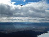
Begunjščica is a mountain range in Karawanks east of Stol. The highest peak is Veliki vrh, which at over 2000m offers a beautiful view of central...
2 h 45 min |
 | Planina Blato - Velika Tičarica
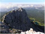
Velika Tičarica is a little-visited peak located north of the more easily accessible and much more visited Mala Tičarica. The summit, located bet...
3 h 50 min |
 | Na Razpotju - Krofička (hunter's way)
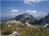
Krofička, or Grofička according to some records, is a peak located northeast of Ojstrica. From the summit, which descends steeply towards the Log...
3 h 40 min |
 | Jermanca - Najvišji rob (Zeleniške špice) (via Repov kot)
Najvišji rob is the highest peak of the Green Spires ridge. Most of them reach the limited summit by the ridge of Zelenický Špice via Staničev Pe...
3 h 45 min |
| End of road on Pokljuka - Veliki Draški vrh (path over north outside corner)
Veliki Draški vrh is a 2243 m high mountain rising steeply above the Krma Valley. From the top, where there is a registration box and a stamp, yo...
3 h 15 min |
 | Štenge - Visoki vrh (via Vretov vrh)
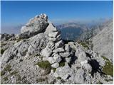
Visoki vrh (also Visoki Kurji vrh) is a 1828 m high mountain located west of the Belka River valley. From the summit, on which stands a small cai...
3 h |
 | Logarski kot - Rjavčki vrh (Planinšca) (via Grlo)
Rjavčki vrh aka Planinšca is a 1898 m high peak located north of the main ridge connecting Ojstrica with Planjava. The peak, which is mostly cove...
3 h 15 min |
| Dom Planincev v Logarski dolini - Krofička (hunting path)
Krofička, or Grofička according to some records, is a peak located northeast of Ojstrica. From the summit, which descends steeply towards the Log...
3 h 35 min |
| End of road on Vogar - Velika Tičarica
Velika Tičarica is a little-visited peak located north of the more easily accessible and much more visited Mala Tičarica. The summit, located bet...
3 h 45 min |
 | Podljubelj (Lajb) - Zajmenove peči
Zajmenove peči is a 1745 m high peak located in the ridge of the same name, which is situated in the western part of Košuta. From the top, next t...
2 h 50 min |
| Podljubelj (Pod Košuto) - Zajmenove peči
Zajmenove peči is a 1745 m high peak located in the ridge of the same name, which is situated in the western part of Košuta. From the top, next t...
2 h 45 min |