Sveti Jurij - Donačka gora (old south path)
Starting point: Sveti Jurij (320 m)
| Lat/Lon: | 46,2537°N 15,7384°E |
| |
Name of path: old south path
Time of walking: 1 h 30 min
Difficulty: difficult marked way
Altitude difference: 564 m
Altitude difference po putu: 564 m
Map:
Recommended equipment (summer): crampons
Recommended equipment (winter): crampons
Views: 19.437
 | 3 people like this post |
Access to the starting point:
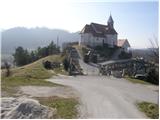
From the Ljubljana - Maribor motorway, take the Dramlje exit and follow the road towards Šentjurje, Rogaška Slatina and Rogatec. In Rogatec, the signs for Donačka gora direct you to the left. Just a little further on, you reach the next crossroads, where you continue right again in the direction of Donačka gora. Continue towards the village of Sveti Jurij (do not follow the signs for Donačka gora). In the village of Sveti Jurij, turn left uphill towards the church of St. George by which you park. You can park a little further down in the parking lot by the road.
Path description:
From St George's Church, continue up the road. After 100 m walk, you will come to a crossroads, where you turn left. After another few dozen steps, you will reach a farm where a marked footpath turns right uphill. The path first climbs across a meadow, then turns right, where it crosses lane of bushes and then, at a cross, leads to the next farm. Here we continue up the marked cart track, which soon leads us over a scenic slope to a fork in the path. Continue straight on in the direction of Rudi's home and St Donatus. After a few minutes of further walking, the slope drops and the path turns left. There is a short walk westwards across the slopes to the Church of St Donatus.
At the church, a marked path continues to the left (west) towards Rudi's home, and we continue straight ahead (north) into the nearby forest. At first we have the feeling that there is no path, but when we reach the forest we see a nice little path and unofficial markings on a tree. Just a minute further on, the forest ends and the path leads us among the ferns, from where we have a beautiful view of the neighbouring Macelj. The path soon returns to the forest, through which it begins to climb steeply. During the ascent, in addition to the unofficial orientation markings, the individual cairns are also helpful. Further on, the path leads us past several fallen trees, and then we arrive in a kind of chute through which logs are dragged into the valley. The path ends here, and then becomes a little more difficult.
Continue upwards, where you will see an unofficial marking (a greyish-white circle) on one of the trees. We climb up a rockier area, where the next cairn is helpful, but can be quickly overlooked. From here the path is level for about a minute, then starts to climb up a very steep slope (especially in wet conditions, a high risk of slipping). Continue along the barely visible path, which climbs in a few switchbacks, helped by some old, almost completely faded markings. Higher up, we reach vertical rock cliffs where the path turns left and leads us to the most challenging part of the trail. With the help of your hands, you climb up through a narrow passage between the rocks, above which the path lays down. The path then opens up to a view of Macelj and Strahinjščica, and for a while the path climbs only gently. The path soon becomes steeper and climbs in a few serpentines, and the unofficial markings end. Here it seems logical that the trail goes up, but it doesn't, so we continue straight on. When we see white lines on a tree a little further ahead, we finally go right. From here on, the path climbs in a few more serpentines, and then leads to a paragliding airstrip. From here, continue for about one minute and the path leads to the ridge where you join the Frolich trail (the path leading from Rudi's home towards Donački Gora). Here, continue to the right and quickly arrive at the Donačka gora lookout peak (opening up views of Medvednica, the Kamnik Alps, Pec, Uršlja Gora, Pohorje. . . ).
The trail is no longer officially marked and has been abandoned for several years.
You can descend by the path past Rudi's house, or by the difficult path past the eastern summit.

Pictures:
 1
1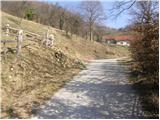 2
2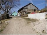 3
3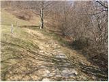 4
4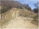 5
5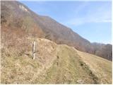 6
6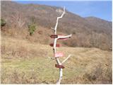 7
7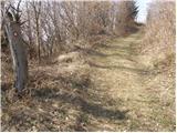 8
8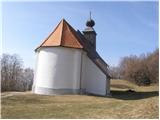 9
9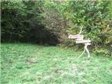 10
10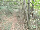 11
11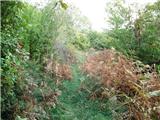 12
12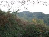 13
13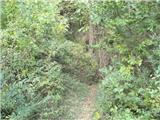 14
14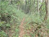 15
15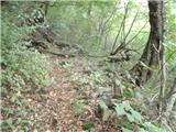 16
16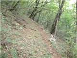 17
17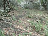 18
18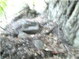 19
19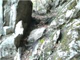 20
20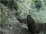 21
21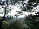 22
22 23
23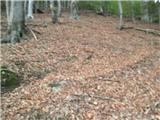 24
24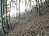 25
25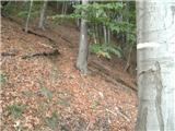 26
26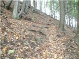 27
27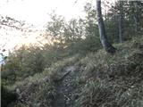 28
28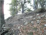 29
29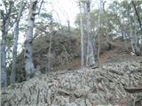 30
30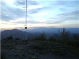 31
31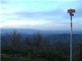 32
32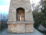 33
33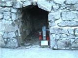 34
34
Discussion about the trail Sveti Jurij - Donačka gora (old south path)
|
| Marx20. 09. 2013 |
Bil danes (20.09.) po ti poti na Donačko goro. Nekdo je narisal množicu neuradnih znamk (bele proge in krogi) in zdaj več ni mogoče zgrešiti. Žal je na poti množica spodrtih drves , eno natančno pred najzahtevnejšim delom skoz skalo...
|
|
|
|
| edelweiss961. 01. 2019 |
Po tej poti smo šli 29.12.2018, in sicer smo zaradi napačnih informacij zgrešili označeno zahtevno pot na vzhodni vrh. Vseeno se je ta pot izkazala za zelo zanimivo in vredno obiska. Začetek poti je nekoliko težje najti, nato pa je pot dobro označena z možici in markacijami.
|
|
|
|
| monika899518. 05. 2020 |
Pot prehodila 16.5.2020. Po poti nekaj podrtih dreves, na par mestih je treba tudi poplezati. Zaradi mile zime in dežja dan pred pohodom v gozdu veliko klopov, zato bodite pazljivi. Pot drugače primerna za aktivne pohodnike, vsekakor pa ne za starejše ali za otroke (nevarnost zdrsa).
|
|
|
|
| lepenatka11. 11. 2022 08:44:55 |
Tale pot pa nima veliko obiska  .Prehojena 8.11. Zanimiva, strma, polna listja in klopov.
|
|
|