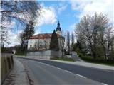
Gornja Radgona (parish church of St. Peter) - Radgona castle (by road)
Starting point: Gornja Radgona (parish church of St. Peter) (222 m)
| Lat/Lon: | 46,67992°N 15,98735°E |
| |
Name of path: by road
Time of walking: 20 min
Difficulty: easy unmarked way
Altitude difference: 45 m
Altitude difference po putu: 45 m
Map: Turistična karta Štajerska 1:50.000
Recommended equipment (summer):
Recommended equipment (winter):
Views: 151
 | 1 person likes this post |
Access to the starting point:
a) Leave the Pomurje motorway at exit Lenart v Slovenskih goricah and follow the road towards Gornja Radgona. When you arrive in Gornja Radgona, take the exit for Radgona castle and turn left about 100 metres further, where you will enter the parking lot of the parish church of St. Peter.
b) Take Radenci, then follow the road towards Gornja Radgona. Through the town, follow the signs for Maribor, and after the parish church of St Peter, which is seen on the right on a small rise, turn right and park in the parking lot below the church.
Path description:
From the parking lot, walk to the pavement, which continues along the main road, and follow it gently uphill to the crossroads where the road to Radgon Castle branches off to the right. We continue along a slightly steeper asphalt road, which leads us past occasional houses. When you reach the crossroads, turn right and continue walking along the priority road. A little further on, a footpath joins us from the right (the path starts on the other side of St Peter's Church), and the road slowly turns to the left and leads us past the Vito natural healing centre to the parking lot in front of Radgon Castle.
There is an entrance fee for access to the castle park and the castle beyond.
Description and pictures refer to the situation in April 2021.
Pictures:
 1
1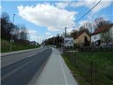 2
2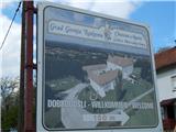 3
3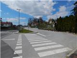 4
4 5
5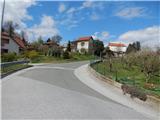 6
6 7
7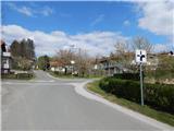 8
8 9
9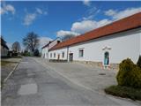 10
10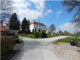 11
11 12
12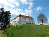 13
13
Discussion about the trail Gornja Radgona (parish church of St. Peter) - Radgona castle (by road)