Zgornje Danje - Altemaver (Ratitovec)
Starting point: Zgornje Danje (1070 m)
| Lat/Lon: | 46,2356°N 14,0493°E |
| |
Time of walking: 1 h 45 min
Difficulty: easy marked way
Altitude difference: 608 m
Altitude difference po putu: 630 m
Map: Škofjeloško in Cerkljansko hribovje 1:50.000
Recommended equipment (summer):
Recommended equipment (winter): ice axe, crampons
Views: 20.442
 | 1 person likes this post |
Access to the starting point:
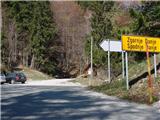
a) From upper Gorenjska, first drive to Bohinjska Bistrica, then continue to Soriška mountain pasture. From Soriška planina we start descending towards Sorica, and at the beginning of the village we turn left in the direction of Zgornje Danj. When you reach Zgornje Danje, at the junction in front of the houses, turn left up a slightly steeper dirt road, then park alongside it after 100 m.
b)From central Slovenia, first drive to Škofja Loka, then continue to Železniki and then Soriška mountain pasture. At the end of the village of Sorica, turn right in the direction of Zgornja Danja. Continue along the road which crosses the slopes to the right, then just before the houses in Zgornje Danje turn left onto a dirt road and park alongside it after 100 m.
c)From Primorska, first drive to Most na Soči or Bača near Modre, then continue to Podbrdo and on to Soriška mountain pasture. At the end of the village of Sorica, turn right in the direction of Zgornja Danja. Continue along the road which crosses the slopes to the right, then just before the houses in Zgornje Danje turn left onto a dirt road and park alongside it after 100 m.
Path description:
From the road along which you parked, turn right and follow the wide stone cart track, which you can only follow to a nearby wooden shack. Here you will see the start of the marked path leading to Ratitovec on your left.
The path first climbs through the forest and then crosses a relatively new clearing, where you will also cross cart track. There are no markings at this point due to the fallen trees, so orientation is a little more difficult in this part, but if you look for a path that continues in the same direction, you will have no major problems with this either. The way forward returns to the forest for a while, then lays down and leads us to a larger meadow (planina Spodnji Jirn). On the other side of the meadow, by the watering place for animals, the path turns slightly to the left and then right into the forest. The way forward leads us to the worse cart track, which we walk on for only a short time, as the faintly visible signs then direct us left onto the mountain path, which we follow through the forest to a relatively new wooden log cabin.
From the log cabin, where we also leave the forest, we continue in the same direction and continue our ascent along the less visible path, which climbs slightly to the right. The increasingly scenic path, which offers beautiful views of Blegoš, Črni vrh and Porezen, leads us higher up to the old military bunker, where we can rest or take some nice panoramic shots. From the bunker, continue for a few minutes on the less well-trodden path, then join the Soriška planina - Krekova koča path.
Here, continue to the right and follow the trail, which ascends and descends slightly a few times, to a marked crossroads where the trail to Altemaver branches off to the right.
Continue in the route mentioned above (slightly to the left, Koča na Ratitovcu) and after 5 minutes of ascent, you will reach the summit with a view.

Pictures:
 1
1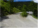 2
2 3
3 4
4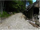 5
5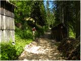 6
6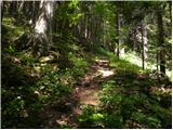 7
7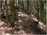 8
8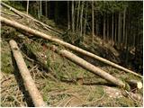 9
9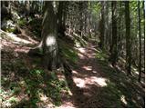 10
10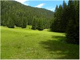 11
11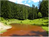 12
12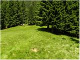 13
13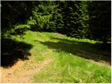 14
14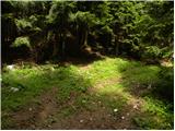 15
15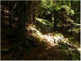 16
16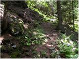 17
17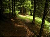 18
18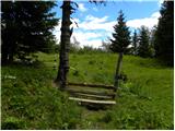 19
19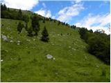 20
20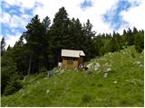 21
21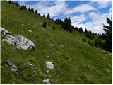 22
22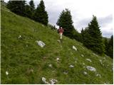 23
23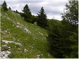 24
24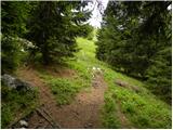 25
25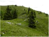 26
26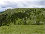 27
27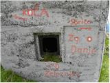 28
28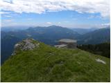 29
29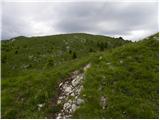 30
30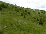 31
31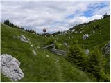 32
32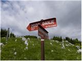 33
33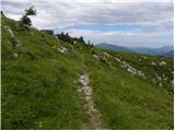 34
34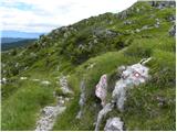 35
35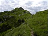 36
36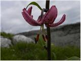 37
37 38
38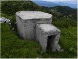 39
39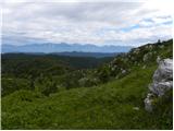 40
40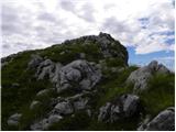 41
41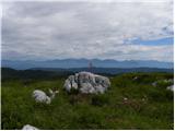 42
42 43
43
Discussion about the trail Zgornje Danje - Altemaver (Ratitovec)
|
| katty29. 01. 2013 |
V soboto,26.tega meseca sva se odpravila po tej poti. Sicer pot ni zahtevna,je pa v zimskih razmerah kar dolga in naporna...Do grebena sva krpljala v deviški sneg, naprej pa je bil greben shojen in presmučan po dolgem in počez. Tura je v zimskem času pravljična, v času cvetenja pa najbrž polna raznoraznih rastlinc, zato se semkaj še vrneva.
|
|
|
|
| ločanka11. 12. 2016 |
Danes po tej poti v podaljšani varianti in sicer s Prtovča čez Poden, nato pa po cesti skozi vse podratitovške vasi, ki so na tej poti in sicer skozi Torko, Zabrdo, do Zgornjih Danj, kjer se prične opisana pot. Lep izlet je že samo sprehod po cesti, s katere lahko občuduješ poglede na strme stene Ratitovca, prave lepote se pa naužiješ po prihodu iz gozda, ker se v tem času lagodno vzpenjaš po ozki potki med rumenimi travami, na grebenu pa itak lahko samo strmiš nad lepotami kot danes, ko so bili Julijci v beli obleki, ves ostali svet pa tudi pravljično lep. Meni je bila pot dosti lepša, kot je videti iz teh posnetkov. Altemaver je itak zakon!
|
|
|
|
| gasssa24. 03. 2019 |
Sonce po celi poti razen na začetku skozi gozd. Ponekod še vedno malo snega. Zelo prijetna pot.
|
|
|
|
| miratan12. 01. 2021 |
Pozdravljeni,
ker ne poznam Škofjeloško-Cerkljanskega hribovja me zanima, kakšne so razmere iz Zgornje Danje na Ratitovec (nevarnost plazov?). Bi šli čez vikend.
Hvala
|
|
|
|
| andraja12. 01. 2021 |
Ta pot se običajno ne uporablja v snegu sedaj pa je nevarnost plazov zaradi strmih travnatih pobočij.
|
|
|
|
| MiaB.17. 03. 2021 |
Katera je najboljsa pot, ce prihajam s Primorske za na Ratitovec in Krekovo koco? Hvala. 
|
|
|
|
| mirank17. 03. 2021 |
Tudi jaz prihajam s Primorske-Goriške in smo razen dvakrat vedno izbrali najdaljšo-to je s Soriške peči. Kaj ti razumeš kot najboljša je zelo relativen pojem; ta iz Zg Dajn je srednje dolžine, lepe so pa vse . One iz Prtovča so za nas malo bolj oddaljene, o cestah tam okoli pa ne bi 
|
|
|
|
| MiaB.17. 03. 2021 |
Hvala ti...ja, jaz sem mislila kot najboljsa, glede, da prihajam z Gorice, prva z Goriskega konca za se ustavit in parkirat. Sklepam, da Zg.Danje ali Torka...za zdaj...spomladi pa lahko se iz Soriske peci 
|
|
|
|
| Lop11. 02. 2023 21:53:20 |
Dover večer. Pericolo valanghe? Servono ramponi?
|
|
|