Starting point: Leskovica (800 m)
| Lat/Lon: | 46,1473°N 14,0866°E |
| |
Time of walking: 2 h 5 min
Difficulty: easy marked way
Altitude difference: 762 m
Altitude difference po putu: 762 m
Map: Škofjeloško in Cerkljansko hribovje 1:50.000
Recommended equipment (summer):
Recommended equipment (winter): ice axe, crampons
Views: 65.127
 | 3 people like this post |
Access to the starting point:
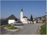
From Škofja Loka we drive towards Gorenja vas and on to Hotavlje, where we turn right in the direction of the village Leskovica. The road soon leads us to the village Kopačnica, after which it starts to climb steeper and leads us higher to the village Leskovica, where we see direction signs for Blegoš. Signs for Blegoš direct us to a narrow and steep road, which we then follow to a parking area next to a church.
The starting point can also be reached from Cerkno.
Path description:
From the parking lot we continue along the initially asphalted road, which, with a view of Blegoš and the surrounding peaks, quickly leads us into the forest. After a good 20 minutes of ascending the road, you will notice direction signs on the left hand side, directing you to cart track in the direction of the mountain guard shelter at Jelenkh.
The track then ascends slightly to the right and after a few steps leads us to a place where the path from Volaka joins us from the right. Continue along the wide marked path, which crosses a torrential stream at a higher altitude and then climbs for some time. The path, which climbs moderately through the forest, soon leads to a forest road, which we only cross.
The way ahead climbs over small steps and leads us within 5 minutes of further walking to the mountain guard shelter at Jelenkh.
From the shelter, continue along the marked trail, which goes into a dense spruce forest. Soon the path from the village of Laze joins us from the left, and we continue slightly to the right on the path that quickly leads us out of the forest. Once out of the forest, continue right towards the hut at Blegoš (left Črni vrh, straight ahead Črni Kal) along a less good road, which will take you up to the hut at Blegoš in a few minutes.
From the hut on Blegoš, continue along the initially winding path, which climbs over a grassy slope with a view. The path soon begins to climb steeply and leads us to the edge of the forest, where it then climbs along a narrow uncultivated strip. The steepness soon gives way and the path leads to the scenic ridge Blegoš, which is climbed to the summit in a few minutes.
Leskovica - Jelenk 1:05, Jelenk - hut on Blegoš 30 minutes, hut on Blegoš - Blegoš 30 minutes.

Pictures:
 1
1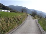 2
2 3
3 4
4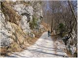 5
5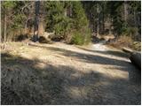 6
6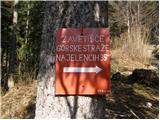 7
7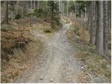 8
8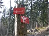 9
9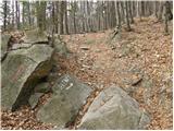 10
10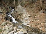 11
11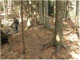 12
12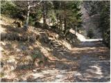 13
13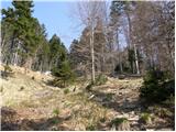 14
14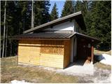 15
15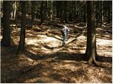 16
16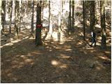 17
17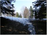 18
18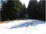 19
19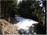 20
20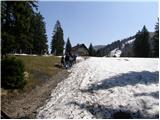 21
21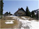 22
22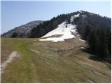 23
23 24
24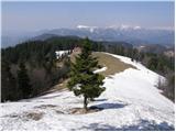 25
25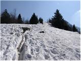 26
26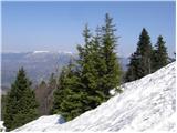 27
27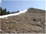 28
28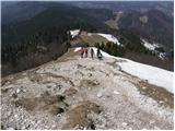 29
29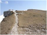 30
30 31
31
Discussion about the trail Leskovica - Blegoš
|
| pohodnik0112. 06. 2010 |
Dodal bi samo to, da se zapeljimo samo še slaba 2 km naprej mimo cerkve in lahko parkiramo v gmajni v senci. Tudi tam je parkirišče. Tega nebi vedel, če mi nebi povedal prijazen domačin. 
|
|
|
|
| istrumel8. 02. 2011 |
V nedeljo 7.2.2011 sem bil na Blegošu iz Leskovice.Pot čudovita,ponekod malce snega,vreme prečudovito za ta letni čas,tako da smo se na vrhu sončili v kratkih rokavih,ker tudi pihalo ni.
|
|
|
|
| croata4. 05. 2011 |
V soboto 07.05.2011 se odpravljam s kolesom na blegoš.Štartal bom v Ljubljani in nadaljeval pot do Hotavelj potem prek Leskovice naprej do koče na Blegošu.Upam da je pot primerna za kolo.
|
|
|
|
| bike4. 05. 2011 |
Croata, 1.5. smo šli na Blegoš s kolesi iz Šk. Loke po vojaški in nato čez Javorje in Žetino na Kal. Cesta je prevozna do koče normalno. Domnevam, da je cesta iz Hotavelj normalno prevozna, saj so po njej prihajali z avtomobili na Kal.
|
|
|
|
| Jože.4. 05. 2011 |
Iz Leskovice, pa do koče na Blegošu s kolesom, nikakor ne, saj bi ga moral večji del poti nositi. Boljša varianta je ta, kot jo je opisal "bike" (to je cesta, ki pelje za Lubnik). Če pa bi se rad večino poti vozil po asfaltu, pa lahko greš od Šk. Loke do Poljan in zaviješ proti Javorjem in naprej skozi Gornjo Žetino, do Črnega Kala. 500 metrov pred Kalom, se asfalt konča. Od Kala pa do koče je še 3 km. Celotna pot od Šk. Loke, pa do koče, je približno 28 km. Odločitev je tvoja, pa srečno pot.
|
|
|
|
| Kokta20. 05. 2012 |
Danes je bilo malo problem s parkirnim prostorom, ker se je odvijal tretji KBK.
Do koče vodi pot po gozdu v senčki. Naprej se pa odprejo pogledi na vse strani. Definitivno ena izmed lepših tur. Toplo priporočam obisk.
|
|
|