Črni kal - Koča na Blegošu (via Prva ravan)
Starting point: Črni kal (1103 m)
| Lat/Lon: | 46,1724°N 14,1243°E |
| |
Name of path: via Prva ravan
Time of walking: 1 h 30 min
Difficulty: easy marked way
Altitude difference: 288 m
Altitude difference po putu: 325 m
Map: Škofjeloško in Cerkljansko hribovje 1:50.000
Recommended equipment (summer):
Recommended equipment (winter): ice axe, crampons
Views: 4.460
 | 1 person likes this post |
Access to the starting point:
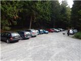
a) First drive to Škofja Loka, then continue driving towards Gorenjska vas. Before arriving in Gorenjska vas, turn right at the traffic lights into Poljane above Škofja Loka, then follow the signs for Javorje. The ascending road takes you higher into the village, then follow the signs for Blegoš at the next crossroads. Continue along a narrower, but still asphalted road. After Gorenja Žetina, the asphalt ends, and it is only a few minutes of cross-country climbing before you reach Črnega kalo, where there is a large parking lot and the junction of several roads.
b) From Žiri, Sovodnja or Horjul, drive to Gorenjska vas, then continue to Škofja Loka. Just after Gorenjska vasja, at the semaphore crossroads, turn left into Poljane above Škofja Loka, then follow the signs for Javorje. The ascending road leads us higher into the village, then at the next crossroads follow the signs for Blegoš. Continue along a narrower, but still asphalted road. After Gorenja Žetina, the asphalt ends, and it is only a few minutes of cross-country climbing before you reach Črnega kalo, where there is a large parking lot and the junction of several roads.
c) From Železniki, drive towards Podbrdo, then turn left towards Davča before Zali Log. At a crossroads a few 100 metres away, at the confluence of the Davča and Muštrva grapa, take the road on the left, which leads you higher up through the hamlet of Potok, and after it, before crossing Matevžkovo grapa, take a sharp left onto the road, which leads you across to the parking lot at Črnji kal.
d) From Petrovy Brdo or Sorice, descend to Podrošto, then continue towards Železniki. After Zali Log, turn right towards Davča. At a crossroads a few 100 metres away, at the confluence of the Davča and Muštrova grapa, take the road on the left, which leads you higher up through the hamlet of Potok, and after this, before crossing Matevžkovo grapa, take a sharp left onto the road, which leads you across to the parking lot at Črnji kal.
Path description:
From the parking lot, walk to the nearby NOB memorial, then continue along the road towards Blegoš via Prva ravan. Shortly after the sign, the road splits again, and we continue straight ahead (right Koča na Blegošu), following the road over which there is a roadblock. We continue on the dirt road, which is closed to public traffic, but which climbs crosswise. At a small right turn, a short path branches off to the left to a lookout point and a NOB memorial, and we continue along the road, which occasionally offers a fine view of the surrounding mountains, especially Koprivnik and Mladi vrh. When the road is laid, we arrive at Prva ravan, where the marked paths from Jelovica and Čabrač join from the left.
Here, at a marked crossroads, continue right on the footpath in the direction of Blegoš. After a short climb, you will reach the next crossroads, where the path to the Cottage on Blegoš branches off to the left.
Continue in the direction mentioned above (straight ahead Blegoš), where you will cross an overgrown clearing and then return to the forest. Crossing the mostly southern slopes of Blegoš, the trail then turns right, where an unmarked trail with Leskovica joins from the left, and an unmarked trail to Blegoš branches off to the right.
Continue straight on, following cart track, which then begins to descend gently. After a few minutes of further walking, when you emerge from the forest, you can already see Koča na Blegošu in front of you, which is only a short walk away.
Description and pictures refer to 2016 (September).

Pictures:
 1
1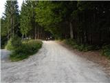 2
2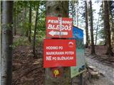 3
3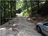 4
4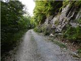 5
5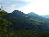 6
6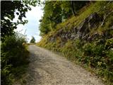 7
7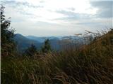 8
8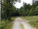 9
9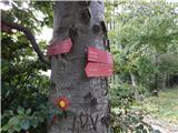 10
10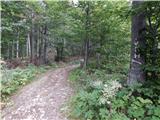 11
11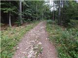 12
12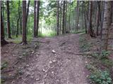 13
13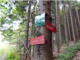 14
14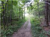 15
15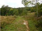 16
16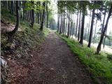 17
17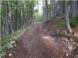 18
18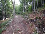 19
19 20
20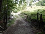 21
21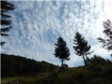 22
22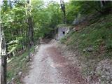 23
23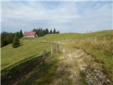 24
24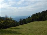 25
25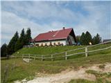 26
26
Discussion about the trail Črni kal - Koča na Blegošu (via Prva ravan)