Starting point: Jesenica (693 m)
| Lat/Lon: | 46,1494°N 13,9503°E |
| |
Time of walking: 2 h 55 min
Difficulty: easy marked way
Altitude difference: 937 m
Altitude difference po putu: 965 m
Map: Škofjeloško in Cerkljansko hribovje 1:50.000
Recommended equipment (summer):
Recommended equipment (winter): ice axe, crampons
Views: 3.530
 | 1 person likes this post |
Access to the starting point:
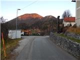
a) First, drive to the centre of Cerkno (to get here from the road Idrija - Most na Soči, or from Gorenje vas and Žiri via the pass Kladje, or from Zali Log via Davča. . . ), and then continue driving in the direction of Zakojca. Just a few metres after we head in the direction of Zakojca, the road to the village of Zakriž branches off to the left, through which a steep shortcut leads, and we continue along the road that continues along the Zapoška stream. Higher up, the road leads us through the villages Trebenče, Gorje, and then, after crossing the slopes, we pass the village Zakriž on the upper side, where the aforementioned shortcut joins us. A little further on, the road turns even more to the right, and then after a few kilometres of crossing we reach the beginning of the village Jesenica, where we see the first signs for the Vrh Ravni, Kojco and Porezen passes, which point to the right, and we continue to the left towards the central part of the village, where we park in a suitable place by the ecological island. There is also a bus stop and a memorial at the starting point.
b) From Most na Soči or Bača pri Modreju drive towards Idrija, then after Reka, just before crossing the brook Jesenica, take a sharp left, and at the next crossroads take a sharp right in the direction of Orehovška grape. After a few kilometres on a relatively steep road you reach the village of Orehek, and just above the village you join the cross road below Kojca, which you follow to the right. When you reach the village Jesenica, park in a suitable place next to the ecological island. There is also a bus stop and a memorial at the starting point.
c) From Bača pri Modreju, drive towards Podbrdo or vice versa, then at Grahovo ob Bači turn towards Zakojca and Bukovy. Continue along the winding and ascending road for some time, then at the marked crossroads turn right in the direction of Cerkno (left Zakojca). Cross Kojca, then, when you arrive in the village of Jesenica, park in a suitable place by the ecological island. There is also a bus stop and a memorial at the starting point.
Path description:
A few steps southeast of the starting point, we see signs for Kojca and Porezen, which direct us left onto the asphalt road that begins to climb steeply through the village. As you look out over Kojca, you climb past a few houses, then the asphalt ends and the road leads you past more houses. After the last house, the road turns into cart track, which takes a few minutes of further walking to reach the Vrh Ravni preval, where there is a crossroads of many paths.
From the Vrh Ravni pass, continue to the right in the direction of Porezno and mountain pasture Otavnik (sharp left Košena, left Kojca, slightly left Čemažar, straight Zakojca, slightly right Podčrnovrhar and sharp right the carriageway to Jesenica) and continue along the ascending macadam road, which leads us further along the slopes of the summit of the Na krogu (1050 m). Higher up, the road passes to the northern slopes of Ritovščice (1156 m), where it turns into a wide cart track at a small quarry. There follows a cross-climb through the forest, which leads us above the Otavnika riverbed, and then out of the forest, where we see a hunting lodge in front of us, which is reached by two serpentine ascents.
From the hunting lodge, follow cart track, which ascends to the southern ridge of Otavnika. This partly wooded ridge is soon abandoned as the trail turns slightly to the left and then climbs cross-country through an increasingly scenic pasture. After a few minutes of cross-climbing, you reach the upper part of mountain pasture Otavnik, where you can see a hunting observation post on the left and a shepherd's hut straight ahead on the other side of the ridge.
Continue in the direction of Porezno, passing the nearby shepherd's hut on the top right-hand side. After the shepherd's hut, the trail enters a belt of forest and continues in a gentle descent along the north-western slopes of Otavnik. When the descent ends, you reach the saddle between Porezno and Otavnik, and a little higher up, the path turns left and starts to climb crosswise up the steeper slope of Porezno. The wide path, which poses no major danger on land, with beautiful views of the Zakojška ravine and the surrounding mountains, leads in a few minutes to a crossroads on the western ridge of Porezno. From the crossroads continue right (left Hudajužna and Podbrdo, slightly right Dom na Poreznu) and continue along the ridge. Climb moderately for a while, then the path leads back to the ridge, where it first lays down and then starts to climb steeply. There are a few minutes of quite steep climbing, where a little more care is needed, especially in the wet and snow. Just below the summit, the path flattens out, and we quickly reach the top of Porezno, taking in the beautiful views that reach all the way to Triglav.
Description and pictures refer to the situation in 2015 (December).

Pictures:
 1
1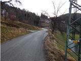 2
2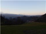 3
3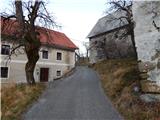 4
4 5
5 6
6 7
7 8
8 9
9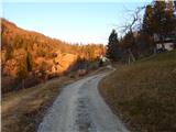 10
10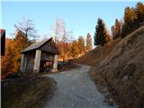 11
11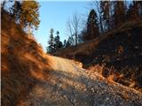 12
12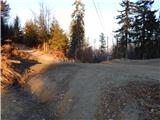 13
13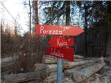 14
14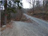 15
15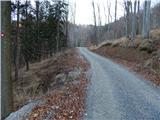 16
16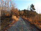 17
17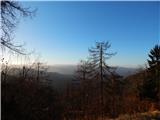 18
18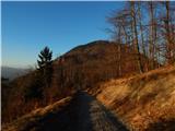 19
19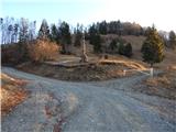 20
20 21
21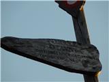 22
22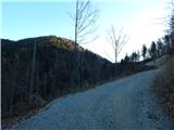 23
23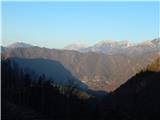 24
24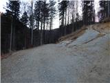 25
25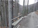 26
26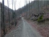 27
27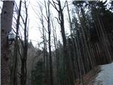 28
28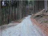 29
29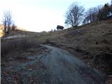 30
30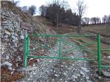 31
31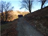 32
32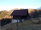 33
33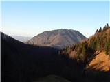 34
34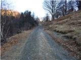 35
35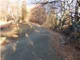 36
36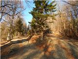 37
37 38
38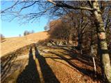 39
39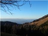 40
40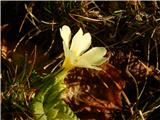 41
41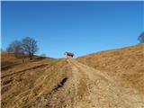 42
42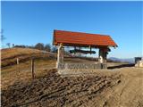 43
43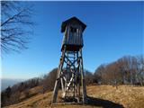 44
44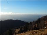 45
45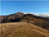 46
46 47
47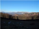 48
48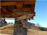 49
49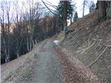 50
50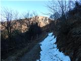 51
51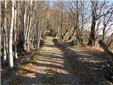 52
52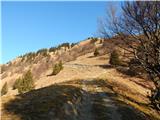 53
53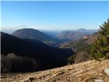 54
54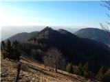 55
55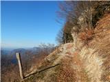 56
56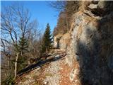 57
57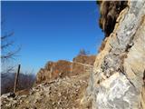 58
58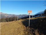 59
59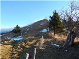 60
60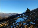 61
61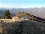 62
62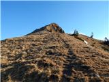 63
63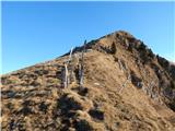 64
64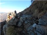 65
65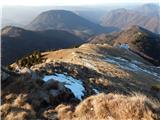 66
66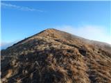 67
67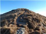 68
68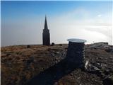 69
69 70
70
Discussion about the trail Jesenica - Porezen