Sveta Jedert (Lajše) - Bela peč (Podbliška gora) (upper part on the road)
Starting point: Sveta Jedert (Lajše) (850 m)
| Lat/Lon: | 46,2477°N 14,1982°E |
| |
Name of path: upper part on the road
Time of walking: 1 h 30 min
Difficulty: easy unmarked way
Altitude difference: 283 m
Altitude difference po putu: 300 m
Map: Škofjeloško in Cerkljansko hribovje 1:50.000
Recommended equipment (summer):
Recommended equipment (winter): ice axe, crampons
Views: 405
 | 2 people like this post |
Access to the starting point:
a) From Ljubljana, take the old road to Kranj, then follow the main road to the bridge over the Sava River. Just before the bridge, we leave the main road and continue straight ahead towards Besnice. We continue through Rakovica, Spodnja and Zgornja Besnica, Njivica, Nemilje to Podblica. A little above Podblica you will reach a marked crossroads where you will join the road Dražgoše - Kropa. Here, take a sharp left (you can also go right and then turn around after 50 metres at the turning point) and follow the narrower road to the Church of St. Jedert, where you can park in a small parking lot nearby.
b) Drive to Kropa and from there continue along the serpentine road to Železniki. At Jamnik, the road levels out a little and then crosses a relatively steep slope to the south. The road then turns left downhill towards Podblica, Besnica and Kranj, and we continue straight on here, following the road to the church of St Jedert, where we park in a small parking lot nearby.
c) We first drive to Škofja Loka, and from there we continue to Železniki, but only follow the main road to Selca, where we turn right after the church onto a local road, which we follow up to the village of Lajše. Above Lajšami, it joins the main road Dražgoše - Kropa, and we follow it to the right and take it to a small parking lot near the church of St. Jedert.
d) We drive to Bača near Modre and then continue to Podbrdo and Železniki. At Železniki turn left towards Dražgoše and from there drive towards Kropa. Just after the road from Lajše joins the village on the right, you will reach a small parking lot next to the church of St. Jedert.
Path description:
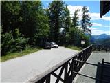
From the parking lot of the church of St. Jedert, continue along the asphalt road towards Dražgoše and Železniki. Soon the road turns left towards the valley, and we continue straight on, passing the NOB memorial. Leave the road just ahead of the memorial, where we take the cart track, which turns sharp right off the road. Cart track immediately takes us into the forest and starts climbing, turning left after a few minutes. A little further on, we join another cart track which branches off the road a little further in the direction of Dražgoše, and we follow it slightly to the right, continuing to climb. At two forks higher up, we continue right, and when we reach the south to south-east slopes, we go up to the left. The way ahead leads past a small cave entrance, and cart track soon ends.
From the point where cart track ends, follow the track, which is marked by a green and white triangle. A few minutes higher, another cart track is reached, which is followed to the left and leads in an easy ascent to an asphalt road, which is followed to the right. The road continues to climb steeply for a few minutes and then, at a left turn, it lays down and leads to the edge of the Jelovice plateau.
Here, at the information board to the right, the marked path continues, which reaches Belo Pec via Riglov, and we continue along the road, which forks just a little further on. Continue along the right-hand road (the left-hand road will take you to Kalisnik), and after a few minutes turn right onto the path that will take you to the nearby Bela Peć.
Description and pictures refer to June 2020.

Pictures:
 1
1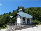 2
2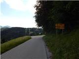 3
3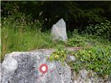 4
4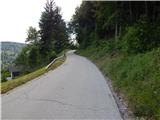 5
5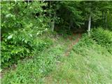 6
6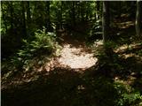 7
7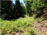 8
8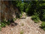 9
9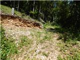 10
10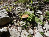 11
11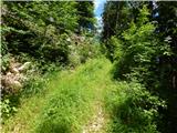 12
12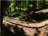 13
13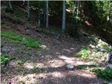 14
14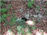 15
15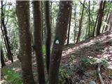 16
16 17
17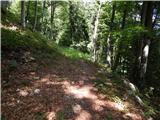 18
18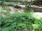 19
19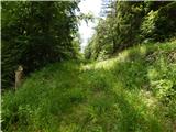 20
20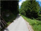 21
21 22
22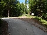 23
23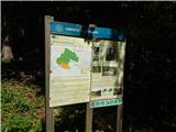 24
24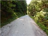 25
25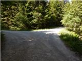 26
26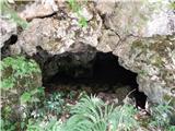 27
27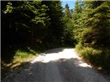 28
28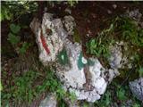 29
29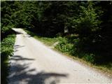 30
30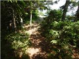 31
31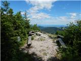 32
32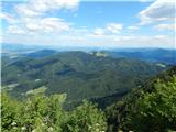 33
33 34
34
Discussion about the trail Sveta Jedert (Lajše) - Bela peč (Podbliška gora) (upper part on the road)