Žnidarjeva planina - Ribenska planina
Starting point: Žnidarjeva planina (952 m)
| Lat/Lon: | 46,3222°N 14,11625°E |
| |
Time of walking: 35 min
Difficulty: easy unmarked way
Altitude difference: 13 m
Altitude difference po putu: 65 m
Map: Karavanke - osrednji del 1:50.000
Recommended equipment (summer):
Recommended equipment (winter): ice axe, crampons
Views: 913
 | 2 people like this post |
Access to the starting point:
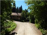
a) From the motorway Ljubljana - Jesenice take the exit Naklo, Podtabor or Brezje, then continue in the direction of Kropa. At the junction where the road continues straight on towards Kropa, turn right and continue through Kamna Gorica. Continue along the Lipnica valley for a while and then turn left in the direction of Spodnja Lipnica and the Hunting Hut on Talež. Spodnja Lipnica soon ends, and then we start climbing along the macadam road towards Jelovica, where we follow the signs for Talež and Goško Ravan. Higher up, the road to Tallez turns off to the right, and we follow the worse road towards Goška Ravna, and when the road to Goška Ravna turns sharp left, we continue straight on towards Ribenska mountain pasture. There is a bit more of a cross-country climb and you reach a crossroads with a restored hut (on the maps this part is marked as Žnidarjeva mountain pasture).
b) From the motorway Jesenice - Ljubljana, take the exit Lesce or Radovljica and then continue in the direction of Radovljica and later the villages Lancovo, Lipnica and Kamna Gorica. The road then crosses the Sava River over a bridge and gradually begins to climb on the other side. The road continues through Lancovo and then descends into the Lipniško valley, where you will soon turn right into Spodnja Lipnica, from where you will continue towards Talež. Spodnja Lipnica soon ends, and then we start climbing on a dirt road towards Jelovica, where we follow the signs for Talež and Goško Ravan. Higher up, the road to Tallez branches off to the right, and we follow the worse road in the direction of Goška Ravna, and when the road to Goška Ravna turns sharp left, we continue straight on towards Ribenska mountain pasture. There is a bit more of a cross-country climb and you reach a crossroads with a restored hut (on the maps this part is marked as Žnidarjeva mountain pasture).
Path description:
From the crossroads at Žnidarjeva mountain pasture take the road to the left in the route Ribenska planina (at the signpost Ribnska mountain pasture and mountain pasture Ribno), which ascends gently to moderately. Higher up, the road flattens out and we reach the top edge of Ribenska planina, from where we have a fine view of mountain pasture.
Here the road turns slightly to the right, and the road to Kravji dolina branches off from it further to the right. Continue straight ahead and start to descend gently, soon turning slightly left from the wider road onto a side road which starts to descend in a semicircle along the edge of Ribenska mountain pasture. Lower down, the road flattens out and you quickly reach the shepherd's hut on Ribenska mountain pasture.
Description and pictures refer to the situation in July 2020.
Pictures:
 1
1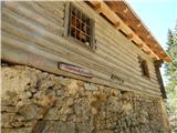 2
2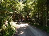 3
3 4
4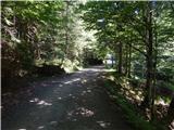 5
5 6
6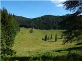 7
7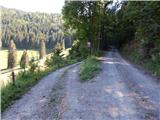 8
8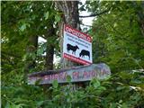 9
9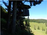 10
10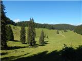 11
11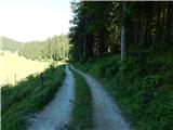 12
12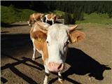 13
13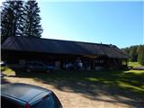 14
14
Discussion about the trail Žnidarjeva planina - Ribenska planina