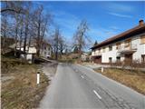
Starting point: Govejk (710 m)
| Lat/Lon: | 46,0251°N 14,07°E |
| |
Time of walking: 1 h 40 min
Difficulty: easy marked way
Altitude difference: 298 m
Altitude difference po putu: 350 m
Map: Škofjeloško in Cerkljansko hribovje 1:50.000
Recommended equipment (summer):
Recommended equipment (winter):
Views: 3.227
 | 2 people like this post |
Access to the starting point:
a) From Železniki, Kranj or Medvode, drive to Škofja Loka, and from there continue in the direction of Gorenje vasi in the Poljanska valley and Žire. In Žire, or at the end of Žire (Stare Žiri), leave the main road towards Rovty and Logatec and turn right towards Idrija. After about 4 km of driving from the crossroads in Žire, you reach the settlement Govejk and a small pass where the road starts to descend. At the pass, the road to Ledine and Ledine Krnice branches off to the right. Park in a suitable place at the crossroads.
b) From Horjul or Polhov Gradec, drive to Šentjošt nad Horjul, and from there continue to Smreč. When you reach the main road Podlipa - Žiri, follow it to the right, and we drive along it to Žiri. When in Žire, reach the main road Škofja Loka - Logatec, follow it to the left, and we drive along it past the parish church and the Lenger Inn and Pizzeria. After the inn we reach a crossroads, where we leave the main road towards Logatec and continue in the direction of Idrija. After about 4 km of driving from the crossroads in Žire, you reach the settlement Govejk and a small pass where the road starts to descend. At the pass, the road to Ledine and Ledine Krnice branches off to the right. Park in a suitable place at the crossroads.
c) From the motorway Ljubljana - Koper take the exit Vrhnika, then when you reach the old road Ljubljana - Logatec, continue in the direction of Logatec, but only for a short time, because at the next junction you will turn right in the direction of Horjul. The road continues for a short time through Vrhnika, then through the outskirts of Stara Vrhnika, and then soon we leave the road towards Horjul and continue slightly left in the direction of Smrečje. After Smrečje the road starts to descend towards Račeva and Žire. Once in Žire, we reach the main road Škofja Loka - Logatec, follow it to the left, and we drive along it past the parish church and the Lenger Inn and Pizzeria. After the inn we reach a crossroads, where we leave the main road towards Logatec and continue in the direction of Idrija. After about 4 km of driving from the crossroads in Žire, you reach the settlement Govejk and a small pass where the road starts to descend. At the pass, the road to Ledine and Ledine Krnice branches off to the right. Park in a suitable place at the crossroads. d) From the motorway Koper - Ljubljana take the exit Logatec, and when you reach the old road Logatec - Vrhnika follow it to the right (first exit from the roundabout), and follow it for a short distance, as the signs for Rovte and Žiri then direct you to the left. After Rovte, the road starts to descend towards Žire, and when you reach the above-mentioned place, you will soon turn left in the direction of Idrija. After driving for about 4 km from the crossroads in Žire, you reach the settlement Govejk and a small pass, where the road starts to descend. At the pass, the road to Ledine and Ledine Krnice branches off to the right. Park in a suitable place at the crossroads.
e) From the road Idrija - Spodnja Idrija, just after the end of Idrija, turn right (if coming from Spodnja Idrija, turn left before Idrija) over the bridge over the Idrijca river towards the Eurospin shop. On the other side of the bridge you will reach the village of Mokraška vas, and we stick to the main road leading to Ledinsko Razpotje and Žire. Higher up, the road leads us through some serpentines, and then we arrive at the settlement Ledine Razpotje, and about 2 km further on to the settlement Govejk. Park in a suitable place, by a small pass, where the road to Ledine and Ledine Krnice branches off to the left.
Path description:
From the starting point at Govejk, continue west towards Ledine, which is about an hour's walk away. The path continues past a few houses and a large wall, and then after a short climb it completely flattens out. At the next crossroads, where you see the signs for Ledine, continue to the right, some 10 m further on, and near the "last" house, turn right at cart track. Continue along cart track, which after a few minutes turns from meadows into woods. After a few minutes out of the woods, the path widens into the passable cart track, and a slightly wider road joins a little further on. Follow the macadam road to the asphalt road in a few minutes and quickly reach a marked crossroads, where the marked path from Ledinsko Razpotje joins from the left.
Continue in the direction of Sivka, along the gently sloping road, which gradually leads to the village of Ledine, where you will see Jureč's shupa (museum collection) on the right and a registration box with a stamp and a registration book attached to the bus stop house on the left.
The way ahead leads through the village, and after the signpost for the end of the Ledine settlement, continue to the right, which is also where the markings direct you. The path then climbs quickly above the village, from where there is a beautiful view over part of the plateau, and on the left, along the path, we see a small park.
The asphalt road continues to climb moderately over the initially still quite scenic slopes, from which a beautiful view opens up, which reaches all the way to the Trnovski Forest. Higher up, the road turns into a forest, where it leads us past a small sign, which we can see slightly to the right of the path. Crossing the meadow follows, and then we climb through the forest for a few more minutes. The main road leads us higher out of the forest, where we arrive in a few steps at a marked crossroads by the chapel.
From this crossroads, continue left (right Bevkov vrh, Ermanovec and also Mrzli vrh, for the latter there are no signs at the crossroads) and continue along the gently sloping macadam road, which we follow only for a short time, as the signs for Sivka then direct us slightly right on the footpath, which after a few steps passes into the forest. Once in the forest, the path climbs moderately and after about 5 minutes of further walking leads to the top of Sivka, where there is a registration box. Description and figures refer to the situation in 2015 (January).

Pictures:
 1
1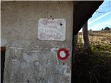 2
2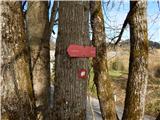 3
3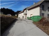 4
4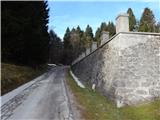 5
5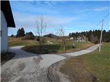 6
6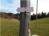 7
7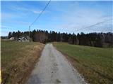 8
8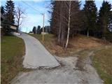 9
9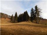 10
10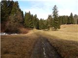 11
11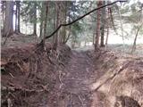 12
12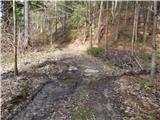 13
13 14
14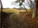 15
15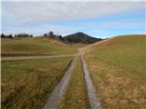 16
16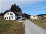 17
17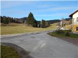 18
18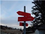 19
19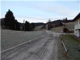 20
20 21
21 22
22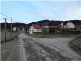 23
23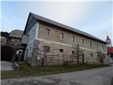 24
24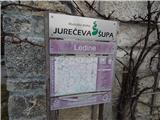 25
25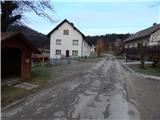 26
26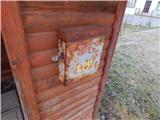 27
27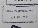 28
28 29
29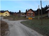 30
30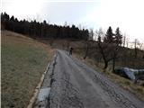 31
31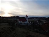 32
32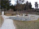 33
33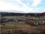 34
34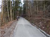 35
35 36
36 37
37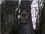 38
38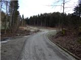 39
39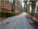 40
40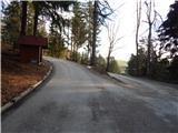 41
41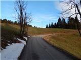 42
42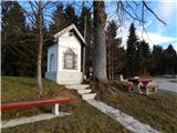 43
43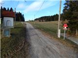 44
44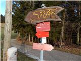 45
45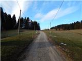 46
46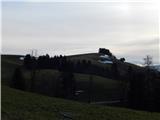 47
47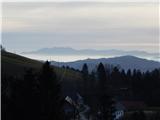 48
48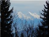 49
49 50
50 51
51 52
52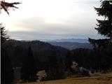 53
53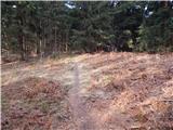 54
54 55
55
Discussion about the trail Govejk - Sivka