Spodnja Idrija - Jelenk (easy way)
Starting point: Spodnja Idrija (305 m)
| Lat/Lon: | 46,0343°N 14,0174°E |
| |
Name of path: easy way
Time of walking: 2 h
Difficulty: easy marked way
Altitude difference: 802 m
Altitude difference po putu: 802 m
Map: Škofjeloško in Cerkljansko hribovje 1:50.000
Recommended equipment (summer):
Recommended equipment (winter):
Views: 16.919
 | 2 people like this post |
Access to the starting point:
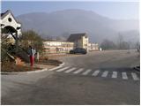
From Logatec, drive to Tolmin or vice versa. When you get to Spodnja Idrija turn left (from Tolmin turn right) in the direction of the village of Kanomlja. After 100 m of driving, you will see a sign for Jelenk. There is also a large parking lot near the sign, but you can only park there on free days (the parking lot is reserved for employees of a nearby company).
Path description:
From the parking lot, cross the bridge over the Kanomljica River and on the other side continue straight along the asphalted road to the crossroads, where you continue along the right-hand road that climbs past the houses. After a short climb, the signs for Jelenk direct you left across the meadow uphill. In the middle of the meadow, leave cart track and continue left up the footpath (the path is waymarked). The path then goes into the forest, where it climbs quite steeply. A little higher you reach a secluded farm, where you also get on the road. The road is only crossed because the markings then direct us to the footpath, which initially climbs up the forest slopes. After a few steps of further walking, the path goes back into the forest, where it leads us to a crossroads.
Continue left on the easier path (right, a very difficult path, which is very dangerous to slip on in wet conditions), which climbs gently up to the ridge where the farmhouse stands. Here the path turns right and climbs over a meadow, at the top of which the path turns left into the wods. The way ahead leads to a pleasant little well, where there is a small crossroads. Continue on the marked path in the direction of Jelenka. The way forward climbs steeply through the forest, where it crosses a forest road and leads us higher to the next farm, where we also join the climbing route.
Here continue left along the road (porly marked) to the next house, after which continue right uphill. Continue climbing along cart track, which leads us over a less and less vegetated slope to the bottom of the Jelenka peak. Just below the summit, we see the signs for Jelenk, which point us right upwards. Follow this path, which will lead you to the summit in a few steps.

Pictures:
 1
1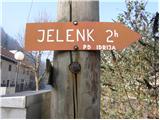 2
2 3
3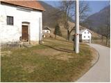 4
4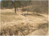 5
5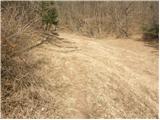 6
6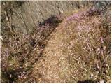 7
7 8
8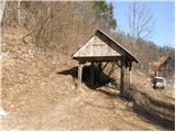 9
9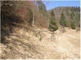 10
10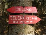 11
11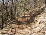 12
12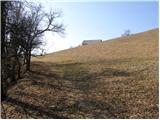 13
13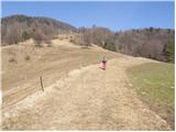 14
14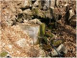 15
15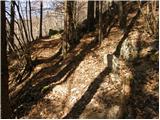 16
16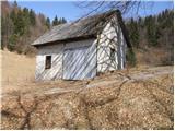 17
17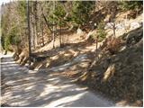 18
18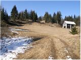 19
19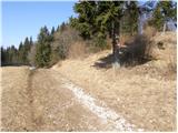 20
20 21
21
Discussion about the trail Spodnja Idrija - Jelenk (easy way)
|
| miri7. 11. 2013 |
Opomba
Od zapuščene domačije tik pod vrhom,vas markirana pot v desetih minutah pripelje na razledišče,kjer imate pred sabo vse gore od Krna do Grintovcev.
|
|
|
|
| Loni8. 11. 2013 |
tu bi pa skoraj lahko dali med obvezno opremo jadralno padalo, neštetokrat sem našim fantom peljala avto nazaj v dolino
|
|
|
|
| miri8. 11. 2013 |
@Loni,da bi pa tebe kdo popeljal s padalom,se pa verjetno ni nobeden spomnil,ane?
|
|
|
|
| Loni11. 11. 2013 |
miri, so se, so se, je bilo prav fajn.
|
|
|
|
| miri16. 10. 2019 |
Obnovljena štirna na Jelenku.
|
|
|
|
| tavzentroza12. 10. 2021 19:05:43 |
ta opis je verjetno kar nekaj let star, ker danes sem ga obiskala in je vrh zelo razgleden, drevesa
so posekana.
Bi priložila sliko, sam ne vem kako.
|
|
|
|
| miri12. 10. 2021 19:27:09 |
Pojdi na Forum-Razmere .Sredina strani.
Je malo spremenjena trasa poti.Takoj na vrhu asfaltiranega klanca je treba na levo. In tudi mimo kmetije,pol ure od štarta, zavije levo.
Sicer je pa odlično označena,za kar skrbijo naši markacisti.
|
|
|
|
| tavzentroza12. 10. 2021 19:48:47 |
ja je označena, samo napisala sem kot obvestilo, da je vrh gol in razgleden, ni več tak kot v opisu (slika št.21.sedaj ni več tako)Kako prosim, naložim novo- dejansko sliko.
Na forumu -razmere je govora o drugem Jelenku (787M)tu pišem o Jelenku 1107m.
|
|
|