 | Polhov Gradec - Tošč (via Grmada)
Tošč, which became the highest peak of Polhograjsko hribovje decades ago when Pasja ravan was lowered by 9 m by the Yugoslav army, is located nor...
2 h 30 min |
 | Gabrje - Tošč
Tošč, which became the highest peak of Polhograjsko hribovje decades ago when Pasja ravan was lowered by 9 m by the Yugoslav army, is located nor...
3 h 5 min |
 | Škofja Loka (Vincarje) - Lubnik (ridge path)
Lubnik is a 1025 m high mountain rising steeply to the west of Škofja Loka. From the summit, on which the mountain lodge stands, you can enjoy a ...
2 h 15 min |
 | Škofja Loka - Lubnik (via Stari grad)
Lubnik is a 1025 m high mountain rising steeply to the west of Škofja Loka. From the summit, on which the mountain lodge stands, you can enjoy a ...
2 h 15 min |
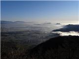 | Praprotno - Lubnik
Lubnik is a 1025 m high mountain rising steeply to the west of Škofja Loka. From the summit, on which the mountain lodge stands, you can enjoy a ...
2 h 15 min |
 | Poljane nad Škofjo Loko - Lubnik (via Gabrška gora)
Lubnik is a 1025 m high mountain rising steeply to the west of Škofja Loka. From the summit, on which the mountain lodge stands, you can enjoy a ...
3 h 45 min |
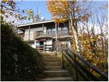 | Preserje - Krim
Krim is a 1107 m high mountain rising south of the Ljubljana Marshes. From the top of the mountain, where the mountain lodge and a number of tran...
2 h 20 min |
 | Jezero - Krim (via Ledenica)
Krim is a 1107 m high mountain rising south of the Ljubljana Marshes. From the top of the mountain, where the mountain lodge and a number of tran...
2 h 30 min |
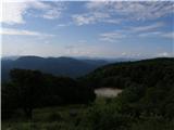 | Strahomer - Krim (via Strmec)
Krim is a 1107 m high mountain rising south of the Ljubljana Marshes. From the top of the mountain, where the mountain lodge and a number of tran...
2 h 10 min |
 | Strahomer - Krim (via Kramarca)
Krim is a 1107 m high mountain rising south of the Ljubljana Marshes. From the top of the mountain, where the mountain lodge and a number of tran...
2 h 10 min |
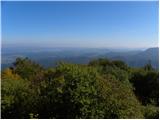 | Dom v Iškem Vintgarju - Krim
Krim is a 1107 m high mountain rising south of the Ljubljana Marshes. From the top of the mountain, where the mountain lodge and a number of tran...
2 h 15 min |
 | Vrbljene - Krim
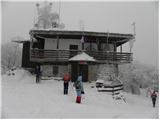
Krim is a 1107 m high mountain rising south of the Ljubljana Marshes. From the top of the mountain, where the mountain lodge and a number of tran...
2 h 15 min |
 | Tomišelj - Krim
Krim is a 1107 m high mountain rising south of the Ljubljana Marshes. From the top of the mountain, where the mountain lodge and a number of tran...
2 h 15 min |
 | Jezero - Krim (via homestead Špelin)
Krim is a 1107 m high mountain rising south of the Ljubljana Marshes. From the top of the mountain, where the mountain lodge and a number of tran...
2 h 20 min |
 | Dolenja Brezovica - Krim
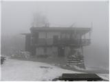
Krim is a 1107 m high mountain rising south of the Ljubljana Marshes. From the top of the mountain, where the mountain lodge and a number of tran...
2 h 10 min |
 | Iška - Krim
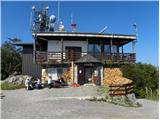
Krim is a 1107 m high mountain rising south of the Ljubljana Marshes. From the top of the mountain, where the mountain lodge and a number of tran...
2 h 10 min |
 | Potoče - Javorov vrh (via Potoška gora)
Javorov vrh (also Javorjev vrh according to some records) is a 1434 m high mountain located northeast of Preddvor. From the top, which has a regi...
2 h 45 min |
 | Potoče - Javorov vrh (direct way)
Javorov vrh (also Javorjev vrh according to some records) is a 1434 m high mountain located northeast of Preddvor. From the top, which has a regi...
2 h 30 min |
 | Gornji Grad - Lepenatka (via Kal)
Lepenatka is a grassy peak located south of the 1557 m high Rogatec. From the top, which has a registration box and a stamp, we have a beautiful ...
3 h |
 | Gornji Grad - Lepenatka (on ridge)
Lepenatka is a grassy peak located south of the 1557 m high Rogatec. From the top, which has a registration box and a stamp, we have a beautiful ...
3 h |
 | Lozice - Vojkova koča na Nanosu
Vojkova koča is located on the southern edge of the Nanoše plateau, close to Pleše, a peak that is clearly visible from the motorway. From the hu...
2 h 45 min |
 | Ernejčkov graben - Pasja ravan
Pasja ravan is the second highest peak in the Polhograje Hills. A few decades ago, at 1029 m, it was the highest peak, but the Yugoslav army flat...
3 h 15 min |
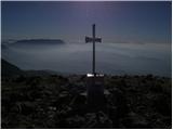 | Vrtovin - Kucelj na Čavnu
Kucelj is located on the southern slopes of Trnovo Forest, north-west of the Vipava valley. From the uncultivated summit on which the cross stand...
2 h 15 min |
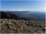 | Stomaž - Kucelj na Čavnu
Kucelj is located on the southern slopes of Trnovo Forest, north-west of the Vipava valley. From the uncultivated summit on which the cross stand...
3 h |
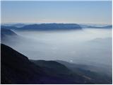 | Vrtovin - Kucelj na Čavnu (via Koča na Mali gori)
Kucelj is located on the southern slopes of Trnovo Forest, north-west of the Vipava valley. From the uncultivated summit on which the cross stand...
3 h |
 | Stomaž - Veliki Modrasovec
Veliki Modrasovec is located in the southern part of the Trnovo Forest near Predmeja. On the top of the hill is an old military building which yo...
2 h 35 min |
 | Vrtovin - Veliki Modrasovec
Veliki Modrasovec is located in the southern part of the Trnovo Forest near Predmeja. On the top of the hill is an old military building which yo...
3 h 5 min |
 | Selski most - Babji zob (via Kupljenik)
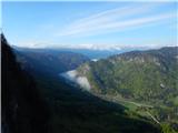
Babji zob is a lookout point above the village of Kupljenik near Bled. The precipitous peak, which has a registration box, has a beautiful view o...
2 h 40 min |
 | Matavun - Vremščica
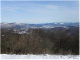
Vremščica is a mountain chain, stretching between Senožeče, Pivka and Divača. The highest top is also called Vremščica and the view from it is am...
3 h 15 min |
 | Famlje - Vremščica
Vremščica is a mountain chain, stretching between Senožeče, Pivka and Divača. The highest top is also called Vremščica and the view from it is am...
2 h 30 min |
 | Marija Reka (Strgar) - Mrzlica
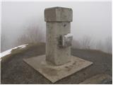
Mrzlica has become an extremely popular excursion point in the last few years, especially for visitors from the Savinjska Valley and Zasavje. At ...
2 h 30 min |
 | Matke - Mrzlica
Mrzlica has become an extremely popular excursion point in the last few years, especially for visitors from the Savinjska Valley and Zasavje. At ...
2 h 30 min |
 | Hrastnik - Mrzlica (via Klobuk)
Mrzlica has become an extremely popular excursion point in the last few years, especially for visitors from the Savinjska Valley and Zasavje. At ...
3 h |
 | Hrastnik - Mrzlica (via Ravne)
Mrzlica has become an extremely popular excursion point in the last few years, especially for visitors from the Savinjska Valley and Zasavje. At ...
3 h |
 | Trbovlje - Mrzlica
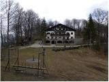
Mrzlica has become an extremely popular excursion point in the last few years, especially for visitors from the Savinjska Valley and Zasavje. At ...
2 h 30 min |
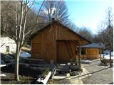 | Vrtovin - Mala gora
Mala gora is a plateau on the slope of the Chavn. A hut is located at an altitude of 1034 metres. Mala gora is known for its flowers, which are u...
2 h 15 min |
 | Vitanje - Basališče (Paški Kozjak)
Basališče is the highest peak of Paško Kozjak. There is a bench and a registration box at the top. Due to the forest, there is no view....
2 h 30 min |
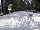 | Slovenj Gradec - Kremžarjev vrh
Kremžarjev vrh is the westernmost millennium on Pohorje. It is located north-east of Slovenj Gradec. There is no view from the summit, which has ...
2 h 15 min |
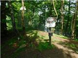 | Vuzenica - Kremžarjev vrh
Kremžarjev vrh is the westernmost millennium on Pohorje. It is located north-east of Slovenj Gradec. There is no view from the summit, which has ...
3 h 50 min |
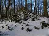 | Jelševica - Črni vrh (Čemšeniška planina)
Črni vrh is the highest peak of Čemšeniška mountain pasture and with a height of 1204 m it is the second highest peak in the Posavje - Zasavje hi...
2 h 45 min |
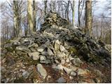 | Dolina Zaplaninščice - Črni vrh (Čemšeniška planina)
Črni vrh is the highest peak of Čemšeniška mountain pasture and with a height of 1204 m it is the second highest peak in the Posavje - Zasavje hi...
2 h 30 min |
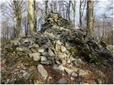 | Loke - Črni vrh (Čemšeniška planina) (via Zajčeva koča)
Črni vrh is the highest peak of Čemšeniška mountain pasture and with a height of 1204 m it is the second highest peak in the Posavje - Zasavje hi...
3 h 35 min |
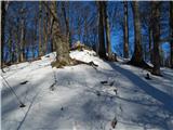 | Izlake - Črni vrh (Čemšeniška planina)
Črni vrh is the highest peak of Čemšeniška mountain pasture and with a height of 1204 m it is the second highest peak in the Posavje - Zasavje hi...
3 h |
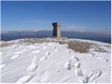 | Hrpelje - Slavnik
Slavnik is a scenic mountain rising south of Kozina and west of Podgorje. Podgorje is a village which is a suitable starting point for ascending ...
3 h 30 min |
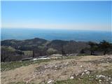 | Hunting cottage Budanje - Sinji vrh (eastern path via Škraplje)
Sinji vrh is a scenic mountain located between Col, Ajdovščina and Predmeja. From the top, you can enjoy a beautiful view over most of western Sl...
3 h 10 min |
 | Hunting cottage Budanje - Sinji vrh (west path)
Sinji vrh is a scenic mountain located between Col, Ajdovščina and Predmeja. From the top, you can enjoy a beautiful view over most of western Sl...
3 h |
 | Jamce - Sinji vrh (eastern path via Škraplje)
Sinji vrh is a scenic mountain located between Col, Ajdovščina and Predmeja. From the top, you can enjoy a beautiful view over most of western Sl...
2 h 55 min |
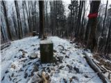 | Kopačnica - Bevkov vrh
Bevkov vrh, which is a point on the Slovenian mountain trail, is located between Cerkno and Spodnja Idrija. The summit is covered with forest and...
3 h 40 min |
 | Cerkno - Bevkov vrh
Bevkov vrh, which is a point on the Slovenian mountain trail, is located between Cerkno and Spodnja Idrija. The summit is covered with forest and...
2 h 50 min |
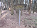 | Žiri - Sivka (via Vrsnik)
Sivka is a forested peak located west of Žiri and north of Idrija. On the summit there is a stamp of the Slovenian mountain trail and a registrat...
2 h 30 min |
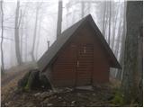 | Spodnja Rečica - Gozdnik (via Tolsto)
Gozdnik is a hill rising steeply above the village of Zabukovica. There is no view from the top, due to the forest, but there is a bivouac on it,...
3 h 20 min |
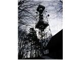 | Slovenske Konjice - Stolpnik (via castle)
At 1012 m, Stolpnik is the highest peak of the Konjiška Gora, a mountain range stretching south-west from Slovenske Konjice. A 25 m high lookout ...
2 h 15 min |
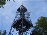 | Žička kartuzija - Stolpnik (via Krniški rob)
At 1012 m, Stolpnik is the highest peak of the Konjiška Gora, a mountain range stretching south-west from Slovenske Konjice. A 25 m high lookout ...
2 h 30 min |
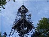 | Žička kartuzija - Stolpnik (via Skala and Krniški rob)
At 1012 m, Stolpnik is the highest peak of the Konjiška Gora, a mountain range stretching south-west from Slovenske Konjice. A 25 m high lookout ...
3 h 15 min |
 | Žička kartuzija - Stolpnik (Žička kartuzija - Stolpnik - Črešnjice)
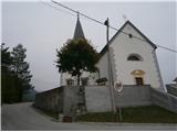
At 1012 m, Stolpnik is the highest peak of the Konjiška Gora, a mountain range stretching south-west from Slovenske Konjice. A 25 m high lookout ...
3 h 15 min |
 | Spodnje Stranice (graves of hundred hostages) - Stolpnik (via Grofov štant)
At 1012 m, Stolpnik is the highest peak of the Konjiška Gora, a mountain range stretching south-west from Slovenske Konjice. A 25 m high lookout ...
2 h 10 min |
 | Frankolovo - Stolpnik
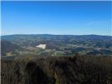
At 1012 m, Stolpnik is the highest peak of the Konjiška Gora, a mountain range stretching south-west from Slovenske Konjice. A 25 m high lookout ...
2 h 30 min |
 | Log - Mariborski razglednik (Cigelnica)
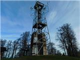
Mariborski razglednik) is a 1147 m high peak located next to the Maribor Pohorje ski resort. A lookout tower stands at the top, offering a beauti...
2 h 50 min |
 | Pivola (Reka) - Mariborski razglednik (Cigelnica) (via Petkovo sedlo)
Mariborski razglednik) is a 1147 m high peak located next to the Maribor Pohorje ski resort. A lookout tower stands at the top, offering a beauti...
2 h 40 min |
 | Fram - Mariborski razglednik (Cigelnica) (via Petkovo sedlo)
Mariborski razglednik) is a 1147 m high peak located next to the Maribor Pohorje ski resort. A lookout tower stands at the top, offering a beauti...
3 h 25 min |
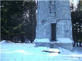 | Ruše - Žigartov vrh
At 1346m, Žigartov vrh is the highest peak in the eastern part of Pohorje. An "observation" tower used to stand on the summit, but was erected on...
3 h 15 min |
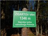 | Log - Žigartov vrh
At 1346m, Žigartov vrh is the highest peak in the eastern part of Pohorje. An "observation" tower used to stand on the summit, but was erected on...
3 h 35 min |
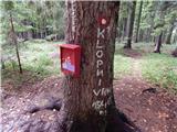 | Činžat - Klopni vrh (northern path)
Klopni vrh encloses the lower lying extensive plateau in the eastern Pohorje Mountains from the north-west. The area of the horizontal section at...
2 h 45 min |
 | Činžat - Klopni vrh (eastern path)
Klopni vrh encloses the lower lying extensive plateau in the eastern Pohorje Mountains from the north-west. The area of the horizontal section at...
2 h 45 min |
 | Lovrenc na Pohorju - Klopni vrh (via Spodnji trg and on northern path)
Klopni vrh encloses the lower lying extensive plateau in the eastern Pohorje Mountains from the north-west. The area of the horizontal section at...
3 h 5 min |
 | Lovrenc na Pohorju - Klopni vrh (via Spodnji trg and on eastern path)
Klopni vrh encloses the lower lying extensive plateau in the eastern Pohorje Mountains from the north-west. The area of the horizontal section at...
3 h 5 min |
 | Lovrenc na Pohorju - Klopni vrh (via Zgornji trg and on northern path)
Klopni vrh encloses the lower lying extensive plateau in the eastern Pohorje Mountains from the north-west. The area of the horizontal section at...
2 h 30 min |
 | Lovrenc na Pohorju - Klopni vrh (via Zgornji trg and on eastern path)
Klopni vrh encloses the lower lying extensive plateau in the eastern Pohorje Mountains from the north-west. The area of the horizontal section at...
2 h 30 min |
 | Ruše - Klopni vrh (severna pot)
Klopni vrh encloses the lower lying extensive plateau in the eastern Pohorje Mountains from the north-west. The area of the horizontal section at...
3 h 40 min |
 | Kokarje (ŠRC Laze) - Tolsti vrh (Dobrovlje) (via Dom na Farbanci)
Tolsti vrh is, together with Šentjoški vrh (1077m), the highest peak of the Dobrovelj Plateau. The view from the summit, which has a registration...
3 h 15 min |
 | Potok (Mostni graben) - Tolsti vrh (Dobrovlje) (via Dom na Farbanci)
Tolsti vrh is, together with Šentjoški vrh (1077m), the highest peak of the Dobrovelj Plateau. The view from the summit, which has a registration...
2 h 50 min |
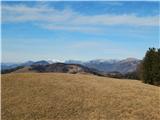 | Hotavlje - Ermanovec (via Slajka)
Ermanovec is a 1026 m high peak located between Cerkno and Gorenjska vasja, specifically above Sovodnje and Trebija. Just a few steps away from t...
2 h 40 min |
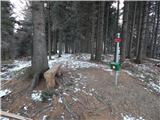 | Cerkno - Ermanovec (via Kladje)
Ermanovec is a 1026 m high peak located between Cerkno and Gorenjska vasja, specifically above Sovodnje and Trebija. Just a few steps away from t...
2 h 55 min |
 | Cerkno - Ermanovec (via Planina pri Cerknem)
Ermanovec is a 1026 m high peak located between Cerkno and Gorenjska vasja, specifically above Sovodnje and Trebija. Just a few steps away from t...
3 h |
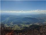 | Socka - Špicasti vrh (Kislica)
Špičasti vrh aka Kislica (the name of a small ridge south of Mala gora and the town of Vitanje) is a 994 m hill situated between Vojnik and Stran...
2 h 15 min |
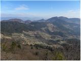 | Loke - Sveta planina (Partizanski vrh)
Sveta planina, also Partizanski vrh, is a 1011 m high mountain located between Čemšeniška mountain pasture and Mrzlica. From the top, where a sma...
2 h 25 min |
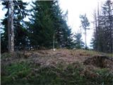 | Radlje ob Dravi - Kapunar / Kapunerkogel
Kapunar is a 1051 m high peak above Radlje ob Dravi. Just below the peak is an old caravan and border guardhouse, which is now used by radio amat...
2 h 15 min |
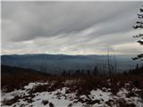 | Radlje ob Dravi - Kapunar / Kapunerkogel (via Župank)
Kapunar is a 1051 m high peak above Radlje ob Dravi. Just below the peak is an old caravan and border guardhouse, which is now used by radio amat...
2 h 30 min |
 | Radlje ob Dravi - Kapunar / Kapunerkogel (via old castle)
Kapunar is a 1051 m high peak above Radlje ob Dravi. Just below the peak is an old caravan and border guardhouse, which is now used by radio amat...
2 h 30 min |
 | Brezno - Kapunar / Kapunerkogel (along Remšniški potok)
Kapunar is a 1051 m high peak above Radlje ob Dravi. Just below the peak is an old caravan and border guardhouse, which is now used by radio amat...
3 h 35 min |
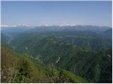 | Srednja Kanomlja - Hudournik
Hudournik is a 1148 m high peak located on the northern edge of the Vojskar plateau, a plateau situated between the valleys of the Idrijca, Kanom...
3 h 45 min |
 | Hotavlje - Štor (via Slajka)
Štor is a 1005 m high peak located directly above the Ermanovec Cottage. The peak itself is covered with forest, but from the meadow, which is on...
2 h 50 min |
 | Hotavlje - Štor (by road)
Štor is a 1005 m high peak located directly above the Ermanovec Cottage. The peak itself is covered with forest, but from the meadow, which is on...
2 h 15 min |
 | Cerkno - Štor (via Kladje)
Štor is a 1005 m high peak located directly above the Ermanovec Cottage. The peak itself is covered with forest, but from the meadow, which is on...
2 h 40 min |
 | Cerkno - Štor (via Planina pri Cerknem)
Štor is a 1005 m high peak located directly above the Ermanovec Cottage. The peak itself is covered with forest, but from the meadow, which is on...
2 h 45 min |
 | Trebija - Štor (via Ermanovec)
Štor is a 1005 m high peak located directly above the Ermanovec Cottage. The peak itself is covered with forest, but from the meadow, which is on...
2 h 20 min |
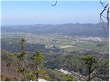 | Rakitnica - Bela stena
Bela stena (also just Stene) is a lookout point located west of Dolenje vas in the Ribnica valley, specifically above the village of Zadolje. Fro...
2 h 10 min |
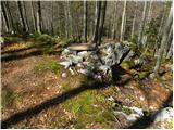 | Rakitnica - Rezinski vrh
Rezinski vrh is a 1231 m high mountain located in the middle of the vast forests of the Great Mountains. The summit, which has a registration box...
2 h 40 min |
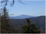 | Rakitnica - Turn
At 1254 m, Turn is the highest peak of the 14 km-long Velika Gora, a plateau rising between Ribnica polje and Liška Potok. The summit, which has ...
3 h |
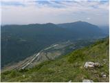 | Planina Polog - Mrzli vrh above Planina Pretovč
Mrzli vrh is a well-known World War I battlefield. Today, the summit is known as an open-air museum, where you can see numerous caverns, trenches...
2 h 45 min |
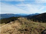 | Dolenji Novaki - Medrce
Medrce is a 1410 m high peak located between Porezno and Hum. From the top, where the old bunker is located, we have a beautiful view of Kojca, P...
3 h 15 min |
 | Cerkno - Medrce (via Labinjske lehe)
Medrce is a 1410 m high peak located between Porezno and Hum. From the top, where the old bunker is located, we have a beautiful view of Kojca, P...
3 h 25 min |
 | Zagreb (Šestine) - Sljeme (path HPD (path 52))
...
2 h 15 min |
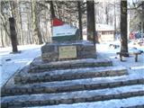 | Matrafüred - Kékestető (red path via Peresberc in Negyeshatar)
Matra is a mountain range located 70 km east of Budapest. The two highest peaks in Hungary are Kékestető, which is the highest peak in Hungary at...
2 h 45 min |
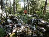 | Slovenska vas - Ledenik
At 1072 metres, Ledenik is the highest peak of Stojna, a forested ridge located between Kočevje and Kočevsko Rijeka. On the summit there is a reg...
3 h 15 min |
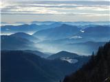 | Rovte - Bela peč (Podbliška gora)
Bela peč is located on the edge of Jelovica above the village of Podblica. From the top of the cliff we have a beautiful view of the village, the...
2 h 45 min |
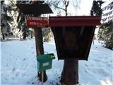 | Dravograd lake - Šteharski vrh (Šteharnikov vrh)
Šteharski or Šteharnikov vrh, also Črneška gora, is a 1018-metre-high mountain located in the south-eastern part of Strojna, a mountain range bet...
2 h 15 min |
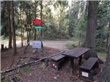 | Bistriški jarek (Verdinek) - Bricnik
Bricnik is a 1017-metre-high peak located in the Kozjak Mountains, above Muta. On the top, which is covered by forest, there is a registration bo...
3 h 10 min |
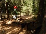 | Radlje ob Dravi - Bricnik
Bricnik is a 1017-metre-high peak located in the Kozjak Mountains, above Muta. On the top, which is covered by forest, there is a registration bo...
2 h 30 min |
 | Radlje ob Dravi - Bricnik (via Zavetišče Onuk - Glavar)
Bricnik is a 1017-metre-high peak located in the Kozjak Mountains, above Muta. On the top, which is covered by forest, there is a registration bo...
2 h 55 min |
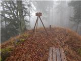 | Bistriški jarek (border crossing Muta) - Kozji vrh (at Košenjak)
Kozji vrh is a 1383-metre-high peak located above Pernice, and its height makes it the highest peak in the municipality of Muta....
2 h 50 min |
 | Bistriški jarek (Glasbeni dom) - Kozji vrh (at Košenjak)
Kozji vrh is a 1383-metre-high peak located above Pernice, and its height makes it the highest peak in the municipality of Muta....
2 h 45 min |
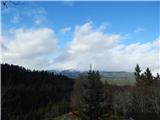 | Bled (Velika Zaka) - Berjanca
Berjanca is a 1264-metre peak located above the eponymous mountain pasture. The summit used to be reached by the long-abandoned lift of the forme...
3 h 10 min |
 | Bohinjska Bela (St. Marjeta) - Berjanca
Berjanca is a 1264-metre peak located above the eponymous mountain pasture. The summit used to be reached by the long-abandoned lift of the forme...
2 h 55 min |
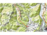 | Rein - Mühlbacher Kogel (via Hochstein)
Mühlbacher Kogel is a 1050m high mountain in the western part of the Graz mountain range in Styria, Austria. It is located above the Mühlbacher H...
2 h 30 min |
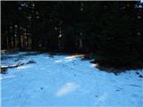 | Oplotnica - Veliki vrh (on Pohorje)
Veliki vrh is a 1344-metre-high peak located above the RTC Jakec - Trije kralji ski resort. The highest point of the peak is located in the fores...
3 h 15 min |
 | Zgornja Bistrica (Center Vintgar) - Veliki vrh (on Pohorje) (via Veliko Tinje)
Veliki vrh is a 1344-metre-high peak located above the RTC Jakec - Trije kralji ski resort. The highest point of the peak is located in the fores...
3 h 50 min |
 | Zgornja Bistrica (Center Vintgar) - Veliki vrh (on Pohorje) (via Bistriški vintgar)
Veliki vrh is a 1344-metre-high peak located above the RTC Jakec - Trije kralji ski resort. The highest point of the peak is located in the fores...
3 h 45 min |
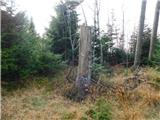 | Log - Ledinekov kogel
Ledinekov kogel is a 1182 m high peak located north of Maribor hut. Just below the summit is a fenced area with a radar tower....
2 h 40 min |
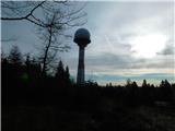 | Pivola (Reka) - Ledinekov kogel (vzhodna pot)
Ledinekov kogel is a 1182 m high peak located north of Maribor hut. Just below the summit is a fenced area with a radar tower....
2 h 40 min |
 | Pivola (Reka) - Ledinekov kogel (zahodna pot)
Ledinekov kogel is a 1182 m high peak located north of Maribor hut. Just below the summit is a fenced area with a radar tower....
2 h 45 min |
 | Fram - Ledinekov kogel (čez Petkovo sedlo, vzhodna pot)
Ledinekov kogel is a 1182 m high peak located north of Maribor hut. Just below the summit is a fenced area with a radar tower....
3 h 25 min |
 | Fram - Ledinekov kogel (čez Petkovo sedlo, zahodna pot)
Ledinekov kogel is a 1182 m high peak located north of Maribor hut. Just below the summit is a fenced area with a radar tower....
3 h 30 min |
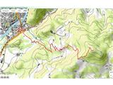 | Frohnleiten - Hochtrötsch (Trötsch)
...
2 h 15 min |
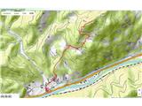 | Laufnitzdorf - Schiffall
...
2 h 15 min |
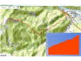 | Zlatten - Hochanger
...
2 h 30 min |