Strane - Suhi vrh (Nanos) (gentle path)
Starting point: Strane (664 m)
| Lat/Lon: | 45,7861°N 14,0873°E |
| |
Name of path: gentle path
Time of walking: 2 h 30 min
Difficulty: easy marked way
Altitude difference: 649 m
Altitude difference po putu: 700 m
Map: Nanos 1:50.000
Recommended equipment (summer):
Recommended equipment (winter): ice axe, crampons
Views: 46.346
 | 2 people like this post |
Access to the starting point:
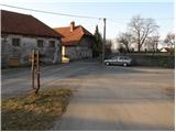
From the Ljubljana - Koper motorway, take the Razdrto exit and follow the parallel old road towards Postojna. Soon you will see signs pointing to the left in the direction of the villages Veliko Ubeljsko and Strane. In the village Malo Ubeljsko you will come to the next crossroads, where you continue slightly right in the direction of Strane (left Veliko Ubeljsko). Follow the road, which climbs slightly further, until you reach the centre of the village Strane, where you will see the mountain direction signs. Park a few metres away, near the children's playground (do not park in the playground).
Path description:
Signs for Nanos direct us to a climbing road, which we follow past a few houses. The road soon loses its tarmac surface and only a little higher up turns into a wide cart track, which we continue to climb. Cart track soon turns into a dense forest and leads us past a small well, in a moderate ascent, to a marked crossroads. Continue right in the direction of St Brice (left Nanos) along the path which, after 2 minutes' further walking, leads us to the church.
From Brice, we return to the nearby crossroads, and then continue our ascent in the direction of Nanos. The path continues to climb crosswise along the slightly narrower cart track, which crosses steeper and steeper slopes. The easy path, which opens up some views of the nearby outcrops, leads us higher up to a crossroads where the marked path to Suhi vrh branches off to the right.
We focus on the above-mentioned path (straight Vojkova koča), which turns to the right and is completely laid out. The path crosses a forest road higher up and continues on a moderate ascent through the forest. A little further on, rejoin the forest road and follow it to the right. After a further 10 steps, the relatively slippery road leads to a hunting lodge.
Continue along the road, which soon turns off a steep path to the right. Continue straight ahead and the road soon leads to a crossroads where you continue to the right in the direction of Suhega vrha. The road starts to descend a little further, and then you see a marked footpath that turns sharp right off the road. Take the footpath and within a few minutes, a slightly steep climb leads to Suhi vrh.

Pictures:
 1
1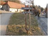 2
2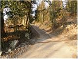 3
3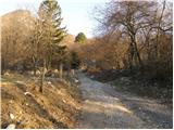 4
4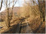 5
5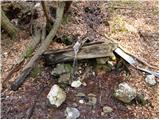 6
6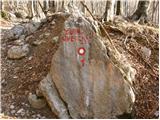 7
7 8
8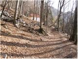 9
9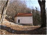 10
10 11
11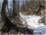 12
12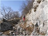 13
13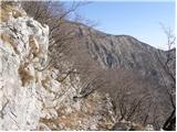 14
14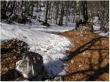 15
15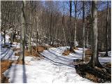 16
16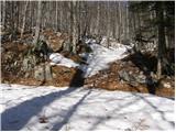 17
17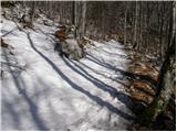 18
18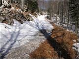 19
19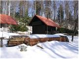 20
20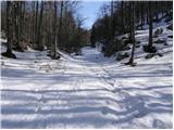 21
21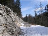 22
22 23
23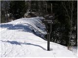 24
24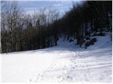 25
25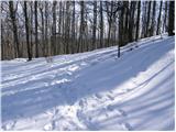 26
26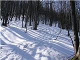 27
27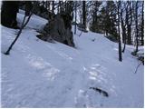 28
28 29
29
Discussion about the trail Strane - Suhi vrh (Nanos) (gentle path)
|
| yamahafazer20. 10. 2012 |
pravkar prišel iz Nanosa - lepo vreme in dobra hrana na koči
|
|
|
|
| leroy25. 05. 2014 |
Ne vem kdo je meril čas po tej poti,a se da lepo priti v uri in 40 minut.Brez hitenja.Pot je lepo speljana a malo obiskana.
|
|
|
|
| miri25. 05. 2014 |
@Leroy,eno mlado pohod(t)nico vzemi s seboj pa boš videl case. 
|
|
|
|
| SuzanaM22. 08. 2014 |
V nedeljo, 17.8.2014 sem se podala na Suhi vrh iz vasi Strane. Pri prvi obledeli oznaki za Suhi vrh (po približno 1 uri hoje od cerkve v Stranah) sem po nekaj korakih prišla do razpotja in nadaljevala po desni poti, ki jo je označeval možic. Mogoče bi morala naravnost in naprej po cesti, ki sem jo videla pod sabo. Dobro označeno razpotje s smernimi tablami in svežimi oznakami na kamnih pa sem videla ob povratku po položni poti. Pot, ki sem jo ubrala, zgleda na karti kar nekaj krajša od te, ki je opisana zgoraj. Za njo sem porabila slabi dve uri s postanki za fotografiranje, s tem da sem s hojo pričela pri cerkvi, kar je nekoliko dlje od opisanega izhodišča, vmes pa še malo skrenila s prave poti. Po opisani poti bi zagotovo porabila dobri dve uri. Leroy ima verjetno dolg korak, da je prišel po njej v tako kratkem času in brez hitenja. Več o mojem pohodu na spodnji povezavi: http://www.hribi.net/trenutnerazmere.asp?slo=1&gorovjeid=26&id=6167
|
|
|
|
| soraya200225. 04. 2021 14:14:52 |
Danes lepa krožna turca Strane - Sv. Bric - Boljunov vrh - Čeledinova koča - Suhi vrh - Votla stena - Maj - Strane. Čas približno 3h 15min. Okus visokogorja, mir in lepi razgledi. Pejte, ne bo vam žal. 
|
|
|
|
| Salsagirl2. 03. 2022 15:57:49 |
Mene zanima, kje se lahko parkira.
|
|
|
|
| garmont2. 03. 2022 16:57:01 |
Sam sem vedno parkiral ob robu igrišča. Je dovolj prostora, da ne moti morebitne košarkaše.
|
|
|
|
| KarmenT6. 03. 2022 20:15:03 |
V centru Stran je manjše otroško igrišče, ki je bilo danes na njegovem koncu zavezano z vrvjo. Lahko se parkira ob avtobusni hišici, midva pa sva parkirala na drugi strani ceste, ob neki propadajoči hiši. Danes sva bila edina. Srečno in varno.
|
|
|