Sviščaki - Snežnik (variant through forest)
Starting point: Sviščaki (1242 m)
| Lat/Lon: | 45,5742°N 14,401°E |
| |
Name of path: variant through forest
Time of walking: 2 h
Difficulty: easy marked way
Altitude difference: 554 m
Altitude difference po putu: 554 m
Map: Snežnik 1:50.000
Recommended equipment (summer):
Recommended equipment (winter):
Views: 17.169
 | 6 people like this post |
Access to the starting point:
On the regional road from Ilirska Bistrica to Sviščaki (19 km), 11 km of the road is asphalted.
Path description:
You can leave your vehicle in the large parking lot 100 metres in front of the lodge (the only option in winter), or in front of the lodge itself. From the large parking lot, follow the forest road on the right side of Sviščaki until you reach the signs which lead you for some time through Male Sviščaki (upper part of Sviščaki), and from in front of the mountain lodge just follow the signs (signpost). The path leads you initially through the weekend village of Sviščaki (almost 100 houses). When you leave Sviščaki, you first walk along the mountain path through the beech forest for about 500 m to the forest road, which you leave after 300 m (the Chapel of St Gabrijel) and continue (signposted!) on the right along the forest logging trail (tractor wood hauling path). See only the Knafelch markings (red circle with white dot), also the E-6 markings (red circle with yellow dot) and the couriers' and rangers' markings (blue circle with yellow dot), as the forests in this area are heavily dotted with forestry markings - red lines that strongly resemble the marker lines that indicate direction. Follow logging trail gently climbing through the beech forest, cross the Lom Forest Road (signpost) and continue to the junction with the Snežnik Forest Road (signpost, the place is called Pri kapetanovi bajti by the locals, but the byte has been gone for a long time). Here there is a wide plateau, where you can continue on the road, or follow a signposted shortcut for 50 m, where you rejoin the road. Follow the signs and climb to the end of the steep forest road (Obračališče), where there is a viewpoint to the west. It took us 1h 15min to get here, and we still have 45min to climb up the mountain path through dwarf pines. The path becomes a little steeper only 300 m below the summit, and the last 100 m to the right (direction S), the steepness eases and we reach the Draga Karolina hut. This is also the summit, as the ridge of the hut is at the same height as the summit of Snežnik. I should also mention that in winter there are two places on the trail that are particularly exposed to the storm or SW wind, namely Obračališče, and the edge on the ridge 100 m before the summit, where the steepness subsides.

Pictures:
 1
1 2
2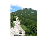 3
3 4
4 5
5 6
6 7
7 8
8 9
9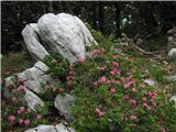 10
10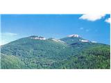 11
11 12
12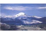 13
13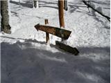 14
14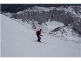 15
15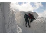 16
16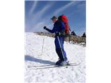 17
17 18
18 19
19
Discussion about the trail Sviščaki - Snežnik (variant through forest)
|
| smatjaz19. 05. 2013 |
Marco, danes bil gor, naredil si izvrsten in izčrpen opis poti. Tudi tisto z burjo drži, le pozabil si omeniti da se je na vrhu nad kočo potrebno privezati, drugače greš po zračni liniji v dolino zaradi burje seveda.
|
|
|