Šembije - Šilentabor (via Brkinški rob)
Starting point: Šembije (597 m)
| Lat/Lon: | 45,6039°N 14,2314°E |
| |
Name of path: via Brkinški rob
Time of walking: 2 h 5 min
Difficulty: easy unmarked way
Altitude difference: 154 m
Altitude difference po putu: 330 m
Map: Snežnik 1:50.000
Recommended equipment (summer):
Recommended equipment (winter):
Views: 5.612
 | 1 person likes this post |
Access to the starting point:
a) From the motorway Ljubljana - Koper take the exit Postojna and follow the road in the direction of Pivka, Rijeka and Ilirska Bistrica. At Pivka, leave the main road leading to Ilirska Bistrica and continue towards Knežak. Just after Knežak, we reach the village of Šembije, where we turn right in the middle of the village towards the nearby church. A little further on from the church, the village ends and we continue driving on a dirt road, which we climb gently to a small crossroads near the old bunkers. Park nearby in a convenient place on the roadside.
b) Drive to Ilirska Bistrica, then continue to Knežak. Before arriving at Šembije, leave the main road and drive left towards the village of Podtabor. At the beginning of Podtabor we reach a crossroads of several roads, and we take the rightmost one (the far right yard of a nearby house) and climb it steeply for a short distance. As the road levels out, you will see old bunkers on the left, a small concrete cross on the right and a small crossroads a few metres further on. Park somewhere nearby in a suitable place along the road.
Path description:
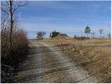
From the starting point, take the side dirt road, which starts to climb gently north-westwards, quickly turning into a wide cart track. After only 10 m, the cart track splits into two parts, and we choose the left one, which quickly takes us over the top edge of the precipitous cliffs. From the edge, we have a fine view of the village of Podtabor, almost vertically below us, and of the Brkini Mountains in the distance. As we continue our ascent, we may even see some old and faded markings along the way, but this is a rarity rather than the rule. A little higher up, the trail leads through a few sparse strips of scrub, then gradually changes to open grassy slopes. Here the path turns slightly to the right and leads to a small pass (the pass between Bezgovica 738 m and Vrh 777 m).
At the pass, cross a grazing fence and begin a gentle descent behind it. The cart track quickly lays down, and we walk along it for only a short time, then on the left side we see several small paths that climb crosswise over the gently sloping grassy slope. We continue along one of the paths, taking care to keep as far to the left as possible, i. e. the paths that run as close as possible to the Brk edge. Higher up, we cross a short strip of forest, and the path, which gradually becomes a distinct ridge, quickly leads us to the lesser-known, but relatively scenic, Gradišče peak, with increasingly beautiful views.
From the top, continue along the path into the forest, through which it begins to descend gently. The trail continues along the Brkinje Edge from time to time, then gradually turns into a rather overgrown part, where the thorns make the passage difficult, especially in the summer months. A little further on, the path turns slightly right and joins the wider cart track, which then leads us in a gentle descent over the panoramic slopes. The path continues along the edge of the pastures, which, with a view of Snežnik and the Upper Pivška basin, leads to a crossroads at the Klanec saddle.
Here the path branches off to the left down to the nearby cross, Narin and Ratečevo Brdo, and we continue straight on (right down Zagorje) and continue along the relatively gently sloping and scenic cart track. After about 15 minutes of further walking, we reach a crossroads where a macadam road branches off to the left towards the nearby St Martin's Church, and we continue straight on along the asphalt road, which quickly leads to the next crossroads. Here, continue right to the village Šilentabor (Narin on the left), where you will pass a few houses and walk to the point where the marked trail from Pivka joins from the right.
Continue straight ahead and walk past the registration box and transmitters to the summit in a few minutes.

Pictures:
 1
1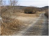 2
2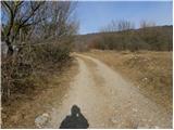 3
3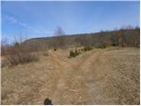 4
4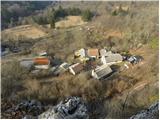 5
5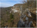 6
6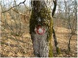 7
7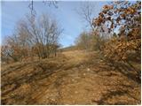 8
8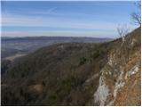 9
9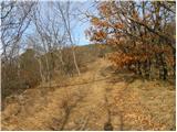 10
10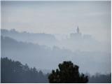 11
11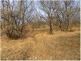 12
12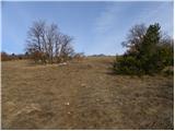 13
13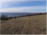 14
14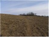 15
15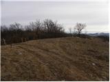 16
16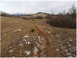 17
17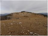 18
18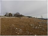 19
19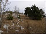 20
20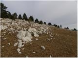 21
21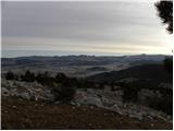 22
22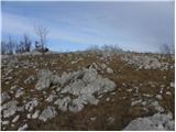 23
23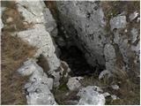 24
24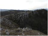 25
25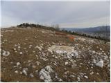 26
26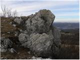 27
27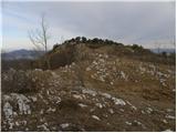 28
28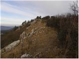 29
29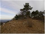 30
30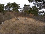 31
31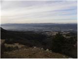 32
32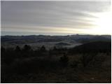 33
33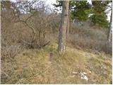 34
34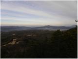 35
35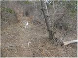 36
36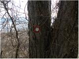 37
37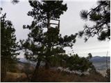 38
38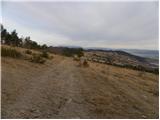 39
39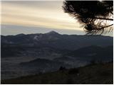 40
40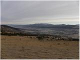 41
41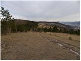 42
42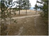 43
43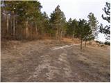 44
44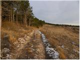 45
45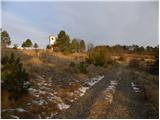 46
46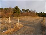 47
47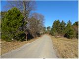 48
48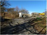 49
49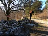 50
50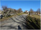 51
51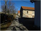 52
52 53
53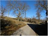 54
54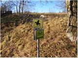 55
55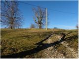 56
56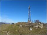 57
57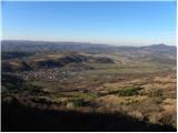 58
58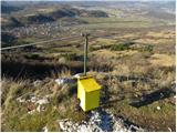 59
59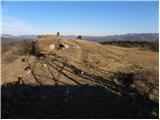 60
60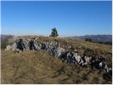 61
61 62
62
Discussion about the trail Šembije - Šilentabor (via Brkinški rob)
|
| bizgo9328. 02. 2021 |
Prekrasen in precej dolg krožni pohod (14 km) s krasnimi razgledi in pohodi čez pašnike in skozi borove gozdičke. Strmejši vzpon je le na začetku proti Bezgovici, nato pa se pohod po Brkinskem robu zmerno vzpenja in po vrhu Gradišče (791 m) do cerkvice sv. Martina rahlo pada. Že med samo potjo je lep razgled na Brkine z dolino reke Reke in Čičarijo na zahodu ter Snežnik z okoliškim hribovjem in kneško kotlino na vzhodu. Iz samega vrha nad vasjo pa se ta odpre še proti Nanosu, Vremščici, v daljavi pa vidimo tudi Dolomite, Julijce in Trnovsko planoto. Za nazaj predlagam da se krožno vrnete po stari italijanski cesti proti Podtaboru, kjer lahko opazujete krasno pokrajino, kjer se mešata fliš in apnenec, ta pa se po izklesanem tunelu zaključi s prekrasno Podtaborsko steno. Nekje 100 m naprej od ostankov grada Tabor v steni, boste opazili potko, ki se bo strmo vzpela skozi gozd in vas bo vrnila do izhodišča v Šembijah.
|
|
|
|
| navdušena26. 04. 2021 20:43:12 |
Lepa pot, markacij pa do Šilentabora ni. Nič hudega, saj je lahko sledljiva. V megli pa le ne hodite tja!
|
|
|
|
| ločanka23. 02. 2022 18:22:49 |
Kot opisuje bizgo93 čudovita pot po tem Brkinskem robu, a najlepša sigurno krožna, le da sva jo midva včeraj delala v obratni smeri. Gor po stari italijanski poti skozi Mussolinijev tunel pod čudovitimi stenami iz vasice Podtabor. Vračala pa po zgoraj opisani poti z razgledi na obe strani, po grebenu med lepimi borovčki, kasneje ob robu pašnikov. Vmes označena točka za Gradišče 791 m. Prekrasno res!
|
|
|