Ledinsko Razpotje - Sveta Marija Magdalena (Gore) (west path)
Starting point: Ledinsko Razpotje (702 m)
| Lat/Lon: | 46,0281°N 14,0477°E |
| |
Name of path: west path
Time of walking: 1 h 10 min
Difficulty: easy marked way
Altitude difference: 149 m
Altitude difference po putu: 200 m
Map: Škofjeloško in Cerkljansko hribovje 1:50.000
Recommended equipment (summer):
Recommended equipment (winter):
Views: 817
 | 1 person likes this post |
Access to the starting point:
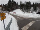
a) From Železniki, Kranj or Medvode, drive to Škofja Loka, and from there continue in the direction of Gorenje vasi in the Poljanska valley and Žire. In Žire, or at the end of Žire (Stare Žiri), leave the main road towards Rovty and Logatec and turn right towards Idrija. After about 6 km of driving from the crossroads in Žire, you will arrive at the Ledine crossroads, where there is a small crossroads with mountain direction signs. Park about 50 m further in the direction of Idrija, in a slightly larger parking lot at the next crossroads. The parking lot is located in the immediate vicinity of several mountain direction signs and the pension Kmečki hram Fortuna.
b) From Horjul or Polhov Gradec, drive to Šentjošt nad Horjul, and from there continue to Smreč. When you reach the main road Podlipa - Žiri, follow it to the right, and we drive along it to Žiri. When you reach the main road Škofja Loka - Logatec in Žire, follow it to the left, and you will pass the parish church and the Lenger Inn and Pizzeria. After the inn we reach a crossroads, where we leave the main road towards Logatec and continue in the direction of Idrija. After about 6 km of driving from the crossroads in Žire, we arrive at the Ledine crossroads, where there is a small crossroads and mountain direction signs. Park about 50 m further in the direction of Idrija, in a slightly larger parking lot at the next crossroads. The parking lot is located in the immediate vicinity of several mountain direction signs and the pension Kmečki hram Fortuna.
c) From the motorway Ljubljana - Koper take the exit Vrhnika, then when you reach the old road Ljubljana - Logatec, continue in the direction of Logatec, but only for a short time, because already at the next junction continue right in the direction of Horjul. The road continues for a short distance through Vrhnika, later through the outskirts of Stara Vrhnika, and then soon we leave the road towards Horjul and continue slightly left in the direction of Smrečje. After Smrečje the road starts to descend towards Račeva and Žire. Once in Žire, we reach the main road Škofja Loka - Logatec, follow it to the left, and we drive along it past the parish church and the Lenger Inn and Pizzeria. After the inn we reach a crossroads, where we leave the main road towards Logatec and continue in the direction of Idrija. After about 6 km of driving from the crossroads in Žire, we arrive at the Ledine crossroads, where there is a small crossroads and mountain direction signs. Park about 50 m further in the direction of Idrija, in a slightly larger parking lot at the next crossroads. The parking lot is located in the immediate vicinity of several mountain direction signs and the pension Kmečki hram Fortuna. d) From the motorway Koper - Ljubljana take the exit Logatec, and when you reach the old road Logatec - Vrhnika follow it to the right (first exit from the roundabout), and follow it for a short time, as the signs for Rovte and Žiri then direct you to the left. After Rovte, the road starts to descend towards Žire, and when you reach the above-mentioned place, you will soon turn left towards Idrija. After about 6 km of driving from the crossroads in Žire, you arrive at the Ledine crossroads, where there is a small crossroads with mountain direction signs. Park about 50 m further in the direction of Idrija, in a slightly larger parking lot at the next crossroads. The parking lot is located in the immediate vicinity of several mountain direction signs and the pension Kmečki hram Fortuna.
e) From the road Idrija - Spodnja Idrija, just after the end of Idrija, turn right (if coming from Spodnja Idrija, turn left before Idrija) over the bridge over the Idrijca river towards the Eurospin shop. On the other side of the bridge you will reach the village of Mokraška vas, and we stick to the main road leading to Ledinsko Razpotje and Žire. Higher up, the road leads us through some serpentines, and then we arrive at the Ledine Razpotje settlement, where we turn right at the first crossroads and park in a slightly larger parking lot. The parking lot is located in the immediate vicinity of several mountain direction signs and the pension Kmečki hram Fortuna.
Path description:
From the starting point, take the road in the direction of Idršek - Gore, Zagodov vrh and Idrija and continue along the Idrija - Cerkljanska mountain trail (ICPP). The trail initially leads past the Fortuna Farmers' Castle, where a marked footpath to Idrija branches off to the right, and we walk along the asphalt road to a nearby crossroads, where we continue along a slightly right-hand road (Idršek and the eastern trail to the left). A little higher up, the road passes into a forest, through which it begins to climb more steeply uphill (Idršek and the eastern trail to the right). Higher up, the asphalt ends, and the road leads us out of the forest onto the occasionally scenic slopes of Cajnega vrh, from where we have a beautiful view of the Idrijska hills. The road then becomes asphalted again, and gradually passes onto the slopes of Marutnik. There is a slight descent, and then we reach the place where the eastern path joins (the paths merge southeast of Marutnik).
Continue on the asphalt road, which first descends gently and then climbs gently with good views to the settlement of Gore. When you reach the village, walk through the village and then turn right at a small crossroads onto the road, which will take you up to the Church of St Mary Magdalene in 2 to 3 minutes.
Description and pictures refer to the situation in 2016 (January).

Pictures:
 1
1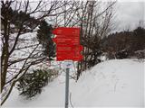 2
2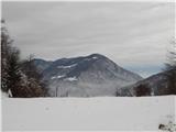 3
3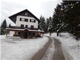 4
4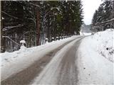 5
5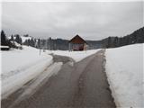 6
6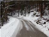 7
7 8
8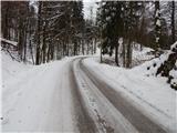 9
9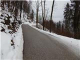 10
10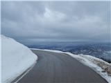 11
11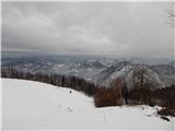 12
12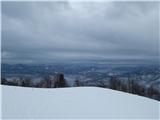 13
13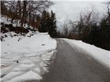 14
14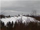 15
15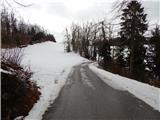 16
16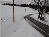 17
17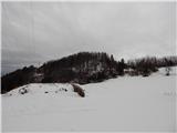 18
18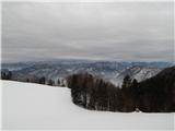 19
19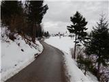 20
20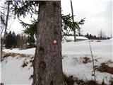 21
21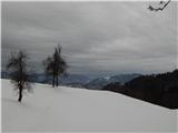 22
22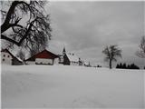 23
23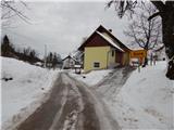 24
24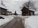 25
25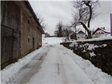 26
26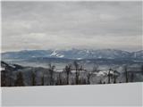 27
27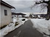 28
28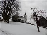 29
29 30
30
Discussion about the trail Ledinsko Razpotje - Sveta Marija Magdalena (Gore) (west path)
|
| rokeg17. 03. 2020 |
Čas je precej pretiran. Hoje je v priemrjavi z Marutnikom 1h in 5 minut
|
|
|
|
| valerija1129. 04. 2020 |
Pri podatku čas hoje je zagotovo tiskarski škrat.
Rabimo dobro uro zmerne hoje(4,5 km).
|
|
|
|
| Tadej10. 04. 2020 |
Hvala obema za opozorilo. Sem Popravil.
|
|
|