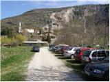
Starting point: Osp (57 m)
| Lat/Lon: | 45,5713°N 13,857°E |
| |
Time of walking: 3 h 30 min
Difficulty: easy marked way
Altitude difference: -39 m
Altitude difference po putu: 400 m
Map: Primorje in Kras 1:50.000
Recommended equipment (summer):
Recommended equipment (winter):
Views: 15.572
 | 4 people like this post |
Access to the starting point:
From the Ljubljana - Koper motorway, take the Črni Kal exit and follow the road towards Črni Kal and Osp. At the beginning of the ascent towards Črni Kal, the road to the left branches off towards the village of Osp. The road then takes us along the viaduct pillars and after a short descent leads us to the village of Osp, where we park in the parking lot near the bivouac.
Path description:
From the parking lot, continue along the road along which you parked. The road quickly leads over a small bridge to the first crossroads, where you turn right and then immediately left. Continue climbing steeply along the less well-marked road. After a few minutes of climbing, the signs direct us to the right on a footpath that climbs through lane of a rather overgrown forest. Once out of the wods, you step onto the vast grassy slopes from which you can see the antenna tower at Tinjan. The trail then re-enters the forest, climbing moderately over a number of well-marked crossroads. Just below the Tinjan peak, rejoin the road and follow it past the waterworks to a viewpoint. At the beginning of the bend, the signs direct us upwards to the left and the path leads us quickly to the summit in a moderate ascent.
From Tinjan, continue right along the road, which descends gently and leads us along a relatively well-marked road to the village of Zgornje Škofije. Further on, the path leads to a slightly more difficult part in terms of orientation. In the village Spodnje Škofije there are a large number of crossroads, where we have to follow carefully the more and more sparse markings. After the village, the path passes through the yard of one of the houses, after which we leave the road for a while. The path continues through the bushes until it reaches the village of Hrvatini. Here again, follow the markings carefully, which will lead you to the other side of the village. After the village, follow the dirt road for a while, which leads down to Ankaran on the right. When you reach Ankaran, turn right in front of the Multiple Sclerosis Centre along the marked path, which then leads you to your destination after a short maze of paths. The stamp for the transversal is available at the Korta bar.

Pictures:
 1
1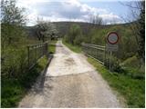 2
2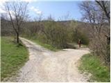 3
3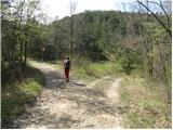 4
4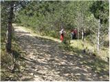 5
5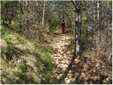 6
6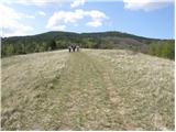 7
7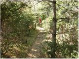 8
8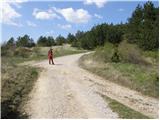 9
9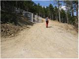 10
10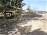 11
11 12
12 13
13 14
14 15
15 16
16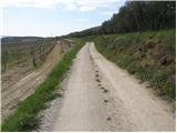 17
17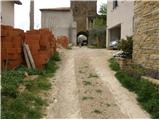 18
18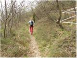 19
19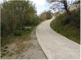 20
20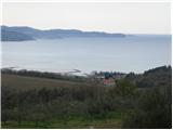 21
21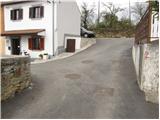 22
22 23
23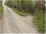 24
24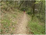 25
25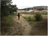 26
26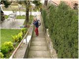 27
27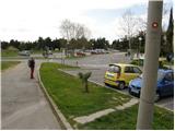 28
28 29
29 30
30
Discussion about the trail Osp - Ankaran
|
| klavdy66. 09. 2009 |
Lep zaključek SPP, kateremu lahko sledi kopanje.
|
|
|
|
| iztok18. 03. 2012 |
Včeraj smo izkoristili lep sončen dan in se odpravili na zadnji del slovenske planinske poti od Socerba do Ankarana.Pohvala markerjem za lepo označeno pot 
|
|
|
|
| claire19. 07. 2014 |
V lokalu se nahaja tudi žig za Tinjan.
|
|
|
|
| modrook1216. 03. 2017 |
zanima me kako je pot kaj markirana? kako je ta čas kaj realen?
|
|
|
|
| modrook1219. 03. 2017 |
primoza, hvala za informacijo.danes sva z ženo prehodila to pot.Pot je odlično markirana.malo naju je zmotilo veliko hoje po asfaltni cesti.drugače pa super izlet.
|
|
|