Klösterle - Gerlitzen (via Stifterboden)
Starting point: Klösterle (1000 m)
| Lat/Lon: | 46,7303°N 13,9143°E |
| |
Name of path: via Stifterboden
Time of walking: 3 h
Difficulty: easy marked way
Altitude difference: 909 m
Altitude difference po putu: 935 m
Map:
Recommended equipment (summer):
Recommended equipment (winter): ice axe, crampons
Views: 580
 | 1 person likes this post |
Access to the starting point:
a) Via Border crossing Ljubelj, drive into Austria, then follow the road to Klagenfurt / Klagenfurt. In Klagenfurt, go straight on at all junctions, but when the main road turns sharp right, leave it just a little further and continue left towards Dhovše near Klagenfurt / Lendorf and Trg am Carinth / Feldkirchen in Kärnten. When you reach the motorway junction, turn left towards Trg in Carinthia, and when you reach the aforementioned town, turn right at the traffic lights towards the Turracher Höhe Alpine pass. After Himmelberg, turn left in the route Gerlitzen and start climbing more visibly. When the road stops climbing, follow it to parking area 6a.
From Border crossing Ljubelj to the starting point is approximately 73 km.
b) Drive through the Karavanke tunnel into Austria, then follow the motorway to the motorway junction, from where you continue to Spittal an der Drau and continue on the A10 motorway. Leave the A10 quickly and take the exit for Ossiacher See, take the third exit at the nearby roundabout (if there was no roundabout, you would go left) and continue along Millstätter Strasse. Follow this road to the crossroads, where you turn right towards Arriach and the ski resort Gerlitzen, and continue along Teuchen Landesstraße. Follow this road until you reach parking lot 6a.
From Border crossing Karawanks to the starting point is approximately 47 km.
Path description:
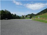
From the parking lot, cross the Arriachbach stream over a wooden bridge and then walk to the bottom station of the Klösterlebahn I cable car, passing it on your right. After the chairlift station, turn right and continue to the edge of the forest. As you enter the forest, you will see the first signpost and the path forks a few steps further on.
The marked path continues straight ahead and leads to Wurzelpark, and we go left, where after a few steps we see a beaten track which, after a short climb, turns right and crosses over the archery area. After about 5 minutes on the unmarked path, we return to the marked path, which we reach at the part where it runs on a dirt road (the route past Wurzelpark is about 15 minutes longer).
Follow the road to the left and quickly reach the edge of the ski slope, where you will get a nice view, and the path turns right and continues along the road. Higher up, there are a few switchbacks, then back to the ski slope, which you climb for a while, then the path goes into the forest again, where you continue on a less favourable road. After crossing a pasture fence, the trail crosses the ski slope for a longer distance and also becomes steeper as it climbs straight up the ski slope. As you approach the top station of the Klosterlebahn I cable car, go right again into the forest. In the forest, the road turns sharp left and leads to the station of the above-mentioned cable car, where, a few 10 steps before it, you continue uphill to the right. You quickly reach the next road and continue along it, taking in the increasingly beautiful views, which reach all the way to the highest peak in Austria. There are a couple of forks where you follow the signs and then, passing a reservoir with a fine view of the Wintertalernock, you reach a crossroads near hut Huaba Hittn.
Go right here (Huaba Hittn hut 1 minute on the left) and follow the road gently downhill to the nearby stream. After the stream, the road turns right and leads us in a slight ascent to a crossroads, where we go slightly left, and then quickly arrive at hut Neugarten Almseehütte.
From the hut, continue slightly right (one of the paths to Gerlitzen is slightly left) in the direction of Stifterboden. The way forward initially leads along a service road that runs along the ski slope, then signs direct you right into the forest, where you cross a pasture fence. After crossing the fence, continue along a wide and winding path, which quickly leads to an asphalt road, which ascends to the Stifterboden holiday home village.
Continue left, a few steps further along the asphalt road, and then go slightly right on the marked footpath that climbs up to the right of the road. The path climbs along a wooden fence, which is wooden at first, but higher up is a wire fence, and the path leads out of the forest onto the increasingly scenic slopes of Gerlitzen. Enjoying the beautiful views, we continue parallel to the road for a short distance before joining it and quickly reaching the Alpin Hotel, from where we are only a short climb away from the top of Gerlitzen, where the Gipfelhaus Hotel is still standing.
From the top, you can descend to the nearby viewpoint, which offers a beautiful view of Lake Osojsko / Osiacher See.
Klösterle - Huaba Hittn 1:40, Huaba Hittn - Neugarten Almseehütte 0:10, Neugarten Almseehütte - Stifterboden 0:30, Stifterboden - Gerlitzen 0:40.
Description and pictures refer to the situation in 2019 (August).

Pictures:
 1
1 2
2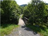 3
3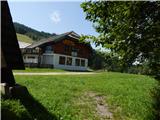 4
4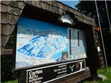 5
5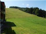 6
6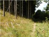 7
7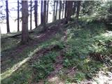 8
8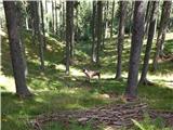 9
9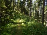 10
10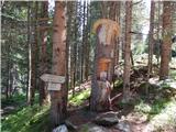 11
11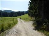 12
12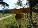 13
13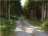 14
14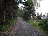 15
15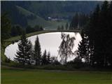 16
16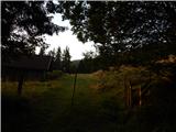 17
17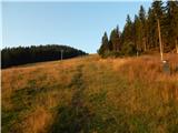 18
18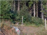 19
19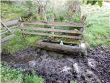 20
20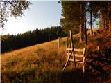 21
21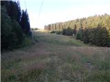 22
22 23
23 24
24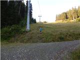 25
25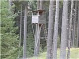 26
26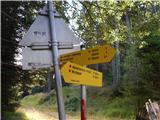 27
27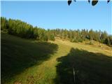 28
28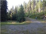 29
29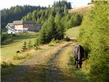 30
30 31
31 32
32 33
33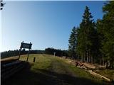 34
34 35
35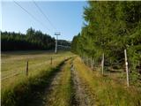 36
36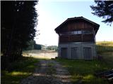 37
37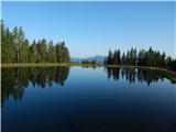 38
38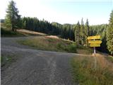 39
39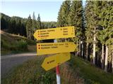 40
40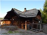 41
41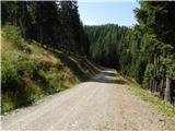 42
42 43
43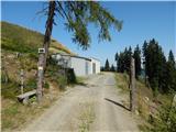 44
44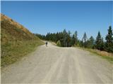 45
45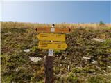 46
46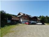 47
47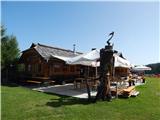 48
48 49
49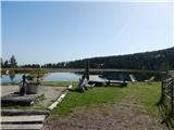 50
50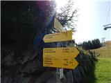 51
51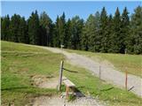 52
52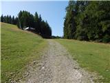 53
53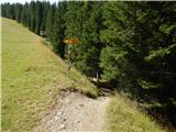 54
54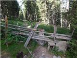 55
55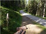 56
56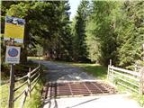 57
57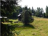 58
58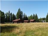 59
59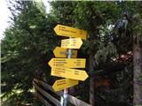 60
60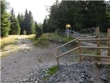 61
61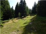 62
62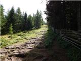 63
63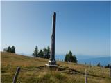 64
64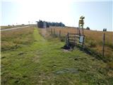 65
65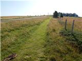 66
66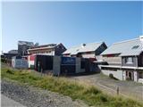 67
67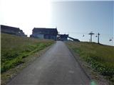 68
68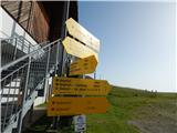 69
69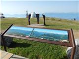 70
70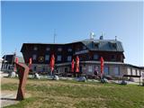 71
71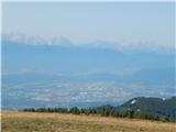 72
72
Discussion about the trail Klösterle - Gerlitzen (via Stifterboden)