Draga - Dobrča (via Ledena trata)
Starting point: Draga (650 m)
| Lat/Lon: | 46,3846°N 14,2178°E |
| |
Name of path: via Ledena trata
Time of walking: 3 h
Difficulty: easy unmarked way
Altitude difference: 984 m
Altitude difference po putu: 1000 m
Map: Karavanke - osrednji del 1:50.000
Recommended equipment (summer):
Recommended equipment (winter): ice axe, crampons
Views: 9.461
 | 2 people like this post |
Access to the starting point:
From the motorway Ljubljana - Jesenice take the exit Radovljica (from the Gorenjska side take the exit Lesce) and follow the road towards Begunj. At the end of Begunje village, turn left towards the house in Draga (Tržič on the right), and we follow the road to a large parking lot next to the hostages' grave site.
Path description:
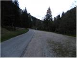
From the parking lot, continue along the asphalt road, which climbs steeply along the Begunjščica stream. After about 5 minutes of walking, you will come to a small crossroads where a forest road branches off to the right. Take the road which climbs moderately along the edge of a larger meadow. Continue along the meadow for some time, then the road turns right, crosses the Črnega potok (Black Stream) and leads to an unmarked crossroads just 10 m further on, where you continue along the right-hand road (the left-hand road soon ends). Next, we cross the climb to the right, and the road leads us to a sharp left turn, from which we have a nice view of Julian Alps with Triglav and Hochstuhl and Begunjščica.
We continue on the macadam road for quite some time, and we follow it to its end with occasional views of the surrounding mountains (we can also drive here, but this shortens the journey by about an hour and a half).
From the end of the road, we continue along the relatively steep cart track, which climbs further up the left side of a small unmarked valley. Higher up, the cart track starts to disappear, and we follow the remnants of some kind of path until we reach the main ridge, where we also get on the marked Preval - Dobrča path.
Once on the marked path, follow it to the right, which climbs steeply at first, then gradually flattens out and turns right onto relatively steep slopes, over which we cross-climb. After a few minutes of traversing, the path climbs steeply again, this time over a steep slope which is in some places dangerous for slipping, mainly because of the foliage (if there are still snowfields on this part of the path, it is obligatory to use a snowshoe and snowshoes). The path then lays down, crosses a grazing fence and splits into two parts just a few metres further on. Continue on the lower path (kolovozu), which after a short crossing leads to the forest road leading to the Dobrči Cottage. Follow the road for a 2-minute walk to the hut, or turn left immediately onto the marked path leading to the top of Dobrča.
Go around the cottages on Maria Elender Alm on the right and climb over a grassy slope with a view, then the path turns into a sparse forest at first, but higher up, it becomes more and more dense. As the slope subsides, two paths join from the right, and in both cases we continue straight ahead. The path ahead climbs steeper again and after a few minutes of further walking leads us to the top of Dobrča.

Pictures:
 1
1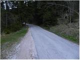 2
2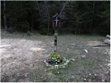 3
3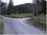 4
4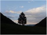 5
5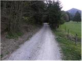 6
6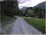 7
7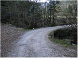 8
8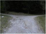 9
9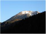 10
10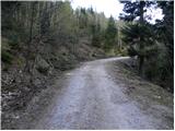 11
11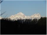 12
12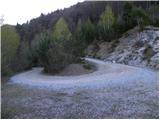 13
13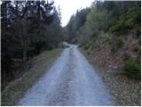 14
14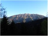 15
15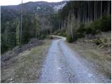 16
16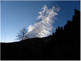 17
17 18
18 19
19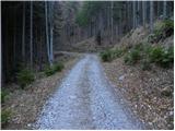 20
20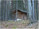 21
21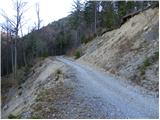 22
22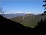 23
23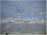 24
24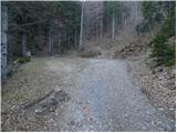 25
25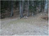 26
26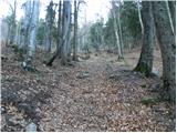 27
27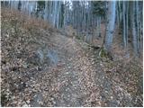 28
28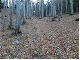 29
29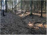 30
30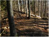 31
31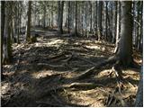 32
32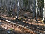 33
33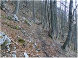 34
34 35
35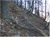 36
36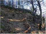 37
37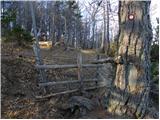 38
38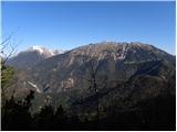 39
39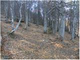 40
40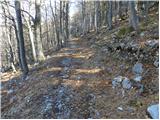 41
41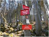 42
42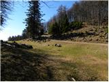 43
43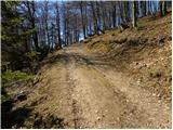 44
44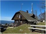 45
45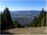 46
46 47
47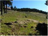 48
48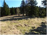 49
49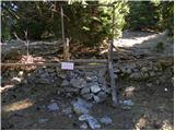 50
50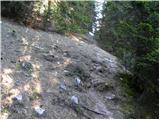 51
51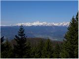 52
52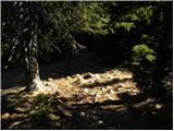 53
53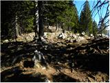 54
54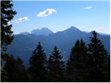 55
55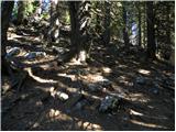 56
56 57
57 58
58 59
59
Discussion about the trail Draga - Dobrča (via Ledena trata)
|
| Majdag15. 06. 2011 |
...Samo začetni del poti bolj strm, potem zelo prijetna pot. Posebno, če se do konca poti pripelješ. Živina je že na planini. Na Šentanskem vrhu so bili dopoldne čudoviti razgledi, smo uživali..Majda 
|
|
|
|
| samoa15. 06. 2011 |
Meni je zelo všeč pot na Dobrčo z Ljubelja. Po Bornovi poti Do Prevale, nato pa isto naprej po markirani poti, kot je opisano zgoraj.Pot pa je kar lepo vzdrževana (že lani),polna razgledov in cvetja.
|
|
|
|
| iztok.maltar15. 06. 2011 |
En dodatek :
Na neoznačenem križišču za Črnim potokom gremo lahko po levi cesti, ki se kmalu konča. Od tam sledimo stezico, ki takoj zavije proč od potoka rahlo v desno. Po njej prav tako pridemo do konca ceste in občutno skrajšamo pot ter se izognemo hoji po cesti. Za tiste, ki se želijo tu povzpeti na Dobrčo, pa bi predlagal parkiranje avtomobila pri gradu Kamen ali na velikem parkirišču malo naprej v Dragi. Od tam ni več daleč do planine, pri povratku pa se lahko spustite od koče na južno stran po markirani poti, ter nad vasjo Slatna ujagate lepo neoznačeno pot, ki vas pripelje nazaj do gradu in tako naredite lepo krožno turo.
|
|
|
|
| Majdag16. 06. 2011 |
...Zanimivo Iztok76, ko ne bo prevoza bom upoštevala ta nasvet, hvala...Majda
|
|
|
|
| Majdag17. 09. 2011 |
Samotna, prijetna pot, meni ljubša kot iz Brezij. Na Šentanskem vrhu je blazinica žiga odtrgana. Če kdo namerava gor, na ta vrh, naj vzame lepilo in to popravi prosim, čav Majda..  .
|
|
|