Na Razpotju - Rjavčki vrh (Planinšca)
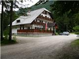
Starting point: Na Razpotju (770 m)
| Lat/Lon: | 46,392°N 14,6273°E |
| |
Time of walking: 3 h
Difficulty: partly demanding marked way, easy pathless terrain
Altitude difference: 1128 m
Altitude difference po putu: 1128 m
Map: Kamniške in Savinjske Alpe 1:50.000
Recommended equipment (summer): helmet
Recommended equipment (winter): helmet, ice axe, crampons
Views: 9.843
 | 1 person likes this post |
Access to the starting point:
We drive to Luce (to get here from Mozirje or via Kranjski Rak) and on to the Logar Valley. Shortly after the village Solčava, you will come to a crossroads where the road to Logarska dolina turns left. Turn left towards the Logar valley (toll) and follow the road to the signs for the hut at Klemenča jama. Park in the parking lot near the Na Razpotju guesthouse. Only guests are allowed to park in front of the guest house.
Path description:
From the parking lot, follow the forest road towards Klemenče jame. After a few minutes' walk, a wide path branches off to the left towards Klemenča Jama. Take this path as it starts to climb. The path, which is quite steep, soon leads to steep slopes, where you cross a slightly exposed ravine with the help of a rope. The path that continues to climb soon leads us to a place where the wall closes the path. Ahead of us we see a cave and above it a marking which directs us into the cave. When we enter the cave, we see that it is not a cave, but a beautifully made tunnel through which we continue. In the tunnel, we have a rope to help us, but we need it more for the descent than for the ascent. On the other side, we cross an exposed ledge on a wide path with a slight incline. The path continues into the forest and climbs steep slopes which are dangerous to slip on when wet. Next, cross another ravine over a small bridge, and then the path leads us to a less steep part of the path, where we join the path from the Planincev home. Continue slightly up the wide path, which soon leads us out of the forest. There is only a short climb up the grassy slope to the hut at Klemenči jama.
From the hut, continue straight in the route Ojstrica along the path, which after a few dozen metres goes into the forest. The path, which climbs moderately to steeply through the forest, leads us higher under rocky cliffs, which are not to crumbly. The path then retreats to the right and leads us to a crossroads where we continue straight towards Škarje, and to the left the very difficult Kopinškova path to Ojstrica branches off. The path continues to cross the slopes to the west, then emerges from the forest and turns slightly to the left. Here it starts to climb a little steeper along the scree, then turns right and climbs towards the saddle below Rjavčki vrh (1898m).
At the saddle (or even a little earlier), leave the marked path and continue ascending to the right on easier, pathless ground. After about 10 minutes of climbing on a partly grassy slope, we reach Rjavčki vrh, which is covered with dwarf pines and offers a beautiful view of the mountains above the Logarska dolina valley.

We can extend the trip to the following destinations: Matkov kot
Pictures:
 1
1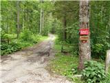 2
2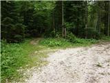 3
3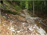 4
4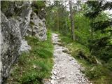 5
5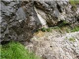 6
6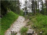 7
7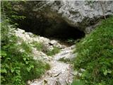 8
8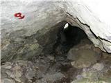 9
9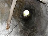 10
10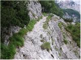 11
11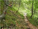 12
12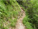 13
13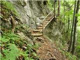 14
14 15
15 16
16 17
17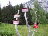 18
18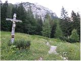 19
19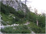 20
20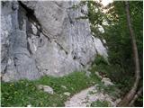 21
21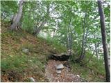 22
22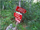 23
23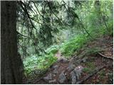 24
24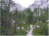 25
25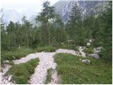 26
26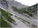 27
27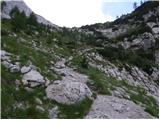 28
28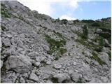 29
29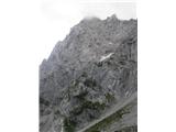 30
30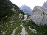 31
31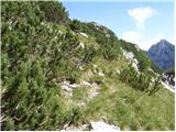 32
32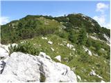 33
33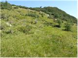 34
34 35
35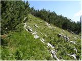 36
36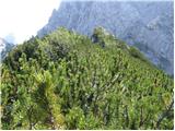 37
37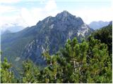 38
38
Discussion about the trail Na Razpotju - Rjavčki vrh (Planinšca)
|
| micamaca17. 08. 2010 |
A je kdo čez Grlo na Rjavčki vrh v zadnem cajtu hodu?
|
|
|
|
| aljazek18. 08. 2010 |
Jaz sem šel skozi Grlo. Če dobro poiščeš pot, res ni težav, jaz sem jo parkrat izgubil (včasih sem si jo zanalašč zakompliciral - rad plezam  ), pa sem moral skalne skoke preplezat. Mislim, da največ težav je, ker se od spodaj gor še slabše vidi steza. Matta ima prav, od spodaj gledano gor -> na začetku se držiš bolj desne (stena Planjave), potem pa po prvem skalnem skoku (pod tisto steno, kjer dosti kamenje leti dol) prečiš na levo in se držiš pobočja Rjavčkega vrha. Jaz pa sem tu direktno šel po sredini, čez tiste platke 
|
|
|
|
| micamaca18. 08. 2010 |
Hej, hvala za napotke vsem! Se že veselim, ker me ta pot izredno "matra" in ne bom mela mira, dokler ne grem po njej sam koleno si morem prej mal pocajtat 
|
|
|
|
| donidoni21. 08. 2010 |
Danes na Rjavički vrh čez Grlo. Do skoka greš kar po hudourniku pač iščeš boljše varijante, po skoku se držiš desno pot se da sledit malo pred stenami prečiš v levo čez skalne platoje in opaziš pot, ki se jo lepo sledi do krnice pod sedlom. V krnici se držiš levo pod stenami in po robu melišča na sedlo, pot se lepo sledi.
Lep vzpon na R. vrh.
LP
|
|
|
|
| Alni24. 07. 2012 |
V soboto bi se podala na to pot. Zanima me ali je pot primerna za začetnike?
Hvala!
|
|
|