Logarski kot - Rjavčki vrh (Planinšca) (via Grlo)
Starting point: Logarski kot (900 m)
| Lat/Lon: | 46,3744°N 14,6132°E |
| |
Name of path: via Grlo
Time of walking: 3 h 15 min
Difficulty: difficult pathless terrain
Altitude difference: 998 m
Altitude difference po putu: 1000 m
Map: Grintovci 1:25000
Recommended equipment (summer): helmet
Recommended equipment (winter): helmet, ice axe, crampons
Views: 7.900
 | 3 people like this post |
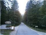
Access to the starting point:
We drive to Luce (to get here from Mozirje or via Kranjski rak) and on to the Logar valley. Shortly after the village Solčava, you will reach a crossroads where the road to Logarska dolina turns left. Turn left towards Logarska dolina (toll) and follow the road to the signs for the Logarski kot Inn. Turn left and park in the parking lot in the immediate vicinity of the inn.
Path description:
Pass the guesthouse and head to the right, under the Grlo buttress. Grlo is a rather distinct gully above the Logarska dolina, to the left of the Planjava wall and to the right of Rjavčski vrh. The path ascends moderately, at the beginning it is necessary to climb some rock jumps, but in dry conditions they do not pose any problems. After about 45 minutes of walking, we reach a part of the route where the remains of wedges are used to advance. This part of the route is somewhat exposed. In the following, keep to the right side by the Planjava wall, the path leads us straight up over the rock jumps in a pleasant climb, with the help of some old preserved markings. Once we have climbed the rock steps, the path turns to the left (not forwards - the wall) and becomes relatively visible.
Follow it up the left side in the keys. After a further hour's walk, the route leads to cirque below Rjavčki vrh and Planjava. In cirque with the help of cairns we see a modest path on the left and follow it over a difficult scree up to the saddle by which Rjavčki vrh is connected to the main ridge (to the right of the Scissors).
From here, it is easy to climb northwards without much difficulty to the left and reach the precipitous summit in a few minutes.
From the top we have an excellent view of the Logar valley and the northern walls of Ojstrica.

We can extend the trip to the following destinations: Matkov kot
Pictures:
 1
1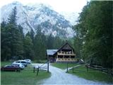 2
2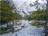 3
3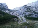 4
4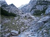 5
5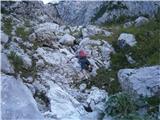 6
6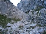 7
7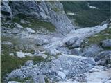 8
8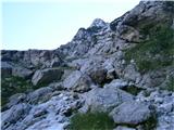 9
9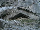 10
10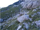 11
11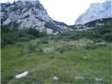 12
12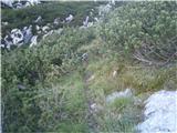 13
13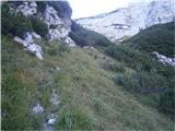 14
14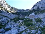 15
15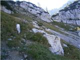 16
16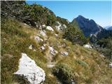 17
17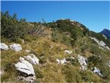 18
18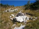 19
19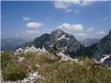 20
20
Discussion about the trail Logarski kot - Rjavčki vrh (Planinšca) (via Grlo)
|
| tone15330. 09. 2012 |
Ze dvakrat sem sel opisano pot in priznam, da vsakic malo drugace. Orijentacija pac ni prav lahka. Stare markacije so vecinoma obledele in tudi bolj redke, stezica pa se vcasih zgubi. Pot je tudi precej strma, da grizes kolena. Poplacan pa si z cudovitimi razgledi v severno steno Planjave in z obcutkom, da hodis tam, kamor ne pride vsak.
|
|
|
|
| amarilis1. 10. 2012 |
Po tehnem premisleku(klub slabši napovedi,smo se odločili,za izlet v Logarsko dolino.Bilo je kar nekaj zablod,saj so bile markacije,bolj slabe;pa tudi steza ,se je večkrat izgubila.Pot se je vspenjala,preplezati je bilo potrebno skalne skoke;po napornem melišču,dospemo do sedla.Poplačani smo bili ,sčudovitim razgledom,na severno steno Planjave.Še se bomo vrnili. Lp
|
|
|
|
| garmont1. 10. 2012 |
Pot je bila nekoč markirana, danes pa je opuščena. Govorimo o brezpotju, zato je tudi temu primerno sledenje "poti". 
|
|
|
|
| pohodnik388. 07. 2013 |
V soboto prehodil tole pot ki me je prav navdušila kljub bolj turobnemu vremenu sem užival.Cela pot ponuja zelo lep razgled proti zatrepu Logarske doline in gore nad njo.Veliko cvetja in mir na poti kar je največ vredno.Občutek je bil tak kot da ste vsi doma jaz pa se edini tam po gorah potepam  Tole pot bom še šel. VIDEO Lp! Tone
|
|
|
|
| pohodnik3814. 07. 2013 |
Še nekaj slik razgledov in utrinkov z te malo manj znane poti. SLIKE
|
|
|
|
| franjo6629. 03. 2014 |
Kakšne so razmere za vzpon na Rjavčki vrh (Planinšca)?
Hvala
|
|
|
|
| geppo29. 03. 2014 |
Razmere so mešane. Na začetku plazovina, ledene plošče,nekje se vdira. Proti Rjavčkem je potem že po 9 uri nevarnost plazu. Imaš shojeno vse na sveže tudi pod S steno Ojstrice ( sipek sneg )pa do Klemenče. Lahko ti pošljem kakšno fotko če te zanima. Vsega skupaj 6 ur do Klemenče ( na izzi ). lp pa seveda priporočam ustrezno orodje... drugače pa fantazija.....
|
|
|
|
| geppo29. 03. 2014 |
Razmere so mešane. Na začetku plazovina, ledene plošče,nekje se vdira. Proti Rjavčkem je potem že po 9 uri nevarnost plazu. Imaš shojeno vse na sveže tudi pod S steno Ojstrice ( sipek sneg )pa do Klemenče. Lahko ti pošljem kakšno fotko če te zanima. Vsega skupaj 6 ur do Klemenče ( na izzi ). lp pa seveda priporočam ustrezno orodje... drugače pa fantazija.....
|
|
|