Kraljev hrib - Gradišče (Velika planina) (via Sivnik and Rigelj)
Starting point: Kraljev hrib (540 m)
| Lat/Lon: | 46,3061°N 14,6088°E |
| |
Name of path: via Sivnik and Rigelj
Time of walking: 4 h
Difficulty: difficult unmarked way
Altitude difference: 1126 m
Altitude difference po putu: 1250 m
Map: Kamniške in Savinjske Alpe 1:50.000
Recommended equipment (summer):
Recommended equipment (winter):
Views: 7.977
 | 1 person likes this post |
Access to the starting point:
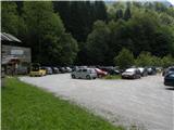
First we drive to Kamnik, then continue in the direction of Kamnik Bistrica and the cable car to Velika planina. At Stahovica, turn left (direction Kamniška Bistrica and cable car Velika planina) and follow the road ascending moderately, then follow it to the large parking lot near the bottom station of the cable car to Velika planina (the parking lot is on the right hand side of the road).
Path description:
This route is not a shortcut for crowds of pilgrims. On the contrary. Take a few more detours than necessary, and you'll encounter more chamois than people.
Park at the bottom of the cable car and follow the gravel road to King's Hill. At the transformer, turn right onto a wide forest road, leaving at the hunting lodge and observation post. The most fussy could drive here, and there is parking. Continue along the new, but much worse forest road, which ends without warning in front of the Šimnov landslide. From here on, a well-trodden path goes and the first crossroads is reached after half an hour. In the middle of the beech forest, you have to look out for a very special beech tree with arrows for left and right and a whole bunch of graffiti carved into it. To the left is the fast track to Rigelj, and we take the right-hand track, which is noticeably less beaten track than the one we came in on, but easy to follow and unchallenging.
The next crossroads is at the Sivnik hunting lodge, which we cannot miss. The hut has seen much better days and is now practically a ruin. The track we came on continues straight past the hut, and we turn onto a poorly trodden hunting track, which just after the hut begins to rise in gentle switchbacks along the inexpressible Sivnik ridge. Even the trained eye has to take the time to look at the path. But once the eye gets used to the darkness, so does such a track and soon it is no longer difficult to follow.
Just when we get tired of the forest we come to a clearing. It is quite steep and in summer the path is practically invisible in the tall grass. We can just feel it under our soles. We enter the clearing on the bottom left and, after a few switchbacks, eventually leave it on the top right. There is some forest and a new clearing which we just cross. Leave it a little higher up by a rock. From here you can see the next meadow. You come to it past a huge rock with a hole where water collects - a sprinkler.
What lies ahead is no ordinary clearing, but a small valley rising steeply towards the top of Velika planina. Right in the middle of it is a crossroads which is so badly marked that even Google cannot find it. To make it not too easy, the trail splits into three legs, not just two. We have come along the path that enters the meadow on the bottom left, looking up, and we will leave it on the top left. The other two paths leave the meadow centre right and top right. Don't panic, we're still on a decent hunting track, it's a long way from potholes. But anyone who doesn't know about this crossroads hardly notices it and his feet carry him down one of the paths without him even knowing he had a choice. When you leave the plateau on the ridge, the track unexpectedly turns downhill. Many people will be disappointed, because the edge mountain pasture was almost visible before, but now the track goes down a little, up a little and down a little more. . . It's just the way it is, that the hunters' main concern is not how to get to the top as quickly as possible. So in a few places the trail rewards us with a nice view, a rare flower or a wild animal that doesn't see a hiker every day.
At the next crossroads, we join the trail that leads straight to Rigelj. You would have reached it if you had turned left at the beech tree. The crossroads is on a ridge whose extension is a lookout. To get to it, you have to pass a giant anthill, which has become so luxuriant that it requires a real detour. But we don't even need to go to the lookout, because nobody has hidden the beautiful view from us before. It is important not to turn left downhill, but right steeply uphill. Soon we will reach the Velika planina boundary. Its pastures are fenced all round and around with metal fencing, rarely with wooden or stone fencing. Where it is crossed by a track, there is usually a nice metal gate, which has to be closed in summer. Only the lane over Rigelj without a gate has to pass through a barricade of dry branches.
At mountain pasture the track quickly splits and disintegrates, as the pastures are one wide track and it does not really matter where you walk. To get to the top, keep as far right as possible, through Družinski Ror to Zeleni rob, and from there it is best to go under the chairlift to Gradišče.

Pictures:
 1
1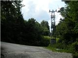 2
2 3
3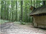 4
4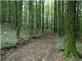 5
5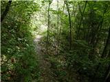 6
6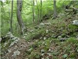 7
7 8
8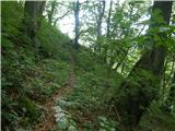 9
9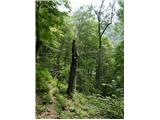 10
10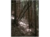 11
11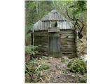 12
12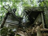 13
13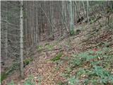 14
14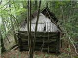 15
15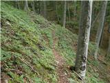 16
16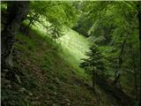 17
17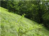 18
18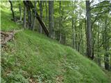 19
19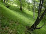 20
20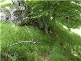 21
21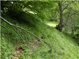 22
22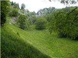 23
23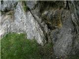 24
24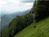 25
25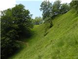 26
26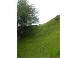 27
27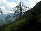 28
28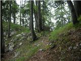 29
29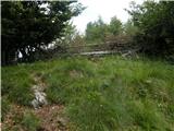 30
30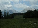 31
31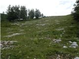 32
32 33
33 34
34
Discussion about the trail Kraljev hrib - Gradišče (Velika planina) (via Sivnik and Rigelj)
|
| andi26. 10. 2014 |
Danes poizkus spusta (gor čez Rigelj). Je praktično opustela in se težko sledi. Že preko jas stezo le čutiš, vidiš pa slabo. Sledi še težje vidna potka do lovske koče, kjer sem v jesenskem listju zgrešil in srečno našel prečnico od lovske koče. Nato sledi popolnoma uničen prečni del proti razpotni bukvi, kjer sem se eno uro mučil in iskal pot med tonami podrtih dreves, nato pa popolnoma izmučen malo pred razpotjem obupal in previdno poiskal spust po strmalih do ceste v kamniški bistrici. Odsvetujem do sanacije stanja.
|
|
|