Starting point: Luče (522 m)
| Lat/Lon: | 46,3553°N 14,7482°E |
| |
Time of walking: 4 h 5 min
Difficulty: easy unmarked way
Altitude difference: 1286 m
Altitude difference po putu: 1315 m
Map: Kamniške in Savinjske Alpe 1:50.000
Recommended equipment (summer):
Recommended equipment (winter): ice axe, crampons
Views: 2.360
 | 2 people like this post |
Access to the starting point:
a) From the motorway Ljubljana - Maribor, take the exit Šentrupert and then continue in the direction of Logarska dolina. At the beginning of Luče, just a few metres before the road crosses the Savinja River, you will notice a large gravel parking lot on the left side of the road.
b) The starting point can also be reached via the Volovljek (Kranjski Rak) pass. In this case, turn right in Luče in the direction Mozirje and then park in the parking lot mentioned in description a just 10 m after the bridge over the Savinja River.
Path description:
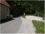
Between the parking lot and the bridge over the Savinja River, you will see a sign for the Koča na Loki (Cottage on the Loka) by the roadside, which directs you to the path, which initially climbs steeply up the steps. The path soon becomes a gentle slope and then continues along a ridge which descends steeply towards the Savinja River. Further on, you enter a dense forest and the path quickly leads to a chapel, after which there is a small crossroads.
Continue along the right-hand path, which begins to climb steeply, then lays down and turns to the right. There is a short crossing to the right, and then you emerge from the woods onto a large hayfield. The path, which is not very visible, then climbs across the hayfield, and then leads to a small hamlet, where we see the markings again. The way ahead leads us past a few houses and above them into the lane of bushes, through which we climb to the nearby road. The road is only crossed, as direction signs located by a small sign direct us to a footpath which continues to climb moderately through the forest. A little higher up, we get a nice view of Raduha, and we continue on the marked path, which leads us just a little higher up to the road, which after a few metres leads to a marked crossroads. Continue slightly to the left and continue your ascent along the road towards Raduha. Continue climbing for some time along the road, which has some marked shortcuts (markings are very rare in this area), and then you will come to a newer road, where a wide marked cart track road branches off in the middle of a left turn to the right. We continue our ascent along the above-mentioned cart track, which leads us higher up again to the above-mentioned road, and we walk along it for only a few more 10 steps, then on the left we see a marked path leading towards the Loka and Arta mountains (the branch from the newer road is not marked). Next, we cross-climb parallel to the road, and the path leads us just a little further to a large bench at which there is a marked crossroads.
Continue on the right path (to the left, Mount Arta), which climbs for some time, then leads to the road leading to the Snow Cave. This road is reached just at a crossroads where a forest road, closed to public traffic, branches off to the right and leads to mountain pasture Loka. Take the road mentioned above and climb it in 15 minutes at a moderate ascent to Hut na Loka pod Raduha. From the hut, continue slightly right along the marked path towards the saddle Durce (slightly left Raduha, right Smrekovec and Travnik). Continue on the right side of the ravine (on the left side of the ravine there is a path to Raduha) on a path that gradually starts to climb steeper. After about 10 minutes' walk from the hut, the path leads to a less visible crossroads, where we continue sharp right along a less visible path (straight Durce). After a few steps of further walking, we will notice on a tree the mountain direction signs marked Lanež and Durce via Lanež, which direct us left up a steep but marked trackless path (in the fog, orientation is quite difficult). After a few minutes of climbing over a steep grassy slope, the "path" leads us to the pasture fence, where we continue to the left. Only a few steps further on, the marked path crosses the fence and then turns slightly to the left (here the path is already more visible).
The ascent continues along the scenic route, which leads past the animal watering point to a small valley between Lanež and Jelovec. The moderately steep path, which continues along a pleasant valley, soon leads us to an undistinguished saddle between the two peaks mentioned above.
Here, turn right and continue along the grassy slope to a small saddle on the south side of Jelovec. From here continue left and cross the slopes on the right (east) side of the ridge. The narrow path continues through dwarf pines and in a few places also slightly descends. Soon you will see the summit with the cross in front of you. The path continues through dwarf pines and soon leads to a viewpoint.
Luče - Koča na Loki 3:00, Koča na Loki - Jelovec 1:05.

Pictures:
 1
1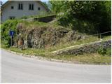 2
2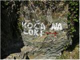 3
3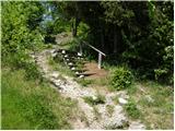 4
4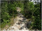 5
5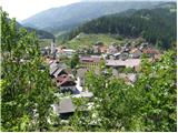 6
6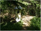 7
7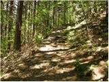 8
8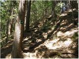 9
9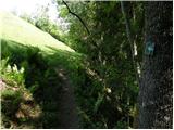 10
10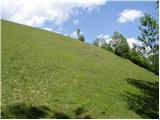 11
11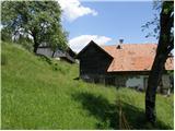 12
12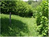 13
13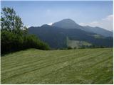 14
14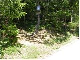 15
15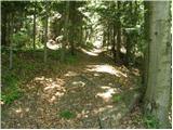 16
16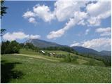 17
17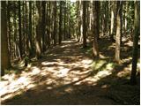 18
18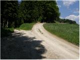 19
19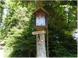 20
20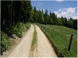 21
21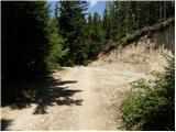 22
22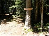 23
23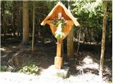 24
24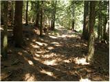 25
25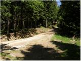 26
26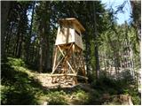 27
27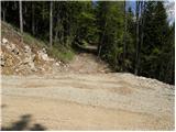 28
28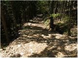 29
29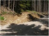 30
30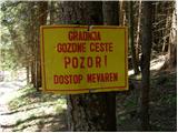 31
31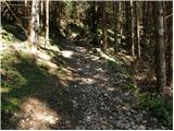 32
32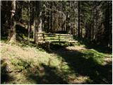 33
33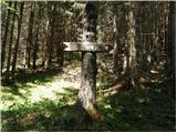 34
34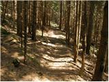 35
35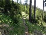 36
36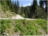 37
37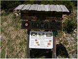 38
38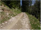 39
39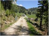 40
40 41
41 42
42 43
43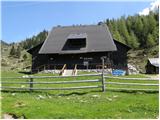 44
44 45
45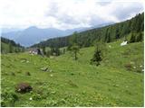 46
46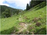 47
47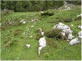 48
48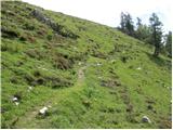 49
49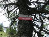 50
50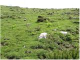 51
51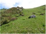 52
52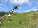 53
53 54
54 55
55 56
56 57
57 58
58 59
59 60
60 61
61 62
62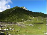 63
63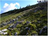 64
64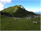 65
65 66
66 67
67 68
68 69
69 70
70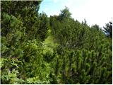 71
71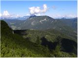 72
72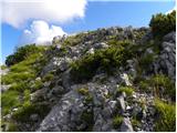 73
73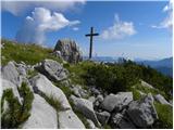 74
74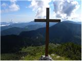 75
75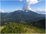 76
76
Discussion about the trail Luče - Jelovec
|
| povhica9. 01. 2017 |
Hvala za nov namig. Krasne fotografije. Posebej lepa se mi zdi pot od planine dalje. Koliko pa je hoje po makedamski cesti od Luč?
|
|
|
|
| ziki11. 01. 2017 |
Po moje se vrh na sliki74 in 75 ne imenuje Jelovc ,ampak Kup "na Kupu" Jelovc pa je pobočje proti planini Jevorje
|
|
|
|
| geppo12. 01. 2017 |
Ko sem se prvič povzpel na Jelovec ( 1808m nmv )sem iskal po zemljevidih ime za ta vrh s križem. Kjer koli sem iskal, sem naletel na ime Jelovec. Tudi Planina Javorje je bila opisana kot Javorje in ne Jevorje.
Mogoče sedaj ti uporabljaš ledinska imena?
lp
|
|
|
|
| Janez Seliškar19. 02. 2023 10:18:03 |
Včeraj so me podučili, da se vrh na posnetkih 74 in 75 imenuje Kup.
|
|
|