Gozd - Vovar (Pot razgleda)
Starting point: Gozd (784 m)
| Lat/Lon: | 46,2578°N 14,6542°E |
| |
Name of path: Pot razgleda
Time of walking: 45 min
Difficulty: easy unmarked way
Altitude difference: 156 m
Altitude difference po putu: 175 m
Map:
Recommended equipment (summer):
Recommended equipment (winter): ice axe, crampons
Views: 2.983
 | 2 people like this post |
Access to the starting point:
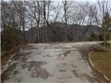
a) Drive to Kamnik, then continue in the direction of the Črnivec Pass and Gornji Grad. After the settlement Krivčevo, drive along the main road towards the Črnivec Pass for a short distance and then turn right towards the settlement Gozd. When you arrive in Gozd, continue straight ahead from the first crossroads (St Anne's parish church in Gozd on the right), and turn right from the second crossroads after the two houses. From the next crossroads, go straight ahead (Laze on the left, the aforementioned church on the right), then immediately turn right again (the road to Brezje nad Kamnikom continues on the left) and pass a few houses to reach the parking lot near the mortuary.
b) Drive to the Volovljek or Črnivec pass, then start descending towards Kamnik. During the descent, leave the main road and continue driving to the left towards the village of Gozd. When you arrive in Gozd, go straight ahead from the first crossroads (St Anne's parish church in Gozd on the right) and turn right from the second crossroads after the houses. From the next crossroads, go straight ahead (Laze on the left, the aforementioned church on the right), then immediately turn right again (the road to Brezje nad Kamnikom continues on the left) and pass a few houses to reach the parking lot near the mortuary.
Path description:
From the parking lot, return to the nearby houses, where you continue straight from the crossroads (left the road from where you came to the starting point), and then the village ends quickly. There is an easy descent across the meadow, which opens up a beautiful view that reaches to the highest peaks of Kamnik Savinja Alps, and when the descent ends we start to climb moderately. We quickly reach a crossroads where a forest road branches off to the left, and we continue straight along the road leading further towards the village of Brezje nad Kamnikom. Approximately 50 metres further on, turn left off the road onto cart track, which leads cross-wise to the left and takes us slightly above a nearby meadow. There is a cross-climb to the left, and the path splits when it reaches an undistinguished ridge.
The eastern path continues to the right, and we continue straight on towards the scenic route. A few steps further on, the signs for the scenic route direct us right onto a ridge, which we initially continue to climb through the forest, and higher up on a partly scenic section. A few minutes further on, we merge with the eastern path, and then quickly reach the top of Vovar on a fairly steep path.
Description and pictures refer to March 2020.

Pictures:
 1
1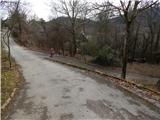 2
2 3
3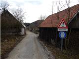 4
4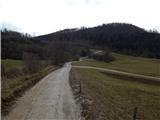 5
5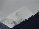 6
6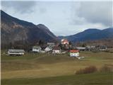 7
7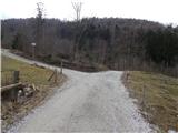 8
8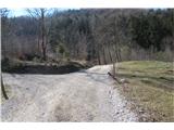 9
9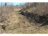 10
10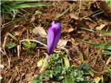 11
11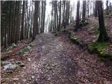 12
12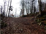 13
13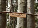 14
14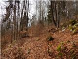 15
15 16
16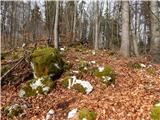 17
17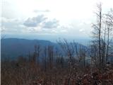 18
18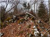 19
19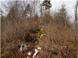 20
20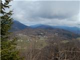 21
21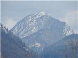 22
22 23
23 24
24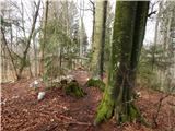 25
25 26
26
Discussion about the trail Gozd - Vovar (Pot razgleda)
|
| CarpeDiem24714. 03. 2020 |
Hvala za zelo svež opis, ko grem kmalu na ta vrh.
|
|
|
|
| zvončica15. 03. 2020 |
Danes sem se povzpela na Vovar in dosledno sledila opisu poti. Administratorju sporočam, da bo potrebno del poti spremeniti. Namreč, ko sem se vračala, mi je kmet, lastnik travnika, dejal, da se čez travnik ne hodi, ker kosijo in da je treba iti po kolovozu. Torej, v križišču na sliki 8 ne gremo levo na gozdno cesto, ampak naprej po cesti približno 50 m, kjer zavijemo na kolovoz (na katerega po trenutnem opisu pridemo na sliki 14). Res enostavna rešitev v zadovoljstvo vseh, kmeta in pohodnikov. Lp
|
|
|
|
| zvončica15. 03. 2020 |
Sem hotela priložiti še dve sliki, pa ne morem. Mogoče kasneje. Lp
|
|
|
|
| zvončica15. 03. 2020 |
Tadej, sem priložila, cesto in kolovoz, tisto ob poti pa pomotoma dvakrat  . Lp
|
|
|
|
| Tadej16. 03. 2020 |
Hvala, sem popravil v opisu in dodal tvoji sliki.
|
|
|
|
| CarpeDiem24721. 03. 2020 |
Včeraj osvojil ta vrh in sicer iz vasi Soteska, približno urco in pow zmerne hoje. Fajn zadeva. Tule so menda zelo popularni Bosonogci na tem vrhu?
|
|
|
|
| miri23. 03. 2020 |
Odvisno od znamke in modela vozička.
|
|
|
|
| grega_p22. 10. 2020 |
Hvala za lep opis, me je zelo nazorno pripeljal k izhodišču in vrhu. Dodal bi še to, da je do vasi Gozd možen avto-pristop iz Tuhinjske doline skozi Markovo in Laze. Sicer je vmes nekaj makadama z luknjami, a zgolj kakšen kilometer. Je pa pot sedaj začinjena še z škratom (na sliki), klopco z razgledom in drevesno poslikavo. Domačin L.S. je na svoj način polepšal pot razgleda. Škrat
Lep dan, lepa izkušnja in lepi konci.
Za povrh pa še marele in lisičke za pod zob...
|
|
|