Kopišča - Kopa (Belska Kopa)
Starting point: Kopišča (550 m)
| Lat/Lon: | 46,3089°N 14,6082°E |
| |
Time of walking: 2 h 30 min
Difficulty: partly demanding unmarked way
Altitude difference: 630 m
Altitude difference po putu: 630 m
Map: Grintovci
Recommended equipment (summer):
Recommended equipment (winter): ice axe, crampons
Views: 4.882
 | 5 people like this post |
Access to the starting point:
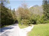
Via Kamnik, head towards Kamnik Bistrica and the cable car to Velika planina. Pass the bottom station of the cable car and drive a few hundred metres further to a large clearing where the hamlet of Kopišča is located. At the end of the clearing there is a right turn-off and the cart track turn-off, where you park.
Path description:
From the starting point, follow cart track eastwards in a gentle ascent. Higher up, cart track heads north-eastwards and becomes increasingly more distinct. Soon a well-worn path branches off to the right and begins to climb steeply up the slope of Kopa. The kopa is always on our left. Along the way we see mine tunnels left over from bauxite mining in the 19th and early 20th centuries. The path becomes narrower, but it is still easy to follow. We reach the ravine between Martinj turno and Kopa, the path heads up the right slope, where it climbs steeply in the keys. When you reach the foot of the cliffs, turn left up a steep slope to a grassy ridge. Here the path is less visible due to the grass. Watch where a barely visible path on steep grass branches off to the left, and the existing path continues into Martinj Stezo. We follow the track to the left (north), first horizontally, then in the keys to a saddle above the Bela valley. Here we turn left towards the top of Kopa, following the southern slope of the ridge in our own way because of the fallen burnt trees. After 15 minutes, reach the top.

Pictures:
 1
1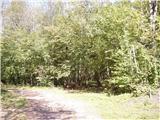 2
2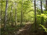 3
3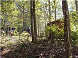 4
4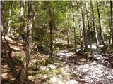 5
5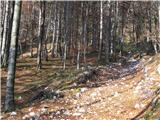 6
6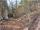 7
7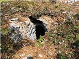 8
8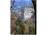 9
9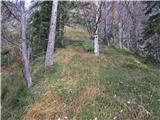 10
10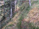 11
11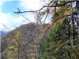 12
12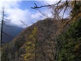 13
13 14
14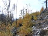 15
15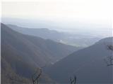 16
16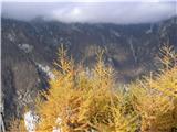 17
17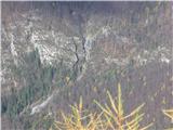 18
18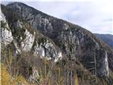 19
19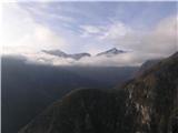 20
20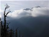 21
21
Discussion about the trail Kopišča - Kopa (Belska Kopa)
|
| franca23. 06. 2014 |
Takoj od izhodišča so zaradi letošnjega žledoloma narejene nove vlake, do konca moramo iti proti vzhodu. Zaenkrat je spodnji del, vse tja do rudniških rovov, še poln podrtega drevja. Poti je nemogoče slediti, najbolje se je vzpeti na greben nad potjo, ker je tam vsaj za silo prehodno, z nekaj plezanja čez drevje in obhodi. Verjetno bo takšno stanje še kar nekaj časa.
|
|
|
|
| simon1625. 09. 2022 11:14:41 |
Včeraj sem se spotoma vzpel še na ta vrh, ko sem se vračal s Konja po Martinj stezi. Odcep je komaj opazen in tudi stezica do vrha je slabo uhojena. Majhen možic je postavljen pri odcepu iz Martinj steze ter nekaj novih sem postavil naprej.
|
|
|
|
| ločanka31. 05. 2023 15:22:36 |
Včeraj na tej poti. Odcep od Martinj steze komaj opazen, ni bilo videti nobenega možička. Tako da sva sprva falila in nadaljevala naprej mimo odcepa. Drugače pa še vedno zelo ozka potka, na zelo strmem terenu. Na omenjenem sedelcu pa moraš malo nižje pod njim levo in prideš še enkrat na drugo sedelce, nato naprej po grebenu.
Povratek pa vreden razmisleka ali si dejansko želiš še enkrat ponavljati tisto sitno prečko. Če nimate namena nadaljevati naprej po Martinj stezi, potem je najbolje, da se spustite od sedelčka direktno po grabnu navzdol in pridete ponovno na markirano pot v bližini podprtega balvana. Drugače pa super vrh in tura!
|
|
|
|
| garmont31. 05. 2023 17:05:57 |
Opažam, da nekdo pridno podira možice v teh koncih.  
|
|
|