MHE Zabukovec - Mali Grintovec
Starting point: MHE Zabukovec (767 m)
| Lat/Lon: | 46,3602°N 14,4244°E |
| |
Time of walking: 3 h 50 min
Difficulty: easy marked way
Altitude difference: 1046 m
Altitude difference po putu: 1170 m
Map: Karavanke - osrednji del 1:50.000
Recommended equipment (summer):
Recommended equipment (winter): ice axe, crampons
Views: 482
 | 1 person likes this post |
Access to the starting point:
First, drive to Preddvor or Tupaliče (reachable from the Gorenjska highway or Kranj), then continue in the direction of Jezersko. When you arrive in Jezersko, you will soon see signs for the Kanonir Inn. After the guesthouse, turn left onto the road in the direction of Dol - Podstoržič and Kovk Farm. Continue along a slightly narrower road, which leads past houses, and then after a further 100 m of driving, you will reach a crossroads where a steep road branches off to the left, which is also the marked path to Kozji vrh. Continue straight on here, then at the next crossroads turn slightly left in the direction of Storžič and Kališča (slightly right Stegovnik). Just a little further on, the path takes you past the small hydroelectric power station Zabukovec, then quickly arrive at a place where there is a road sign stating that further driving is forbidden from 20. 7. to 20. 10. due to forestry work. Park in a small marked parking lot just before the road closure. For more information on the road's navigability, please call 04/25-45-300 (ZGS KE Jezersko - Kokra).
Path description:
From the starting point, continue along the road that leads past the ramp and continues along the Reka stream, which flows through the Podstoržič valley. The stream has several waterfalls, rapids, pools and some side tributaries, where some of the larger waterfalls are visible from our route. Higher up, a marked trail branches off to the right to Javorniški preval, and we continue straight on in the direction of Storžič, following the road to a right turn where it branches off in the direction of cart track in the direction of Bašeljski preval, Kališča and Storžič.
Continue briefly on the wider cart track (trains), then continue slightly left on the slightly narrower cart track, from which you soon turn right onto a marked footpath which crosses the aforementioned cart track a few more times higher up. Further on, the path leads us over the left bank of a mighty torrential gully, where a pleasant bench with a viewpoint of the torrent awaits us along the way, and if we look on the other side, we can also see several waterfalls in one of the gorges, which dry up on dry days. From here, the path climbs quite steeply for a few minutes, then gradually descends and leads us a little higher to Praprotnikova koča, which is located at the edge of a small clearing.
Behind the hut, we continue on the marked path, which again begins to climb steeply, and then at the boulder, it transitively lays down. After the boulder, the path crosses the stream bed and then begins to climb steeply to the right. This is followed by a steeper climb on quite scenic terrain, from which a beautiful view of the surrounding mountains opens up. When we enter lane of dwarf pines, a path branches off to the right, leading under or along the slopes of Storžič towards the aforementioned Javorniški preval, and we continue straight ahead and in a few minutes reach the crossroads at Bašeljski Preval.
At the signposts at Bašeljski sedlo, turn left towards Kališča (right Storžič), but follow the path towards the mountain lodge for only a few metres, as the signs for Bašeljski vrh then direct us left onto the grassy - rocky slopes. Continue climbing slightly to the left, to the point where the crossing is stopped by dwarf pines. If you have missed the right path during the ascent, find it a little further to the left. There is a short climb to the summit, from which Bašeljski vrh can be seen. From the summit we have only one minute to walk along the ridge, which is dangerous to slip in the snow. From Bašeljski vrh we start a relatively steep descent east to northeast, following a path that runs along and along a ridge that is mostly covered with dwarf pines, but where it is not a little more care is needed. After about 15 minutes the descent ends and the path leads to Mačensko sedlo, where we join the marked path from Kališča and the unmarked path along the valley of Suha.
Continue straight on in the direction of Maly Grintovec, following the path which begins to climb relatively steeply up the western slope of the mountain. After about half an hour's walk from Mačensko sedlo, we arrive at a marked crossroads where the path from Dolga njiva joins from the right. Continue left and after some 10 steps of further walking you will reach the top of Maly Grintovec.
Starting point - Praprotnikova koča 2:10, Praprotnikova koča - Bašelj preval 35 minutes, Bašelj preval - Bašeljski vrh 20 minutes, Bašelj summit - Mačensko sedlo 15 minutes, Mačensko sedlo - Mali Grintovec 30 minutes.

Pictures:
 1
1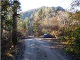 2
2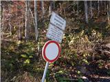 3
3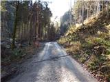 4
4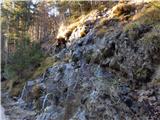 5
5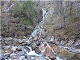 6
6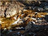 7
7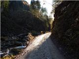 8
8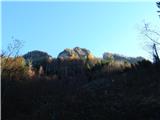 9
9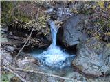 10
10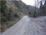 11
11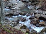 12
12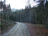 13
13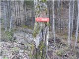 14
14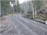 15
15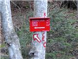 16
16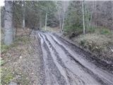 17
17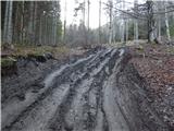 18
18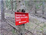 19
19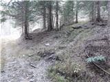 20
20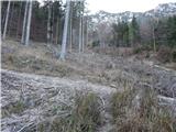 21
21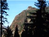 22
22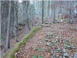 23
23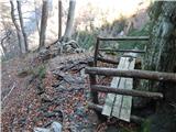 24
24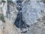 25
25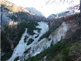 26
26 27
27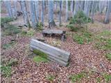 28
28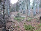 29
29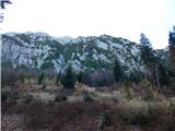 30
30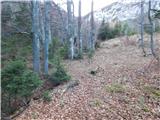 31
31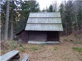 32
32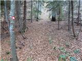 33
33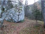 34
34 35
35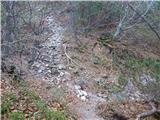 36
36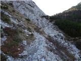 37
37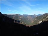 38
38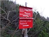 39
39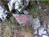 40
40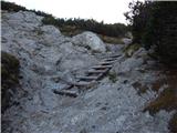 41
41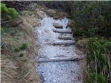 42
42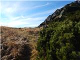 43
43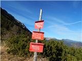 44
44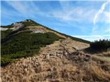 45
45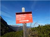 46
46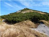 47
47 48
48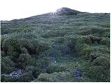 49
49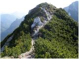 50
50 51
51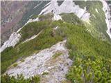 52
52 53
53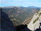 54
54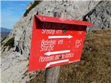 55
55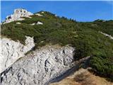 56
56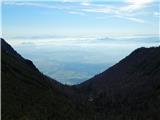 57
57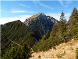 58
58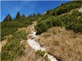 59
59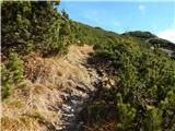 60
60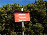 61
61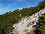 62
62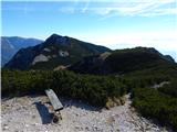 63
63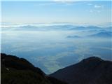 64
64 65
65
Discussion about the trail MHE Zabukovec - Mali Grintovec