Planina Ravne - Veliki vrh (Veža) (via Dleskovec)
Starting point: Planina Ravne (1500 m)
| Lat/Lon: | 46,3493°N 14,6997°E |
| |
Name of path: via Dleskovec
Time of walking: 2 h 45 min
Difficulty: easy unmarked way
Altitude difference: 610 m
Altitude difference po putu: 800 m
Map: Kamniške in Savinjske Alpe 1:50.000
Recommended equipment (summer):
Recommended equipment (winter): ice axe, crampons
Views: 8.504
 | 1 person likes this post |
Access to the starting point:
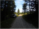
a) First drive to Kamnik, then continue to Stahovica and the Črnivec Pass. A few 100 metres before the Črnivec Pass, leave the main road leading to Gornji Grad and drive sharp left in the direction of the Volovljek Pass (Kranjski Rak). From the above-mentioned pass, continue straight ahead (on the left the road leading to Velika planina, on the right the Štajerski Rak) and start descending towards Luče. Lower down, the road bends slightly and leads to the Podvolovljek valley. Continue past the road leading to the Lučka Bela valley, then past the bar at Gams. After the bar, pay attention, because just a few 100 metres further on, a road branches off to the left, leading to mountain pasture Podveža and Ravne and the Planinšek farm (at the point where you leave the main road, the road marking is approximately 11 km). Continue along the initially still asphalted road, which climbs further towards the Dleskovská plateau. Higher up, the road to Planinšek branches off to the right, and here we continue along the upper road on the left, which leads us a little further to the next crossroads, where we continue straight on in the direction of mountain pasture Ravne (on the left mountain pasture Podveža). Continue on a slightly less favourable road, then follow to the start of mountain pasture Ravne, where you park in a suitable place on the roadside.
From the main road to mountain pasture Ravne is about 10 km.
b) First drive to Luce, then continue to Kamnik. When you see the road sign by the side of the road indicating 10,5 km, pay attention to the right fork, as just a little further on the road will branch off to the right towards mountain pasture Podveža and Ravne and the Planinšek farm. Continue along the initially still asphalted road, which climbs further towards the Dleskovški plateau. Higher up, the road to Planinšek branches off to the right, and here we continue along the upper left road, which leads us a little further to the next crossroads, where we continue straight on in the direction of mountain pasture Ravne (to the left mountain pasture Podveža). Continue on a slightly less favourable road, then follow to the start of mountain pasture Ravne, where you park in a suitable place on the roadside.
Path description:
At the beginning of mountain pasture Ravne (also Ravni) we see wooden mountain direction signs for Velika vrh, Korošica, Molička mountain pasture and Dolgo trato, which direct us to the left towards the nearby hut, which is located on the edge of mountain pasture. Go around the hut on the left and then into the narrow lane of a forest, where signs lead you to the left. The path ahead leads through a clearing, over which it climbs crosswise into the forest. Continue climbing through the forest, soon crossing a grazing fence. Higher up, the forest begins to thin out, or change into lane of dwarf pines. In a few places, the slightly less well-beaten but still well-traced path climbs higher and leads to the lower edge of the Long Lawn pastures. Here the path is fully laid and in a few 10 steps of further walking leads us to the shepherd's hut on the Long Grass.
At the shepherd's hut, where there is a small marked crossroads, continue to the right in the direction of Dleskovec (to the left Molička mountain pasture, Velika vrh and Korošica). The unmarked trail then passes a nearby cross on the left and turns into dwarf pines through which it starts to climb moderately. From the cross onwards, follow the beaten and partly mown path for a while, then, when it is laid and leads to a small sinkhole, it suddenly disappears almost completely. Here we continue along the left side of the sinkhole and climb between dwarf pines on the left and the scrotum on the right. The steep part ends quickly and the "path" then leads quickly to a viewpoint.
From the top of Dleskovec, continue northwards, where a fainter path, along which you can see some small cairns, gradually leads to a small valley. The path, which continues to descend moderately to occasionally slightly steeper, continues slightly to the left of the valley, where it follows a partly grassy slope surrounded by dwarf pines. Lower down, the path descends right into the valley and then joins the waymarked path from mountain pasture Ravne or, from the end of the road, slightly above mountain pasture.
Follow the marked trail to the left, and it will soon lead to a crossroads where the marked trail over Dolgo Trata will join us from the left. Continue straight on here, and we will reach a place where the path to Velika vrh branches off to the right. At this point, leave the wide path leading towards Korošica and continue to the right, following the Velika summit markers. Continue along a slightly less well-trodden path, which continues through the dwarf pines zone. After about 15 minutes of further walking, the path turns into a rockier world, where the path becomes even slightly less beaten. The trail, which is further on well marked with cairns and more recent markings, climbs up the right-hand side of the scree, where it leads under small cliffs. The steepness then eases and after about 10 minutes of further walking we arrive in a more grassy world. Here, bear left upwards and continue along the less well-trodden track, which leads towards the saddle between Velika peak on the left and Velika Zelenica on the right. In the upper part of the ascent, keep slightly to the right as the slope below Velika Peak becomes very steep. After crossing the steep part, the path suddenly flattens out and leads to vast grassy slopes.
Here we continue to the left towards the Velika peak (Velika Zelenica to the right), the top of which is already visible and can be reached without too much difficulty.

Pictures:
 1
1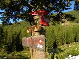 2
2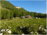 3
3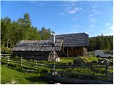 4
4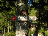 5
5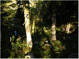 6
6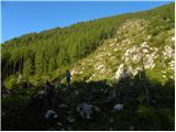 7
7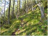 8
8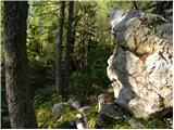 9
9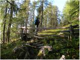 10
10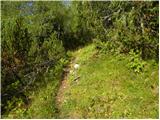 11
11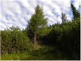 12
12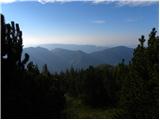 13
13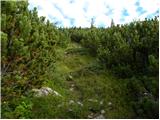 14
14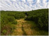 15
15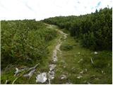 16
16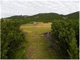 17
17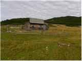 18
18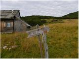 19
19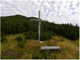 20
20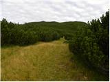 21
21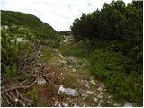 22
22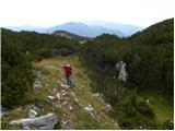 23
23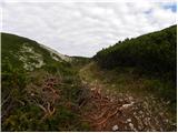 24
24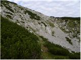 25
25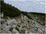 26
26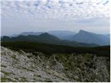 27
27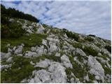 28
28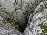 29
29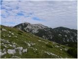 30
30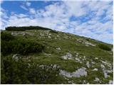 31
31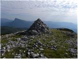 32
32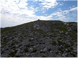 33
33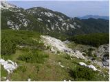 34
34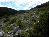 35
35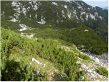 36
36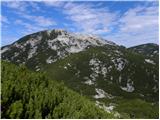 37
37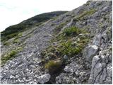 38
38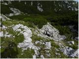 39
39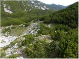 40
40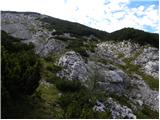 41
41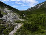 42
42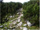 43
43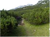 44
44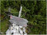 45
45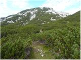 46
46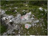 47
47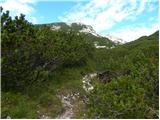 48
48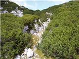 49
49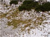 50
50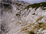 51
51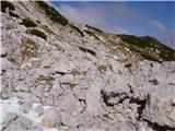 52
52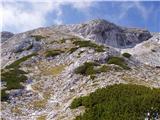 53
53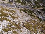 54
54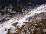 55
55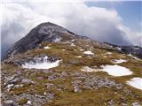 56
56 57
57
Discussion about the trail Planina Ravne - Veliki vrh (Veža) (via Dleskovec)
|
| LidijaJesih14. 10. 2012 |
Pot do Planine Dolga trata je sedaj markirana, naprej na Dleskovec pa lepo sledljiva, a ni označena. Prav tako nemarkiran je spust z Dleskovca na vezno markirano pot do Korošice, je pa zato markirna tudi pot , ki se odcepi na Veliki vrh.Pot je sedaj torej večinoma označena. 
|
|
|
|
| Stamp28. 09. 2015 |
Ima li netko možda Track (GPX ili bilo koji) ovog puta ? Lijepo je ovdje opisano, ne može se izgubiti, no rado bih imao nešto na GPSu za slučaj magle ili sl..
|
|
|
|
| KarmenT24. 07. 2022 20:26:19 |
Midva nisva našla poti, ki se spusti z vrha po severni strani, sva pa našla dobro uhojeno stezico na zahodni strani, ki pripelje na markirano pot iz Dolge trate. Sva srečala domačina, ki je rekel, da je možnih več poti.
|
|
|