Planina Ravne - Molička peč (via planina Polšak)
Starting point: Planina Ravne (1500 m)
| Lat/Lon: | 46,3493°N 14,6997°E |
| |
Name of path: via planina Polšak
Time of walking: 2 h 25 min
Difficulty: easy pathless terrain
Altitude difference: 529 m
Altitude difference po putu: 600 m
Map: Kamniške in Savinjske Alpe 1:50.000
Recommended equipment (summer):
Recommended equipment (winter): ice axe, crampons
Views: 16.937
 | 2 people like this post |
Access to the starting point:
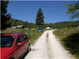
a) First drive to Kamnik, then continue to Stahovica and the Črnivec Pass. A few 100 metres before the Črnivec Pass, leave the main road leading to Gornji Grad and drive sharp left in the direction of the Volovljek Pass (Kranjski Rak). From the above-mentioned pass, continue straight ahead (on the left the road leading to Velika planina, on the right the Štajerski Rak) and start descending towards Luce. Lower down, the road bends slightly and leads to the Podvolovljek valley. In the following, you first pass the road branch leading to the Lučka Bela valley, and then the bar at Gams. After the bar, pay attention, because just a few 100 metres further on, a road branches off to the left, leading to mountain pasture Podveža and mountain pasture Ravne and the Planinšek farm (at the point where you leave the main road, the road marking is approximately 11 km). Continue along the initially still asphalted road, which climbs further towards the Dleskovská plateau. Higher up, the road to Planinšek branches off to the right, and here we continue along the upper left road, which a few 100 metres further on from the turnoff to the Planinšek farm becomes macadam, and this road leads us a little further on to the next crossroads, where we continue straight on in the direction of mountain pasture Ravne (to the left, mountain pasture Podveža). Continue on a slightly less favourable road, then follow to the start of mountain pasture Ravne, where you park in a suitable place on the roadside.
From the main road to mountain pasture Ravne is about 10 km, of which about 4 km are macadam.
b) First drive to Luce, then continue driving towards Kamnik. When you see the road sign by the side of the road indicating 10,5 km, pay attention to the right fork, as just a little further on the road will branch off to the right towards mountain pasture Podveža and Ravne and the Planinšek farm. Continue along the initially still asphalted road, which climbs further towards the Dleskovški plateau. Higher up, the road to Planinšek branches off to the right, and here we continue along the upper left road, which a few 100 metres further on from the turn-off to Planinšek Farm becomes macadam, and this road leads us a little further on to the next crossroads, where we continue straight on in the direction of mountain pasture Ravne (to the left of mountain pasture Podveža). The road to the right is the road to Planinšek Farm, and the road to Planinšek Farm becomes macadam. Continue on a slightly less favourable road, then follow to the start of mountain pasture Ravne, where you park in a suitable place on the roadside. From the main road to mountain pasture Ravne is about 10 km, of which about 4 km are macadam.
Path description:
From the starting point, walk via mountain pasture to the shepherd's hut, which you go around on the right by continuing in the direction of Molička mountain pasture and mountain pasture Polšak (the path on the left side of the hut leads across the Dolgo trata). After the hut the path is a bit harder to follow at first, but the markings help us, and a little further on we join the cart track, which branches off the road on the mountain pasture straight at a right-hand bend.
Once on cart track, continue left, initially walking without any significant change in elevation, and then starting a gentle to moderate climb. After a few minutes, you will reach a faint saddle between Dleskovec on the left and Smrekovec on the right. Here a path joins us from the end of the road on the right, and we continue straight ahead over a pasture fence. After the grazing fence there is a short crossing, and then we arrive at the next marked crossroads, where we continue straight in the direction of mountain pasture Polšak (Korošica on the left, Molička mountain pasture, and at the crossroads there are markings for Lučko Hut). Although the fork is marked, the trail is no longer marked, with the exception of occasional informal markings with a red stripe marking the trail below.
After a short initial climb, the path lays down, then descends gently for a while, then crosses the slopes to the right. When the crossing ends, we reach an undistinguished valley where a path branches off to the right to a nearby hunting lodge, and we continue left and climb up the valley, where the path leads us past a waterhole. Following a pleasant valley surrounded by a sparse larch forest, we climb gently to moderately, and after a few minutes we reach mountain pasture Polšak, in the middle of which is a newer shepherd's hut (the old one burnt down).
From the hut, continue slightly to the right (direction north), then return to the rare larch forest, and after a few minutes the path leads to a wooden trough with water, where the water usually flows very slowly, as it is a small spring. During the easy ascent, the larches are joined by dwarf pines, and we reach a crossroads a little higher up, on a small grassy level, where we continue on the left path (the right path leads to Križevnik, which is about 30 minutes away from the crossroads). From here on the path turns slightly more to the left, and the larches along the way are increasingly replaced by dwarf pines, but the path is always traceable and passable. After a short traverse, a grassy part is reached, where there are several piles of burnt dwarf pines and an ingenious small bench. From this part there is a nice view towards Dleskovec, Velika peak and Velika Zelenica, and the path returns to the dwarf pines zone, through which the crossing continues. After a while, the traverse ends and the path starts to climb steeply and occasionally get lost, but with some care it can be followed. Higher up, the path becomes rockier in a few short sections and gradually less steep again. Once the path has completely settled, a relatively nice passage opens up to the right towards the Molička peč summit, which is a good 10-minute climb away.
From the point where you leave the beaten track you climb up a partly grassy slope surrounded by dwarf pines, so follow the moguls carefully and look for passages, which are relatively easy if you have left the path at the most suitable place. When we reach the top we are rewarded with an outstanding view of the mountains above Robanov Kot.
Description and pictures refer to the situation in 2016 (August).

Pictures:
 1
1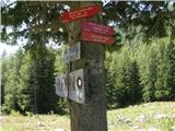 2
2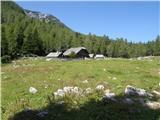 3
3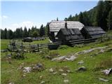 4
4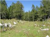 5
5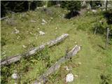 6
6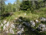 7
7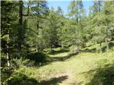 8
8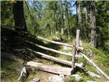 9
9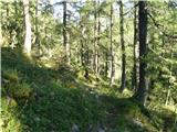 10
10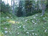 11
11 12
12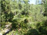 13
13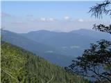 14
14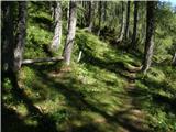 15
15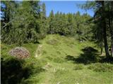 16
16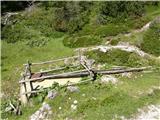 17
17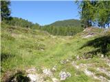 18
18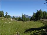 19
19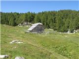 20
20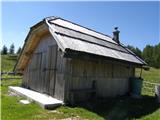 21
21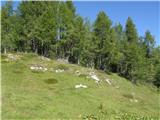 22
22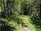 23
23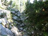 24
24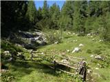 25
25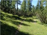 26
26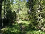 27
27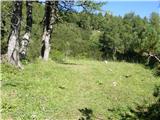 28
28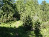 29
29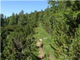 30
30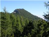 31
31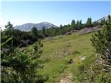 32
32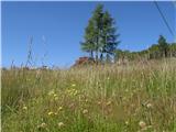 33
33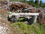 34
34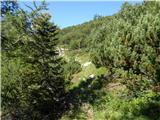 35
35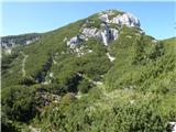 36
36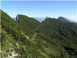 37
37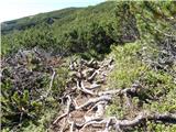 38
38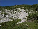 39
39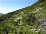 40
40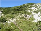 41
41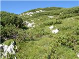 42
42 43
43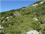 44
44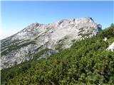 45
45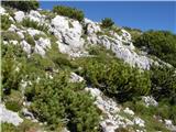 46
46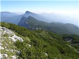 47
47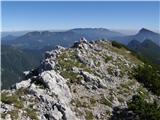 48
48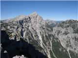 49
49
Discussion about the trail Planina Ravne - Molička peč (via planina Polšak)
|
| Matija G2. 08. 2020 |
Dober opis poti, sem ji brez večjih težav sledil. Le pri samem vzponu na vrh we nisem najbolje znašel, vzpel sem se po gruščnati grapi z jugovzhodne strani, ki pa me je pripeljala na greben nekoliko vzhodno is vrha od koder je prečenje do vrha po izpostavljenem grebenu kar zoprno zaradi ruševja. Enostavneje je poiskati prehode skozi ruševje, ki v resnici ni tako gosto kot je videti od spodaj s poti.
Pa še tole - na poti of Raven do Poljšaka sem na poti opazil več nenavadno velikih svežih stopinj. Na travniku s kupi nažaganega ruševja, ki ga opisujete, pa sem naletel na več okostij ovac, verjetno is lanskega leta. Tako, da svetujem glasno hojo.
|
|
|
|
| veja52. 08. 2020 |
Zanimivo,
Jaz pa sem konec februarja malo nad planino Ravni skoraj stopil kosmatincu na nogo. Moja in njegova gaz sta se križali. V snegu so bile sveže sledi. Velikosti čevlja st.42, le 2x bolj široke.
Pozdrav. Venčeslav.
|
|
|
|
| zago2. 08. 2020 |
Pokol ovac nad Podvolovljekom
Štefka Sem, 23.6.2020 10:24:00
Konec preteklega tedna je volk ali trop volkov, lahko tudi trop volka in potepuških psov na območju Poljšaka in pod Križevnikom nad Podvolovljekom pokončal 20 ovc in jagnjet
Se pa na tem območju prehodno opazi tudi medved.
Zato previdnost ni odveč in se držite poti in predvsem pse imejte na povodcih.
Varen korak vsem.
|
|
|
|
| Enka2. 08. 2020 |
Eno vprašanje. Če greš po tej poti z Moličke peči proti Planini Ravne, avto pa imaš parkiran pod Pl. Podvežak, katera opcija do avta je najboljša (najkrajša, najlepša, najmanj naporna  ).
|
|
|
|
| garmont2. 08. 2020 |
Vsekakor moraš mimo planine Polšak, do stika z markirano potjo Ravne-Veliki vrh. Tu zaviješ desno ( levo planina Ravne...). Tej poti slediš kar nekaj časa, do sedelca pod Velikim vrhom, kjer te nove usmerjevalne table usmerijo levo proti Podvežaku.
|
|
|
|
| Enka2. 08. 2020 |
Aha, se pravi ta je najbolj optimalna? To je tam, kjer je do Raven še 20 minut, a ne? No, tako sva tudi šli
|
|
|
|
| garmont2. 08. 2020 |
Tako je. Je pa še, nekje na pol poti od planine Polšak, nemarkiran odcep v desno, ki te privede precej višje na markirano pot Ravne-Veliki vrh... 
|
|
|
|
| iUnknown2. 08. 2020 |
@Zago, za to območje je znano, da se na njem zadržuje trop mešancev med volkovi in psi. https://sasa-novice.si/v-zgornje-savinjski-dolini-se-vedno-tezave-zaradi-zveri/ Po nekih informacijah, ki jih nisem uspel preveriti iz večih virov, naj bi celo napadli neko žensko na parkirišču. Od istega vira sem tudi slišal, da naj bi okoli 26. decembra 2019 na planini Dol postrelili tri mešance. Tudi to informacijo še skušam preveriti, ampak imam to smolo, da kadar jaz tam hodim, ne srečam nobenega lovca, čeprav vem v katerih stanovih so.
|
|
|
|
| iUnknown2. 08. 2020 |
Se je pa tudi meni zgodilo pozimi, da so mi v temi sledile neke živali, ko sem se vračal čez planino Dol iz Rzenika. Srne zagotovo niso bile, ker srne ti ne sledijo, sploh pa ne na razdalji nekaj metrov. Klub močni luči sem uspel videti le odsev njihovih oči, tako da res ne vem kaj je to bilo.
|
|
|
|
| zago2. 08. 2020 |
Ja Unknown ja nekaj navedb drži jas sem to sporočilo povzel iz članka Savinjskih novic. Mešanci so bili res postreljeni lani. To ti lahko zagotovim iz zanesljivih virov. Ni pa bila odstreljena volkulja. Je pa znano, da se je lansko leto to krdelo največ časa zadrževalo na območju Lučke bele. Obstaja možnost, da si je ustvarila novo. Zato previdnost ni odveč.
|
|
|
|
| iUnknown7. 08. 2020 |
Tile iz Lučke bele zelo verjetno zaidejo tudi pod Rzenik in do planine Dol.
Danes sem šel po grebenu nad planino Dol in pod Rzenikom. Tam je neka neoznačena pot, kjer hodi zelo malo ljudi in zato niti ni pretirano shojena. Na nekaterih mestih moraš tudi študirati, kje točno gre.
Ampak jaz nisem šel po tej poti ampak nad njo, kjer pa je precej živalskih sledi in stečin. In med temi sem opazil povsem sveže sledi "psov". Ker pa tam zelo verjetno ni potepuških psov, bi se dalo sklepati, da so bili ali šakali ali pa volkovi.
|
|
|