 | Ravne - Črna prst (via Orožnova koča)
On the northern slope of the Črna prst summit head, you can see the black soil from which the mountain takes its name. Črna prst is known for its...
3 h 5 min |
 | Kocenpohar - Črna prst
On the northern slope of the Črna prst summit head, you can see the black soil from which the mountain takes its name. Črna prst is known for its...
2 h 45 min |
| Ravne - Črna prst (via planina za Črno goro)
On the northern slope of the Črna prst summit head, you can see the black soil from which the mountain takes its name. Črna prst is known for its...
3 h 25 min |
 | Kal - Črna prst
On the northern slope of the Črna prst summit head, you can see the black soil from which the mountain takes its name. Črna prst is known for its...
2 h 30 min |
| Podbrdo - Črna prst
On the northern slope of the Črna prst summit head, you can see the black soil from which the mountain takes its name. Črna prst is known for its...
3 h 15 min |
 | Polje - Črna prst
On the northern slope of the Črna prst summit head, you can see the black soil from which the mountain takes its name. Črna prst is known for its...
3 h 45 min |
 | Polje - Črna prst (via Orožnova koča)
On the northern slope of the Črna prst summit head, you can see the black soil from which the mountain takes its name. Črna prst is known for its...
4 h |
| Bohinjska Bistrica - Črna prst (via Planina za Črno goro)
On the northern slope of the Črna prst summit head, you can see the black soil from which the mountain takes its name. Črna prst is known for its...
4 h |
 | Zalog - Tolsti vrh
Tolsti vrh, located to the west of Storžič, is also the highest peak of the Kriška Gora, a mountain range rising steeply above the central Gorenj...
3 h |
 | Tržič - Tolsti vrh
Tolsti vrh, located to the west of Storžič, is also the highest peak of the Kriška Gora, a mountain range rising steeply above the central Gorenj...
3 h 15 min |
 | Golnik - Tolsti vrh (via Kriška goro)
Tolsti vrh, located to the west of Storžič, is also the highest peak of the Kriška Gora, a mountain range rising steeply above the central Gorenj...
3 h 30 min |
 | Golnik - Tolsti vrh (via Ježa)
Tolsti vrh, located to the west of Storžič, is also the highest peak of the Kriška Gora, a mountain range rising steeply above the central Gorenj...
3 h 15 min |
 | Križe - Tolsti vrh (steep path over Kriška gora)
Tolsti vrh, located to the west of Storžič, is also the highest peak of the Kriška Gora, a mountain range rising steeply above the central Gorenj...
3 h 30 min |
| Križe - Tolsti vrh (easier path over Kriška gora)
Tolsti vrh, located to the west of Storžič, is also the highest peak of the Kriška Gora, a mountain range rising steeply above the central Gorenj...
3 h 45 min |
| Križe - Tolsti vrh (via Ježa)
Tolsti vrh, located to the west of Storžič, is also the highest peak of the Kriška Gora, a mountain range rising steeply above the central Gorenj...
3 h 30 min |
| Povlje - Tolsti vrh
Tolsti vrh, located to the west of Storžič, is also the highest peak of the Kriška Gora, a mountain range rising steeply above the central Gorenj...
2 h 45 min |
 | Leskova dolina - Snežnik
Snežnik or Veliki Snežnik is the highest peak in the near and far surroundings with a height of 1796 m. It offers a beautiful view over most of S...
3 h 15 min |
 | Brezje pri Tržiču - Dobrča (on path Po robu and via Lešanska planina)
Dobrča is a 1634 m high mountain located between Begunje and Tržič. From the top, where the registration box with the stamp is located, we can se...
2 h 35 min |
 | Brezje pri Tržiču - Dobrča (via koča na Dobrči)
Dobrča is a 1634 m high mountain located between Begunje and Tržič. From the top, where the registration box with the stamp is located, we can se...
3 h |
| Brezje pri Tržiču - Dobrča (po robu)
Dobrča is a 1634 m high mountain located between Begunje and Tržič. From the top, where the registration box with the stamp is located, we can se...
2 h 30 min |
| Tržič - Dobrča
Dobrča is a 1634 m high mountain located between Begunje and Tržič. From the top, where the registration box with the stamp is located, we can se...
3 h 10 min |
 | Hudi Graben - Dobrča (via Koča na Dobrči)
Dobrča is a 1634 m high mountain located between Begunje and Tržič. From the top, where the registration box with the stamp is located, we can se...
3 h |
| Slatna - Dobrča
Dobrča is a 1634 m high mountain located between Begunje and Tržič. From the top, where the registration box with the stamp is located, we can se...
3 h |
 | Begunje (Preska) - Dobrča
Dobrča is a 1634 m high mountain located between Begunje and Tržič. From the top, where the registration box with the stamp is located, we can se...
3 h |
 | Bistrica pri Tržiču - Dobrča
Dobrča is a 1634 m high mountain located between Begunje and Tržič. From the top, where the registration box with the stamp is located, we can se...
2 h 55 min |
| Brezje pri Tržiču - Dobrča (by road)
Dobrča is a 1634 m high mountain located between Begunje and Tržič. From the top, where the registration box with the stamp is located, we can se...
2 h 45 min |
 | Volaka - Blegoš
Blegoš is a 1562 m high mountain located between Selška and Poljane Sora. From the grassy summit, on which there is a stamp and a registration bo...
2 h 35 min |
 | Zali Log - Blegoš (via Potok)
Blegoš is a 1562 m high mountain located between Selška and Poljane Sora. From the grassy summit, on which there is a stamp and a registration bo...
3 h |
 | Petrovo Brdo - Možic (via Vrh Bače)
Možic is a 1602 m high peak located west of Soriška mountain pasture. It is at the highest point of the peak that there is an old military bunker...
2 h 30 min |
| Podbrdo - Možic
Možic is a 1602 m high peak located west of Soriška mountain pasture. It is at the highest point of the peak that there is an old military bunker...
3 h 15 min |
| Podbrdo - Možic (via Lajnar)
Možic is a 1602 m high peak located west of Soriška mountain pasture. It is at the highest point of the peak that there is an old military bunker...
3 h 25 min |
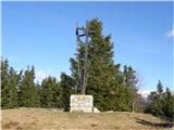
 | Petrovo Brdo - Porezen
Porezen is a 1630 m high mountain located between Davča and Baška Grapa. From the top, where a large NOB monument stands, we have a beautiful vie...
2 h 30 min |
 | Poče - Porezen (steep path)
Porezen is a 1630 m high mountain located between Davča and Baška Grapa. From the top, where a large NOB monument stands, we have a beautiful vie...
2 h 30 min |
| Poče - Porezen (gentle path)
Porezen is a 1630 m high mountain located between Davča and Baška Grapa. From the top, where a large NOB monument stands, we have a beautiful vie...
2 h 45 min |
 | Podbrdo - Porezen
Porezen is a 1630 m high mountain located between Davča and Baška Grapa. From the top, where a large NOB monument stands, we have a beautiful vie...
3 h 30 min |
| Podbrdo - Porezen (via Dom na Poreznu)
Porezen is a 1630 m high mountain located between Davča and Baška Grapa. From the top, where a large NOB monument stands, we have a beautiful vie...
3 h 35 min |
 | Jesenica - Porezen
Porezen is a 1630 m high mountain located between Davča and Baška Grapa. From the top, where a large NOB monument stands, we have a beautiful vie...
2 h 55 min |
| Jesenica - Porezen (via Dom na Poreznu)
Porezen is a 1630 m high mountain located between Davča and Baška Grapa. From the top, where a large NOB monument stands, we have a beautiful vie...
3 h |
| Preval Vrh Ravni - Porezen
Porezen is a 1630 m high mountain located between Davča and Baška Grapa. From the top, where a large NOB monument stands, we have a beautiful vie...
2 h 30 min |
| Preval Vrh Ravni - Porezen (via Dom na Poreznu)
Porezen is a 1630 m high mountain located between Davča and Baška Grapa. From the top, where a large NOB monument stands, we have a beautiful vie...
2 h 35 min |
 | Dolenji Novaki - Porezen
Porezen is a 1630 m high mountain located between Davča and Baška Grapa. From the top, where a large NOB monument stands, we have a beautiful vie...
4 h |
| Poče - Porezen (via Labinjske lehe)
Porezen is a 1630 m high mountain located between Davča and Baška Grapa. From the top, where a large NOB monument stands, we have a beautiful vie...
3 h 15 min |
| Poče - Porezen (winter way)
Porezen is a 1630 m high mountain located between Davča and Baška Grapa. From the top, where a large NOB monument stands, we have a beautiful vie...
3 h 25 min |
 | Mače - Srednji vrh (via Kozjek and Dolga njiva)
Srednji vrh is an 1853 m high mountain located to the east of Storžič. From the top, where there is a bench, a registration box and a stamp, we h...
3 h 30 min |
| Spodnja Kokra - Srednji vrh
Srednji vrh is an 1853 m high mountain located to the east of Storžič. From the top, where there is a bench, a registration box and a stamp, we h...
4 h |
| Mače - Srednji vrh (Mačenska pot and via Cjanovca)
Srednji vrh is an 1853 m high mountain located to the east of Storžič. From the top, where there is a bench, a registration box and a stamp, we h...
3 h 50 min |
| Mače - Srednji vrh (Mačenska pot and via Dolga njiva)
Srednji vrh is an 1853 m high mountain located to the east of Storžič. From the top, where there is a bench, a registration box and a stamp, we h...
3 h 35 min |
| Mače - Srednji vrh (via Kozjek and Cjanovca)
Srednji vrh is an 1853 m high mountain located to the east of Storžič. From the top, where there is a bench, a registration box and a stamp, we h...
4 h |
 | Stara Fužina - Pršivec (direct way)
Lookout Mountain is located above Lake Bohinj. The view is extensive on all sides. Triglav and the mountains around it can be seen, and on the ot...
3 h 45 min |
 | Spodnja Kokra - Javorov vrh
Javorov vrh (also Javorjev vrh according to some records) is a 1434 m high mountain located northeast of Preddvor. From the top, which has a regi...
2 h 20 min |
 | Potoče - Javorov vrh (via Potoška gora)
Javorov vrh (also Javorjev vrh according to some records) is a 1434 m high mountain located northeast of Preddvor. From the top, which has a regi...
2 h 45 min |
| Potoče - Javorov vrh (direct way)
Javorov vrh (also Javorjev vrh according to some records) is a 1434 m high mountain located northeast of Preddvor. From the top, which has a regi...
2 h 30 min |
 | Mače - Javorov vrh (Mačenska pot)
Javorov vrh (also Javorjev vrh according to some records) is a 1434 m high mountain located northeast of Preddvor. From the top, which has a regi...
2 h 50 min |
| Mače - Javorov vrh (via Kozjek)
Javorov vrh (also Javorjev vrh according to some records) is a 1434 m high mountain located northeast of Preddvor. From the top, which has a regi...
3 h |
 | Mače - Bašeljski vrh
Bašeljski vrh is a 1744 m high mountain located between Mali Grintovec and Storžič. From the top, where there is a bench and a registration box w...
3 h 15 min |
| Laško - Bašeljski vrh
Bašeljski vrh is a 1744 m high mountain located between Mali Grintovec and Storžič. From the top, where there is a bench and a registration box w...
2 h 45 min |
 | Bašelj - Bašeljski vrh (via hospital Košuta)
Bašeljski vrh is a 1744 m high mountain located between Mali Grintovec and Storžič. From the top, where there is a bench and a registration box w...
3 h 25 min |
| Bašelj - Bašeljski vrh
Bašeljski vrh is a 1744 m high mountain located between Mali Grintovec and Storžič. From the top, where there is a bench and a registration box w...
3 h 15 min |
| Mače - Bašeljski vrh (via Kozjek)
Bašeljski vrh is a 1744 m high mountain located between Mali Grintovec and Storžič. From the top, where there is a bench and a registration box w...
3 h 30 min |
 | MHE Zabukovec - Bašeljski vrh
Bašeljski vrh is a 1744 m high mountain located between Mali Grintovec and Storžič. From the top, where there is a bench and a registration box w...
3 h 5 min |
 | Dovje - Frauenkogel/Dovška Baba
Frauenkogel is an 1891 m high peak located on the border ridge between Slovenia and Austria. The summit, which has a registration box and a stamp...
3 h |
 | Kraljev hrib - Konj
Konj is a 1803 m high peak located between Velika planina and Presedlje. From the top, we have a beautiful view of the highest peaks of Kamnik Sa...
3 h 30 min |
 | Petrovo Brdo - Slatnik (northwestern peak) (via Lajnar)
Slatnik is a scenic mountain located to the west of the Soriška mountain pasture ski resort. The grassy peak offers a beautiful view of the Škofj...
2 h 15 min |
 | Podbrdo - Slatnik (northwestern peak)
Slatnik is a scenic mountain located to the west of the Soriška mountain pasture ski resort. The grassy peak offers a beautiful view of the Škofj...
3 h 15 min |
| Podbrdo - Slatnik (northwestern peak) (via Lajnar)
Slatnik is a scenic mountain located to the west of the Soriška mountain pasture ski resort. The grassy peak offers a beautiful view of the Škofj...
3 h 10 min |
 | Grahovše - Bela peč (via Boršt)
The mountain, which is known mainly by climbers, is located north of Storžič on the slopes of Konjščice. From the top there is a beautiful view o...
2 h 30 min |
 | Grahovše - Bela peč (via rot)
The mountain, which is known mainly by climbers, is located north of Storžič on the slopes of Konjščice. From the top there is a beautiful view o...
2 h 30 min |
 | Grahovše - Bela peč (via Rekar)
The mountain, which is known mainly by climbers, is located north of Storžič on the slopes of Konjščice. From the top there is a beautiful view o...
2 h 30 min |
 | Tržič - Bela peč (via Potarje and Spodnja Konjščica)
The mountain, which is known mainly by climbers, is located north of Storžič on the slopes of Konjščice. From the top there is a beautiful view o...
3 h 55 min |
 | Mače - Mali Grintovec (via Bašeljski vrh)
Mali Grintovec is a lookout mountain located to the east of Storžiča. From the top, where there is a registration box, a stamp and a nice bench, ...
4 h |
| Mače - Mali Grintovec (via Kozjek and Dolga njiva)
Mali Grintovec is a lookout mountain located to the east of Storžiča. From the top, where there is a registration box, a stamp and a nice bench, ...
3 h 30 min |
| Laško - Mali Grintovec (via Bašeljski vrh)
Mali Grintovec is a lookout mountain located to the east of Storžiča. From the top, where there is a registration box, a stamp and a nice bench, ...
3 h 30 min |
| Mače - Mali Grintovec (Mačenska pot and via Dolga njiva)
Mali Grintovec is a lookout mountain located to the east of Storžiča. From the top, where there is a registration box, a stamp and a nice bench, ...
3 h 30 min |
| Bašelj - Mali Grintovec (via Bašeljski vrh)
Mali Grintovec is a lookout mountain located to the east of Storžiča. From the top, where there is a registration box, a stamp and a nice bench, ...
4 h |
 | MHE Zabukovec - Mali Grintovec
Mali Grintovec is a lookout mountain located to the east of Storžiča. From the top, where there is a registration box, a stamp and a nice bench, ...
3 h 50 min |
| Mače - Mali Grintovec (via Dom na Kališču)
Mali Grintovec is a lookout mountain located to the east of Storžiča. From the top, where there is a registration box, a stamp and a nice bench, ...
3 h 45 min |
| Laško - Mali Grintovec (via Dom na Kališču)
Mali Grintovec is a lookout mountain located to the east of Storžiča. From the top, where there is a registration box, a stamp and a nice bench, ...
3 h 15 min |
| Bašelj - Mali Grintovec (via Dom na Kališču)
Mali Grintovec is a lookout mountain located to the east of Storžiča. From the top, where there is a registration box, a stamp and a nice bench, ...
3 h 45 min |
| Bašelj - Mali Grintovec (via hospital Košuta and Dom na Kališču)
Mali Grintovec is a lookout mountain located to the east of Storžiča. From the top, where there is a registration box, a stamp and a nice bench, ...
3 h 55 min |
 | Rosenbach - Rosenkogel/Hruški vrh
Rosenkogel is a 1776 m high mountain located between Frauenkogel and the slightly less known Klek. From the top, where there is a small chapel de...
3 h 50 min |
 | Rosenbach - Rosenkogel/Hruški vrh (via Koprivnjak)
Rosenkogel is a 1776 m high mountain located between Frauenkogel and the slightly less known Klek. From the top, where there is a small chapel de...
4 h |
 | Podbrdo - Kobla
The peak is located in the Lower Bohinj Mountains between Črna prst and Soriška mountain pasture. Just below the peak is a railway tunnel connect...
3 h |
| Petrovo Brdo - Kobla
The peak is located in the Lower Bohinj Mountains between Črna prst and Soriška mountain pasture. Just below the peak is a railway tunnel connect...
2 h 15 min |
 | Mojstrana - Jerebikovec
The peak is slightly overgrown and is situated above Mojstrana and Radovna. From the top there is a beautiful view towards Karawanks and the moun...
2 h 20 min |
 | Zavrzelno - Čukla
Čukla is located above the Bovec basin on the Rombon escarpment. From the top of the pyramid (a monument commemorating the capture of Čukla) ther...
3 h |
 | Podbrdo - Lajnar
Lajnar is a 1549 m high mountain located north of Soriška mountain pasture. From the top, which is also the highest point of the ski resort, we h...
2 h 55 min |
 | Petrovo Brdo - Šavnik
Šavnik is a grassy peak located between the Soriška planina and Kobla ski resorts. From the summit, which has a registration box with a stamp, yo...
2 h 15 min |
| Podbrdo - Šavnik
Šavnik is a grassy peak located between the Soriška planina and Kobla ski resorts. From the summit, which has a registration box with a stamp, yo...
3 h |
 | Zali Log - Koprivnik
Koprivnik is a 1393 m high mountain located between Blegoš and Mladi vrh. The view from the summit, which has a registration box and a stamp, is ...
2 h 45 min |
 | Lipa - Vivodnik
At 1508 m, Vivodnik is the highest peak of the Menina mountain pasture, a plateau rising south of Gornji Grad. From the top, where there is a sma...
3 h 30 min |
 | Golice - Vivodnik
At 1508 m, Vivodnik is the highest peak of the Menina mountain pasture, a plateau rising south of Gornji Grad. From the top, where there is a sma...
2 h 45 min |
 | Tirosek (Nova Štifta) - Vivodnik
At 1508 m, Vivodnik is the highest peak of the Menina mountain pasture, a plateau rising south of Gornji Grad. From the top, where there is a sma...
4 h |
 | Ukanc - Šija (via Žagarjev graben)
The peak is located above the Vogel ski slope in the Lower Bohinj Mountains. From the top there is a beautiful view of the neighbouring peaks in ...
4 h |
 | Mojstrana - Vrtaški vrh
Vrtaški vrh is a scenic mountain overloking the Vrata valley. From the grassy summit, which is covered around and around with dwarf pines, there ...
3 h 40 min |
 | Ljubenske Rastke (Kumprej) - Smrekovec
Smrekovec is a volcanic mountain on the eastern edge of the Smrekov Mountains. The extensive grassy summit, on which stands a pyramid with a regi...
2 h 10 min |
 | Ljubenske Rastke - Komen
At 1684m, Komen is the highest peak of the Smrekov Mountains, a mountain range bordering Styria and Carinthia. From the top, in good weather, we ...
3 h 15 min |
 | Dolina potoka Žep - Veliki Travnik
Veliki Travnik, or Turnovka as the locals call it, is located on the western edge of the Smrekov Mountains. From the top of the hill, where a woo...
2 h 45 min |
 | Bistra - Veliki Travnik
Veliki Travnik, or Turnovka as the locals call it, is located on the western edge of the Smrekov Mountains. From the top of the hill, where a woo...
3 h 45 min |
| Ljubno ob Savinji - Veliki Travnik
Veliki Travnik, or Turnovka as the locals call it, is located on the western edge of the Smrekov Mountains. From the top of the hill, where a woo...
4 h |
 | Robanov kot - Strelovec
This scenic peak is located between two Alpine valleys, the Logarska dolina and Robanov Kot. The view from the top is the most beautiful of the m...
3 h |
 | Spodnja Kokra - Cjanovca
Cjanovca is the peak east of Storžič and south of Sredni vrh. It is a peak that can be seen from Kranj and the surrounding area. The southern slo...
3 h 45 min |
| Mače - Cjanovca (Mačenska pot and on SE ridge)
Cjanovca is the peak east of Storžič and south of Sredni vrh. It is a peak that can be seen from Kranj and the surrounding area. The southern slo...
3 h 35 min |
| Mače - Cjanovca (over Kozjek and on SE ridge)
Cjanovca is the peak east of Storžič and south of Sredni vrh. It is a peak that can be seen from Kranj and the surrounding area. The southern slo...
3 h 45 min |
| Mače - Cjanovca (Mačenska pot and via Dolga njiva)
Cjanovca is the peak east of Storžič and south of Sredni vrh. It is a peak that can be seen from Kranj and the surrounding area. The southern slo...
3 h 30 min |
| Mače - Cjanovca (via Kozjek and Dolga njiva)
Cjanovca is the peak east of Storžič and south of Sredni vrh. It is a peak that can be seen from Kranj and the surrounding area. The southern slo...
3 h 25 min |
 | Vitanje - Rogla
Rogla is the peak in the middle of the ski resort of the same name. The summit is woded with a small clearing on which stands a lookout tower. Th...
4 h |
 | Lovrenc na Pohorju - Lovrenška jezera
Lovrenška jezera are located on a high mor in the middle of Pohorje between Rogla and Ribnica Pohorje. Smaller lakes, which receive water only fr...
3 h 35 min |
 | Mislinja - Črni vrh
Črni vrh is the highest peak of Pohorje. Being partly unspoilt, Velika Kopa, Uršlja gora and the Kamnik and Savinja Alps can be seen behind. Part...
2 h 30 min |
 | Dovže - Črni vrh
Črni vrh is the highest peak of Pohorje. Being partly unspoilt, Velika Kopa, Uršlja gora and the Kamnik and Savinja Alps can be seen behind. Part...
3 h 45 min |
 | Dovže - Velika Kopa
Velika kopa is a 1542 m high peak located between Grmovškov dom and the nearby Malo Kopa. The summit, which is only 1 m lower than the highest pe...
3 h 15 min |
 | Poštarski dom pod Plešivcem - Uršlja gora (Plešivec) (via Kozarnica)
Uršlja gora or Plešivec is a lookout mountain between Slovenj Gradec and Črna na Koroškem. On the top or just below it stands the Church of St Ur...
2 h 30 min |
| Poštarski dom pod Plešivcem - Uršlja gora (Plešivec) (via Kal)
Uršlja gora or Plešivec is a lookout mountain between Slovenj Gradec and Črna na Koroškem. On the top or just below it stands the Church of St Ur...
2 h 45 min |
 | Ivarčko jezero - Uršlja gora (Plešivec) (Železarska pot)
Uršlja gora or Plešivec is a lookout mountain between Slovenj Gradec and Črna na Koroškem. On the top or just below it stands the Church of St Ur...
2 h 45 min |
 | Ivarčko jezero - Uršlja gora (Plešivec) (via Kozji hrbet)
Uršlja gora or Plešivec is a lookout mountain between Slovenj Gradec and Črna na Koroškem. On the top or just below it stands the Church of St Ur...
3 h |
 | Žerjav - Uršlja gora (Plešivec)
Uršlja gora or Plešivec is a lookout mountain between Slovenj Gradec and Črna na Koroškem. On the top or just below it stands the Church of St Ur...
3 h 15 min |
 | Učja - Monte Guarda/Skutnik
Monte Guarda is a peak located north of the Učje River on the border with Itali. The summit offers a beautiful view of the Kanin mountain group, ...
3 h 45 min |
 | Drežniške Ravne - Krasji vrh (via snežna jama)
Krasji vrh is located between Bovec and Kobarid on the Polovnik mountain ridge. At 1773m, Krasji vrh is also the highest peak of the ridge, offer...
3 h |
 | Valbruna/Ovčja vas - Svete Višarje / Monte Lussari
Svete Višarje is a pilgrimage site for Slavs, Germans and Romans. As early as the 16th century, the mountain was called the God's Way of the Thre...
2 h 30 min |
 | Podpeca (Helenski potok) - Mala Peca (via Mirjanca)
Mala Peca is the peak above the lodge on the eastern slopes of Pec. From the top, where the viewing platform stands, there is a beautiful view of...
3 h 20 min |
 | Bad Vellach - Kärntner Storschitz / Pristovški Storžič
Kärntner Storschitz is an extremely scenic peak above Jezersko. It offers a beautiful view of the northern flanks of the Grintovci Mountains, thr...
2 h 30 min |
 | Jasna - Ciprnik (via Mojčin dom)
A hidden and scenic peak above the Kranj ski slopes. To the east we can see the Martuljek Mountains and on the other side Jalovec, Ponce, Mojstro...
3 h |
| Kranjska Gora - Ciprnik (via Bedančev dom)
A hidden and scenic peak above the Kranj ski slopes. To the east we can see the Martuljek Mountains and on the other side Jalovec, Ponce, Mojstro...
2 h 55 min |
 | Waidisch / Bajdiše - Ferlacher Horn / Grlovec
Ferlacher Horn is a mountain with a large cross on top. From the top, you have a beautiful view of Karawanks, part of the Julian and Carnic Alps....
3 h 35 min |
| Deutcher Peter / Dajčpeter - Ferlacher Horn / Grlovec
Ferlacher Horn is a mountain with a large cross on top. From the top, you have a beautiful view of Karawanks, part of the Julian and Carnic Alps....
3 h |
 | Podbrdo - Krevl
Krevl is a 1515 m high peak located to the south of the Kobla ski area, more precisely between Koble Peak and Kravje Črna Gora. From the summit, ...
3 h 15 min |
| Petrovo Brdo - Krevl
Krevl is a 1515 m high peak located to the south of the Kobla ski area, more precisely between Koble Peak and Kravje Črna Gora. From the summit, ...
2 h 30 min |
 | Ravne - Krevl
Krevl is a 1515 m high peak located to the south of the Kobla ski area, more precisely between Koble Peak and Kravje Črna Gora. From the summit, ...
2 h 20 min |
| Bohinjska Bistrica - Krevl (via Planina za Črno goro)
Krevl is a 1515 m high peak located to the south of the Kobla ski area, more precisely between Koble Peak and Kravje Črna Gora. From the summit, ...
2 h 55 min |
 | Masseris - Monte Mataiur/Matajur
Monte Mataiur is a scenic mountain located on the border between Slovenia and Itali. From the top, you have a beautiful view of the Kobarid or Br...
2 h 30 min |
 | Livek - Monte Mataiur/Matajur
Monte Mataiur is a scenic mountain located on the border between Slovenia and Itali. From the top, you have a beautiful view of the Kobarid or Br...
3 h |
 | Bistrica v Rožu / Feistritz im Rosental - Sinacher Gupf / Psinski vrh (west path)
Sinacher Gupf (on maps we mostly see the name Psinski vrh) / Sinacher Gupf is a peak located north of the main chain Karawanks, more precisely no...
3 h 15 min |
| Bistrica v Rožu / Feistritz im Rosental - Sinacher Gupf / Psinski vrh (east path)
Sinacher Gupf (on maps we mostly see the name Psinski vrh) / Sinacher Gupf is a peak located north of the main chain Karawanks, more precisely no...
3 h 15 min |
 | Trnje / Dornach - Singerberg / Žingarica
Singerberg is a peak located on the Austrian side of Karawanks above the village of Slovenji Plajberk / Windisch Bleiberg. The summit, which is p...
3 h 20 min |
 | Bistrica v Rožu / Feistritz im Rosental - Singerberg / Žingarica
Singerberg is a peak located on the Austrian side of Karawanks above the village of Slovenji Plajberk / Windisch Bleiberg. The summit, which is p...
3 h 55 min |
 | Glavaš - Dinara (mimo zavetišča Drago Grubać)
At 1831m, Sinjal Peak or Dinara is the highest peak in Croatia. From the top, where there is a signing box and a cross, there is a beautiful view...
4 h |
 | Žekovec - Boskovec (via Verbučeva planina)
At 1587m, Boskovec is the highest peak of the Golta plateau. From the top of the lookout tower, you can see part of Kamnik Savinja Alps and the e...
3 h |
 | Žekovec - Boskovec
At 1587m, Boskovec is the highest peak of the Golta plateau. From the top of the lookout tower, you can see part of Kamnik Savinja Alps and the e...
3 h 20 min |
 | Dom v Lepeni - Mali Šmohor
Mali Šmohor is a scenic peak located south-east of Lake Krn. From the summit, which has a registration box, there is a beautiful view of the near...
4 h |
 | Ljubenske Rastke - Bezovec
Bezovec is a lesser known peak located in the Smrekov Mountains. From the top of the peak, where the hunting observatory stands, we have a beauti...
2 h 15 min |
 | Razdrto - Suhi vrh (Nanos) (gentle path)
At 1313m, Suhi vrh is the highest peak of the karst plateau of Nanos. From the summit, which has a registration box and a stamp (the stamp is cur...
4 h |
 | Jesenice (Ukova) - Španov vrh (Čez sedem grabnov)
Španov vrh is a 1334m high mountain located between Javorniški Rovt and Mountain pasture below Golica. From the top, reached by the cable car of ...
2 h 30 min |
 | Rosenbach - Kleiner Frauenkogel/Koprivnjak
Kleiner Frauenkogel (Little Frauenkogel) is a 1754 m high peak located on the Austrian side of the Karavanke Mountains. From the top, where the c...
3 h 30 min |
 | Zali Log - Gladki vrh (Ratitovec)
Gladki vrh is the most visited peak in the Ratitovec mountain range with an altitude of 1667 m. The uncultivated summit, on which the viewing pla...
3 h 5 min |
 | Rudenska grapa - Gladki vrh (Ratitovec)
Gladki vrh is the most visited peak in the Ratitovec mountain range with an altitude of 1667 m. The uncultivated summit, on which the viewing pla...
4 h |
 | Podrošt - Gladki vrh (Ratitovec)
Gladki vrh is the most visited peak in the Ratitovec mountain range with an altitude of 1667 m. The uncultivated summit, on which the viewing pla...
3 h 5 min |
 | Podrošt - Altemaver (Ratitovec)
Altemaver is the highest peak of Ratitovec at 1678 m. The grassy peak offers a beautiful view of Julian Alps, Jelovica, Karawanks, Kamnik Savinja...
3 h 20 min |
 | Trdnjava Kluže - Kota 1313
Kota 1313 was the location of the Austro-Hungarian artillery observation post during the First World War. From position 1313, which is located in...
2 h 20 min |
 | Montemaggiore - Punta di Montemaggiore
Punta di Montemaggiore or Italian. Punta di Montemaggiore is a 1613 m high mountain located above the source of the River Nadija, on the Italian ...
3 h |
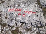 | ŽP Zrmanja - Poštak
Poštak (also "Kečina kosa") is a picturesque mountain at the crossroads of Lika and Dalmatia. It belongs to the Lika Plješivica mountain range as...
2 h 30 min |
 | Susalitch - Zajčnik
Zajčnik (also Blekova) is a 1746 m high peak located northeast of Voška. The partially vegetated peak, which borders between Slovenia and Austria...
3 h 35 min |
| Korpitch - Zajčnik
Zajčnik (also Blekova) is a 1746 m high peak located northeast of Voška. The partially vegetated peak, which borders between Slovenia and Austria...
3 h 35 min |
 | Planina Polog - Mrzli vrh above Planina Pretovč
Mrzli vrh is a well-known World War I battlefield. Today, the summit is known as an open-air museum, where you can see numerous caverns, trenches...
2 h 45 min |
 | Ukanc - Visoki Orlov rob (via Žagarjev graben)
Visoki Orlov rob is an 1800 m high peak located in the immediate vicinity of the upper station of the single-seater Šija. The summit, located sli...
3 h 45 min |
 | Dolenji Novaki - Medrce
Medrce is a 1410 m high peak located between Porezno and Hum. From the top, where the old bunker is located, we have a beautiful view of Kojca, P...
3 h 15 min |
| Poče - Medrce (winter way)
Medrce is a 1410 m high peak located between Porezno and Hum. From the top, where the old bunker is located, we have a beautiful view of Kojca, P...
2 h 40 min |
| Poče - Medrce (via Labinjske lehe)
Medrce is a 1410 m high peak located between Porezno and Hum. From the top, where the old bunker is located, we have a beautiful view of Kojca, P...
2 h 30 min |
 | Poče - Kopa (Cimprovka) (winter way)
Kopa is a 1360 m high peak or viewing pier from which we can enjoy a beautiful view of Cerkno, the hills surrounding the above-mentioned place, R...
2 h 25 min |
 | Podbrdo - Slatnik (southeastern peak)
Slatnik) is a scenic mountain that rises steeply above Baška Grapa on one side and descends more gently towards Soriška planina on the other side...
3 h 25 min |
| Podbrdo - Slatnik (southeastern peak) (via Lajnar)
Slatnik) is a scenic mountain that rises steeply above Baška Grapa on one side and descends more gently towards Soriška planina on the other side...
3 h |
 | Podrožca / Rosenbach - Kamnica (Komnica) / Ferlacher Spitze
Kamnica is a lookout mountain located on the Austrian side of Karawanks, more precisely north of Kepe. From the top, where there is a cross, a re...
3 h 55 min |
| Čemernica / Tschemernitzen - Kamnica (Komnica) / Ferlacher Spitze
Kamnica is a lookout mountain located on the Austrian side of Karawanks, more precisely north of Kepe. From the top, where there is a cross, a re...
3 h 40 min |
 | Bistriški jarek (border crossing Muta) - Kozji vrh (at Košenjak)
Kozji vrh is a 1383-metre-high peak located above Pernice, and its height makes it the highest peak in the municipality of Muta....
2 h 50 min |
 | Oberort - Messnerin
...
2 h 45 min |
| Oberort (parkirišče Zeleno jezero) - Messnerin (Kamplsteig)
...
3 h 30 min |
 | Zlatten - Hochanger
...
2 h 30 min |
 | Laufnitzgraben - Bei den drei Pfarren
...
2 h 30 min |
 | Pernegg an der Mur (železniška postaja) - Rennfeld
...
2 h 45 min |