Ljubelj - Šentanski vrh (Bornova pot)
Starting point: Ljubelj (1058 m)
| Lat/Lon: | 46,4306°N 14,261°E |
| |
Name of path: Bornova pot
Time of walking: 4 h 35 min
Difficulty: partly demanding unmarked way, partly demanding marked way
Altitude difference: 577 m
Altitude difference po putu: 840 m
Map: Karavanke 1:50.000 - osrednji del
Recommended equipment (summer): helmet, lamp
Recommended equipment (winter): helmet, ice axe, crampons, lamp
Views: 1.140
 | 1 person likes this post |
Access to the starting point:
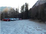
Drive to Border crossing Ljubelj, where you turn left before the tunnel towards Zelenica. Drive over the small bridge, then follow the parking lot down to the lower southern part of the parking lot, where you park.
Path description:
At the end of the parking lot we see the signs for mountain pasture Preval, which directs us to the Bornova trail. At first, the path ascends across a small scree slope, then it passes into the forest, where it crosses the steep slopes to the left with a few short ascents and descents. The forest is soon replaced by steep rocky slopes, over which a wide and, in exposed places, sheltered path leads. With beautiful views of the mountains rising above Podljubelj, you will reach the Borna Tunnel, where the use of a torch is highly recommended for easier and safer progress. Somewhere in the middle of the tunnel there is a large window with a picturesque view of the surrounding area, and we proceed carefully through the other part of the tunnel. After leaving the tunnel, which also has a few large puddles after rain, there are a few minutes of exposed scrambling before we reach a large scree slope behind the "Mary's Resting Place" bench.
There is a slight downhill section of scree, and then the path gradually begins to climb cross-country. Initially, the path continues to climb over steep slopes, then first the slope is laid down, and higher up the path widens into cart track. Higher up, there is a crossing of a pasture fence, and then the path leads us out of the woods, and in a few 10 steps of further walking we climb up to Preval, where there is a marked crossroads.
From the crossroads, continue left (right Begunjščica) and walk to the shepherd's hut.
The hut, which offers a beautiful view that reaches all the way to Triglav, is bypassed on the left, and we continue in the direction of Dobrča. The marked trail towards Dobrča, which we continue on, passes an unnamed peak on the left, and when the trail returns to the ridge, we reach it at the saddle between Čisovec and the unnamed peak.
At this saddle, the marked trail to Dobrča turns right downhill (straight unmarked trail to Čisovec) and passes onto the western slopes of Čisovec, where the trail leads us across the sometimes quite steep slopes. There follows a longer crossing on a poorly maintained path, which is usually full of foliage and in several places somewhat damaged by erosion. In the following we cross a few more ravines, then the slope becomes less steep, but the path occasionally opens up some views towards Begunjščica, Stolu, Julian Alps, Gorenjska. . . A little further on, we reach the southern ridge of Čisovec, where the path starts to descend (here, a few steps off the path, we can see a stand of auricles, usually in April or May), and occasionally we get a view of the Kamniško Savinjske Alps. Lower down, the trail descends even more steeply, and then leads to the Vrh Luž preval, where we join the unmarked trail past Waterfall Tominčev slap on the left, and the trail from the Črnega potok on the right.
Continue straight ahead, mainly along the ridge, which is occasionally climbed. Later, a path leading over the Ice Lawn joins us from the right, and our route gradually turns slightly right off the ridge and onto the increasingly steep slopes of Dobrča. There follows a cross-climb over a steep slope, where extra care is needed in the wet, and then the path lays down and leads us over a grazing fence to cart track, after which we walk to the edge of Maria Elender Alm, where there is a marked crossroads.
Continue left towards the top of Dobrča (straight ahead Cottage on Dobrča 3 minutes), where the path takes you past a couple of cottages on Podgorska mountain pasture. After the huts, continue slightly to the left and climb over the viewpoint mountain pasture. Higher up, the initially less traceable path turns into forest, and we follow the markings carefully at the crossroads. A little higher up, the trail transitions and leads us past two crossroads, from both of which we continue straight on in the direction Dobrča. There is a short, slightly steeper section and the path leads to the top of Dobrča.
From the Dobrča peak, continue towards the Šentanski vrh lookout point, following the path which first descends to a small pass between the two peaks, and then climbs gently up to the Šentanski peak, a few minutes away from the lookout point.
Ljubelj - Prevala 1:30, Prevala - Hut on Dobrča 2:30, Hut on Dobrča - Dobrča 30 minutes, Dobrča - Šentanski vrh 5 minutes.
Description and pictures refer to the situation in 2017 (January, April).

Pictures:
 1
1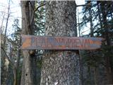 2
2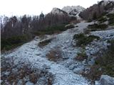 3
3 4
4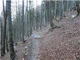 5
5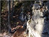 6
6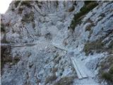 7
7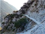 8
8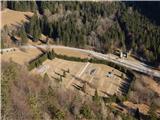 9
9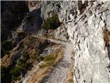 10
10 11
11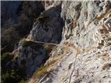 12
12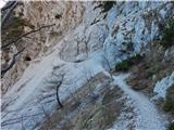 13
13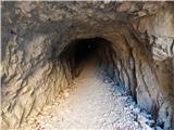 14
14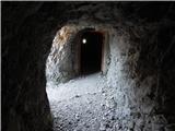 15
15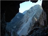 16
16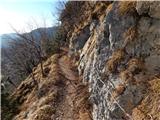 17
17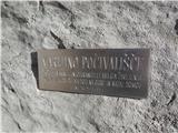 18
18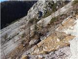 19
19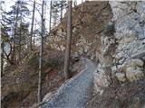 20
20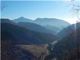 21
21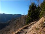 22
22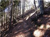 23
23 24
24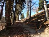 25
25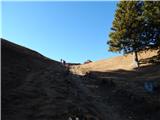 26
26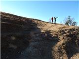 27
27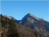 28
28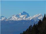 29
29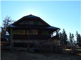 30
30 31
31 32
32 33
33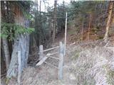 34
34 35
35 36
36 37
37 38
38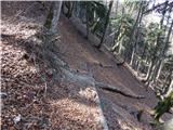 39
39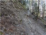 40
40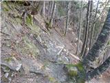 41
41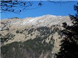 42
42 43
43 44
44 45
45 46
46 47
47 48
48 49
49 50
50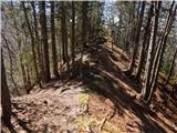 51
51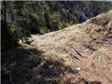 52
52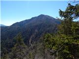 53
53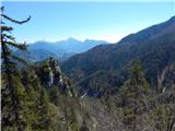 54
54 55
55 56
56 57
57 58
58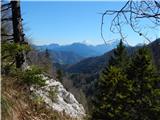 59
59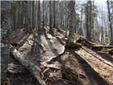 60
60 61
61 62
62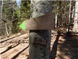 63
63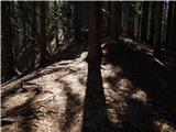 64
64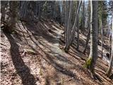 65
65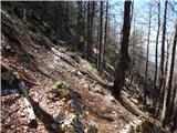 66
66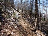 67
67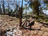 68
68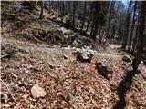 69
69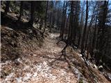 70
70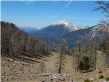 71
71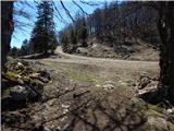 72
72 73
73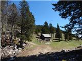 74
74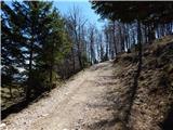 75
75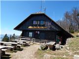 76
76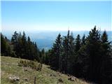 77
77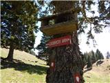 78
78 79
79 80
80 81
81 82
82 83
83 84
84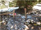 85
85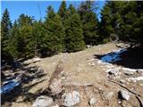 86
86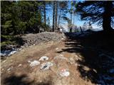 87
87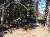 88
88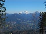 89
89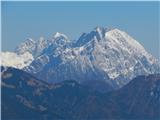 90
90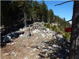 91
91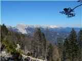 92
92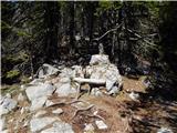 93
93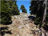 94
94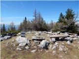 95
95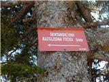 96
96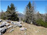 97
97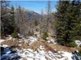 98
98 99
99 100
100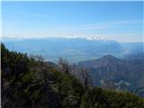 101
101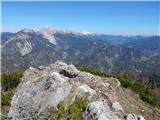 102
102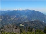 103
103
Discussion about the trail Ljubelj - Šentanski vrh (Bornova pot)
|
| jpresern2. 06. 2017 |
Na sliki 102 zadaj ni Begunjščica, ampak greben Košute.
|
|
|
|
| Tadej2. 06. 2017 |
Hvala za opozorilo, sem popravil.
|
|
|