Jochalm - Reißkofel (235-1)
Starting point: Jochalm (1496 m)
| Lat/Lon: | 46,67205°N 13,15819°E |
| |
Name of path: 235-1
Time of walking: 3 h
Difficulty: difficult marked way
Altitude difference: 875 m
Altitude difference po putu: 900 m
Map:
Recommended equipment (summer): helmet
Recommended equipment (winter):
Views: 939
 | 1 person likes this post |
Access to the starting point:
Drive to the village of Reisach in Austria, either from Villach via Hermagor or from Lienz.
In the village where a road crosses a stream, turn right (if you are driving from Villach) and follow the signs for Reißkofelbad. After Reißkofelbad follow the signs for Jochalm.
You will continue on a dusty road and then soon turn right. At this point the road was damaged (as of for 2018) but still open for traffic.
After this section the road is in good condition. From this point on, always follow the road that is better and wider than the alternative (i.e. four times left and after that right).
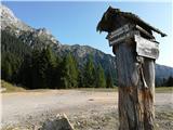
Park at the sharp right turn just above the tree line. The parking is about 50 meters below the Jochalm mountain pasture where a road (closed for traffic) branches off in direction to a Gregorihütte (see a photo).
Path description:
At parking place begin your hike along the road closed for traffic (a boom gate) that is leading west. Follow the road, pass a Gregorihütte and continue walking on the road a few sections uphill, until a footpath branches off to the left.
The path leads straight into the forest. A path is steep, therefore a bench is a welcoming sight. Once above the tree line, the path eventually descends a little until it reaches a point under the steep stone mountain wall. There are two option to continue. A path going left is steeper and shorter, while a right path is a longer one that will take you on the ridge. Turn left.
At first the path crosses grassy slopes, but after that it will lead you to the rocky terrain. Here, the steepest part of the path continues. With the help of steel rope you will gain altitude fast while ascending a gully.
After that, a ridge gets into the sight. A steep path ascends to the ridge. Due to an erosive terrain, be careful of loose / falling rocks. Helmet is strongly advised here.
On the ridge continue left / west. Follow the ridge, that also descends in some sections. The path than crosses the northern slopes of Reißkofel and circles below summit and arrives to the summit from the west. Just below the summit, a very difficult path from the bivouac will also merge here.
The path over the ridge is crumbly, therefore exercise your steps with caution.
A summit cross, a summit book and a stamp will await you on the summit (for "Vrhovi Prijateljstva / Gipfel der Freundschaft / Cime dell' Amicizia" hikers passport).
You can return by different route via the ridge to the east and then double back to the same path at the crossroads under the ridge where the shorter and longer path join again.

Pictures:
 1
1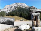 2
2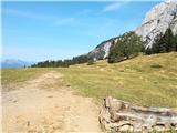 3
3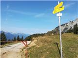 4
4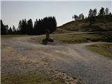 5
5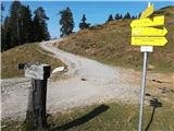 6
6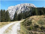 7
7 8
8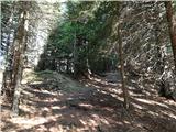 9
9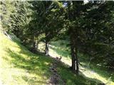 10
10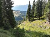 11
11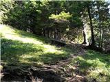 12
12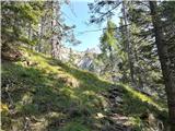 13
13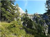 14
14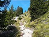 15
15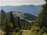 16
16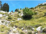 17
17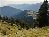 18
18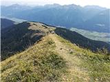 19
19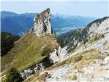 20
20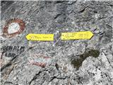 21
21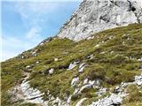 22
22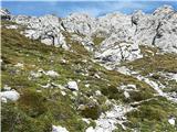 23
23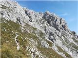 24
24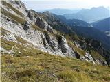 25
25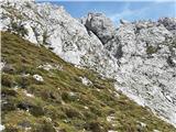 26
26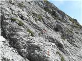 27
27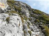 28
28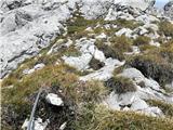 29
29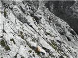 30
30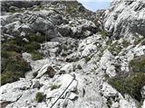 31
31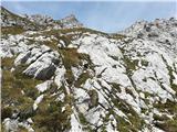 32
32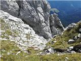 33
33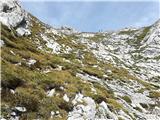 34
34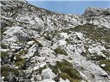 35
35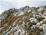 36
36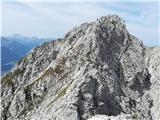 37
37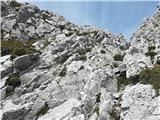 38
38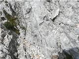 39
39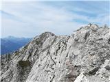 40
40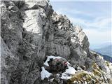 41
41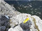 42
42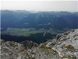 43
43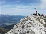 44
44 45
45 46
46 47
47
Discussion about the trail Jochalm - Reißkofel (235-1)