Vrbovska Poljana - Bjelolasica (via Žuta Poljana)
Starting point: Vrbovska Poljana (1120 m)
Name of path: via Žuta Poljana
Time of walking: 1 h 30 min
Difficulty: easy marked way
Altitude difference: 414 m
Altitude difference po putu: 480 m
Map:
Recommended equipment (summer):
Recommended equipment (winter): ice axe, crampons
Views: 6.615
 | 1 person likes this post |
Access to the starting point:
Cross the Petrina border crossing and drive to Delnice, where you reach the old Zagreb-Rijeka road. Continue to the right and follow the road towards Mrkopalj. In Mrkopalj, the sign for Begovo - Razdolje (the highest settlement in Croatia) directs you to the right on the ascending road, which soon leads to the village. At the end of the village, you will come to a small crossroads, where you continue along the right-hand road, which soon becomes a macadam road. After a few kilometres, this road leads to the next crossroads, where you turn left in the direction of Bjelolasica (Janjčarica on the right). Continue past the quarry, behind which you will soon see the KPP mountain signs, which direct you upwards to the left. Here we park in a small parking lot by the road.
Path description:
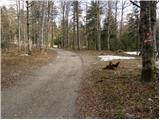
From the parking lot, turn left onto the footpath, which after a moderate climb of just over 10 minutes leads to a worse macadam road, where there is a crossroads. Continue left along the road in the direction of Žuta Poljane (straight ahead Bjelolasica direct path). After a few tens of metres, the minor road turns into a wide cart track road, which starts to descend. As the path flattens out, an unmarked, fainter cart track branches off to the right, slightly uphill, along which you soon see rather faded markings. Cart track then climbs a little more and after a few minutes turns into a steep footpath. The steep path soon leads to an initially indistinct ridge, which is followed along a barely visible path with faded markings. Despite the poor visibility of the path, there are no major problems with orientation, as the path follows the ridge, which is quite wide in places. Eventually, the path leads us to less vegetated slopes, from which we can enjoy increasingly beautiful views. The ridge then gradually narrows and the path quickly leads to the top of Bjelolasica.

Pictures:
 1
1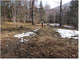 2
2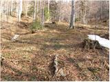 3
3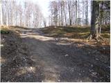 4
4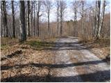 5
5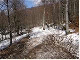 6
6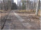 7
7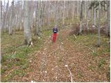 8
8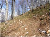 9
9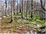 10
10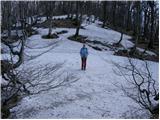 11
11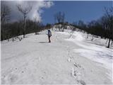 12
12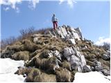 13
13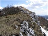 14
14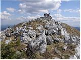 15
15
Discussion about the trail Vrbovska Poljana - Bjelolasica (via Žuta Poljana)