Starting point: Platak (1111 m)
| Lat/Lon: | 45,4251°N 14,5653°E |
| |
Time of walking: 3 h 30 min
Difficulty: easy marked way
Altitude difference: 417 m
Altitude difference po putu: 620 m
Map:
Recommended equipment (summer):
Recommended equipment (winter): ice axe, crampons
Views: 24.015
 | 4 people like this post |
Access to the starting point:
From the Zagreb - Rijeka motorway, take the Kikovica exit, which leads to the old Zagreb - Rijeka road. Follow the old road in the direction of Zagreb, but only as far as where the ascending road to the ski resort of Platak turns off to the left. Follow this road to a large parking lot, where you park.
Path description:
At the beginning of the parking lot, the road branches off to the right (in the route of the climb), which leads us after a 100m walk to the mountain home Sušak on Platku. At the home we see the mountain signs for Risnjak, which direct us to the left on the worse road. Soon the road leads to the place where it ends. Continue right along the marked cart track, which climbs gently through the forest and after 15 minutes of further walking leads us to the next road, where we continue to the left. This road also soon ends and the climb continues in the route of Risnjak. The wide path continues and leads us higher to the next road, where we continue to the right and then immediately to the left on the wide path towards Risnjak. It is an hour's walk along cart track, which ascends and descends several times. After an hour and a half walk from Platko, you reach the first major fork in the trail, where you continue straight up again in the route of Risnjak. The path ahead starts to climb steeply up the forested slopes of the Risnjak Nature Park. After a half-hour climb, the path descends gently and soon leads to a crossroads, where you continue straight on in the route of 'Risnjak dom'. The way forward continues to descend for some time and then, with a few short ascents and descents, leads us to the next crossroads, where we continue in the route of home. This is followed by only 15 minutes of moderate ascent and the path leads us to home.
From home, continue along the dwarf pines path in the route of Risnjak. The path, which climbs quite steeply, leads us in a few minutes with the help of two jeklenice to a scenic peak.

Pictures:
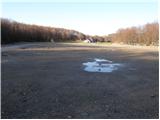 1
1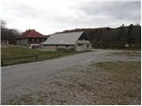 2
2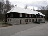 3
3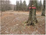 4
4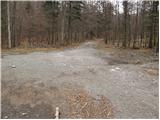 5
5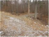 6
6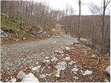 7
7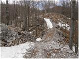 8
8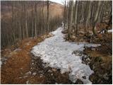 9
9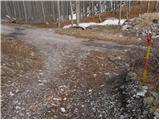 10
10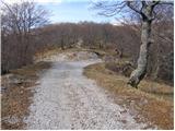 11
11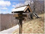 12
12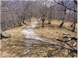 13
13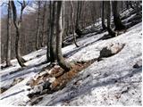 14
14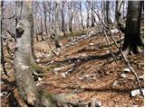 15
15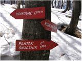 16
16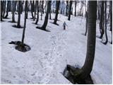 17
17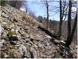 18
18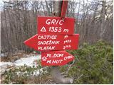 19
19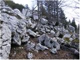 20
20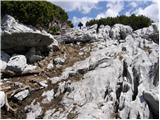 21
21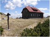 22
22 23
23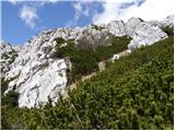 24
24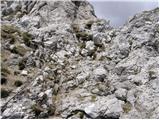 25
25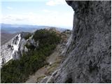 26
26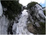 27
27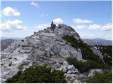 28
28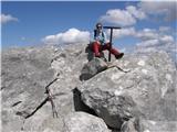 29
29
Discussion about the trail Platak - Veliki Risnjak
|
| kofram27. 02. 2013 |
Ali kdo ve če je koča na Risnjaku odprta ob nedeljah? Hvala za informacijo
|
|
|
|
| mishka1. 03. 2013 |
Dom na Risnjaku zatvoren je do 01.05.
|
|
|
|
| CarpeDiem24714. 07. 2016 |
Včeraj opravljen ta pohod in sicer iz smeri Platak-a. Za vzpodbudo vam lahko povem, da 3h in pol dobesedno nimate kaj počet, realno se lahko odšteje (vsaj) urco od tega časa 
|
|
|
|
| Grive6. 07. 2019 |
Prehodili konec junija. Na poti nismo nobenega planinca niti divje živali. Srečali smo jih (planince šele pri koči, ko so prihajali iz smeri Vilj. V koči ni ponudbe. Pot je čudovita, se večkrat spušča in vzpenja, poteka pa vedno po gozdovih, razen zadnjih dvajset minut od koče do vrha v ruševju. Dodal bi k sedanjemu opisu da je potrebno biti pozoren pri sliki 7, da se tam zavije desno (v smeri nazdol) čez cca 20 metrov pa takoj navzgor. V poletnem času zaradi zaraščenosti ni tako jasno videti to prečenje makadamske poti, k sreči smo imeli s seboj karto. Lahko pa tudi nadaljujemo po makadamski poti do razcepa Cigoje (slika 11), vendar brez karte ne gre ker ni oznak.
|
|
|
|
| Grive6. 07. 2019 |
Popravljam: ne Cigoje ampak Cajtige.
|
|
|