Landro - Monte Piano (Via Ferrata Bilgeri)
Starting point: Landro (1406 m)
| Lat/Lon: | 46,64035°N 12,23197°E |
| |
Name of path: Via Ferrata Bilgeri
Time of walking: 3 h
Difficulty: very difficult marked way
Altitude difference: 899 m
Altitude difference po putu: 910 m
Map: Tabacco 10 1:25.000
Recommended equipment (summer): helmet, self belay set
Recommended equipment (winter): helmet, self belay set, ice axe, crampons
Views: 2.138
 | 2 people like this post |
Access to the starting point:
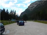
Via Border crossing Rateče, take the road to Trbiž / Tarvisio, where you take the motorway towards Udine. Leave the motorway at the exit for Tolmezzo and follow the road to the above-mentioned place. From Tolmezzo, continue in the direction of Ampezzo and the Passo della Mauria mountain pass. The road then begins to descend and leads into the Cadore valley, where you continue to the right (Belluno and Cortina d'Ampezzo on the left) in the direction of Auronzo. After a few more kilometres, you reach the next major crossroads, where you turn right towards Misurina (left Tre Croci Pass). From here you follow the road down to a major crossroads, where you turn right towards Toblach / Dobbiaco (left Cortina). From the crossroads continue past Lago di Landro / Dürrensee. From the lake, follow the main road for about a kilometre and then turn right into a large gravel parking area.
Path description:
From the parking lot, head east on the dirt road (route 102), following the signs "Monte Piano". After a few dozen metres, you will reach a crossroads where you continue straight ahead on the dirt road. Here, the path opens up to a fine view of the Cristallo mountain group and the nearby Monte Piano.
As we get a little closer to the slopes of Monte Piano, we are at the crossroads again. The path leads straight ahead towards the Locatelli hut, and we continue to the right on path No 6 after the "Monte Piano" signs. From the crossroads, follow the dirt road and soon reach a crossroads where the path from Lago di Landro joins from the right.
At the crossroads, continue straight ahead and you will soon come close to a stream where the road ends. Here the path crosses the stream via a wooden bridge and soon leads to another crossroads. This time continue on the upper left path.
We then climb for a long time in the keys along an old military trail, from which we have a view of the Valle di Landro with Lago di Landro and the Cristallo mountain group. The path here passes mainly through dwarf pines and a sparse larch forest, but occasionally crosses a slightly steeper slope. The path runs gently south-eastwards throughout and leads us higher up to slightly steeper slopes where we are helped by a few steel cables. Then climb again through dwarf pines, which leads us to a lookout point at which crosses are erected in memory of fallen soldiers.
Further on, the dwarf pines becomes less frequent and the path soon leads to a marked crossroads.
Straight ahead is an easier path to Monte Piano, which we will descend later. At the crossroads we turn left towards the protected climbing route.
At the very beginning, the protected route climbs vertically for a short while, then becomes slightly less difficult and climbs up the otherwise very steep slope in switchbacks. Once you reach the bench, which is located on a precipitous ledge, the route becomes slightly more difficult again. It climbs steeply along a steel track a couple of times and then follows a steep gully. Once out of the ravine, the relatively short protected path soon ends. The increasingly scenic route then turns slightly to the left and leads to a ridge on the north side of the mountain. Here, continue right and after a short climb along the ridge, you will soon reach the summit.
Descend along the easier path, which runs along the eastern side of the mountain in the upper part. Follow the signs for Val di Landro.

Pictures:
 1
1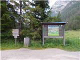 2
2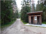 3
3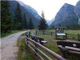 4
4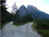 5
5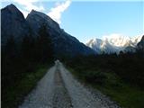 6
6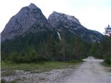 7
7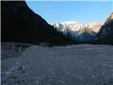 8
8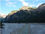 9
9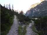 10
10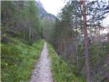 11
11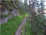 12
12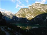 13
13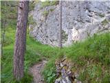 14
14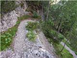 15
15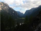 16
16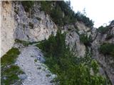 17
17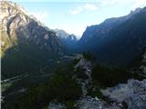 18
18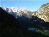 19
19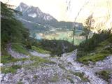 20
20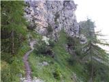 21
21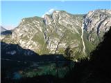 22
22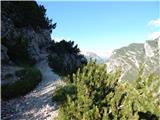 23
23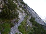 24
24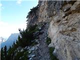 25
25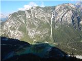 26
26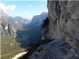 27
27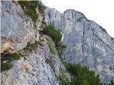 28
28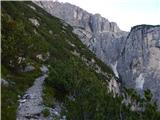 29
29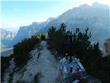 30
30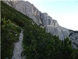 31
31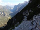 32
32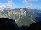 33
33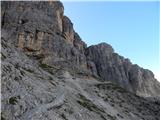 34
34 35
35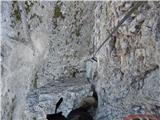 36
36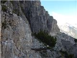 37
37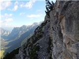 38
38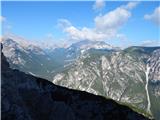 39
39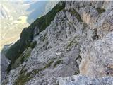 40
40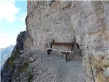 41
41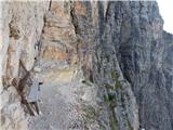 42
42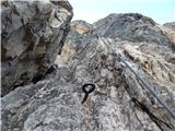 43
43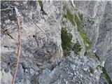 44
44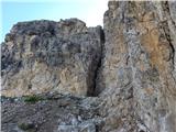 45
45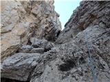 46
46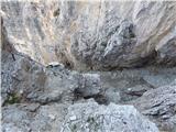 47
47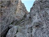 48
48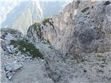 49
49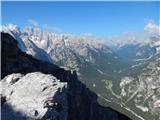 50
50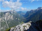 51
51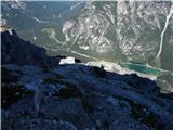 52
52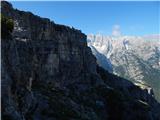 53
53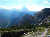 54
54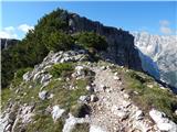 55
55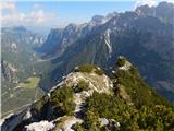 56
56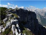 57
57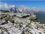 58
58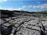 59
59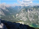 60
60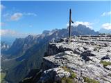 61
61
Discussion about the trail Landro - Monte Piano (Via Ferrata Bilgeri)