Rifugio Primula - Forcella Marmarole
Starting point: Rifugio Primula (1104 m)
| Lat/Lon: | 46,54251°N 12,37382°E |
| |
Time of walking: 5 h
Difficulty: very difficult marked way
Altitude difference: 1557 m
Altitude difference po putu: 1570 m
Map: Tabacco 16 1:25.000
Recommended equipment (summer): helmet, self belay set
Recommended equipment (winter): helmet, self belay set, ice axe, crampons
Views: 847
 | 1 person likes this post |
Access to the starting point:
Access from Gorenjska: Take the Border crossing Rateče road to Trbiž / Tarvisio, where you take the motorway towards Udine. Leave the motorway at the exit for Tolmezzo and follow the road to the above-mentioned place. From Tolmezzo, continue in the direction of Ampezzo and the Passo della Mauria mountain pass. The road then begins to descend and leads into the Cadore valley, where you continue to the right (Belluno and Cortina d'Ampezzo on the left) in the direction of Auronzo. Towards the end of Auronzo di Cadore, turn slightly left down a narrow road towards Val da Rin. The road then turns left and crosses a bridge over the Ansiei River. Follow the narrow ascending road to the Rifugio Primula Di Pais hut. From the hut continue along the road for about 200 metres to a junction with a dirt road. Turn left onto the dirt road and park in the small parking area at the beginning of the dirt road.
From the Primorska side: Take the motorway towards Venice/Venezia. At Portogruaro, leave the motorway towards Venice and turn right on the motorway towards Pordenone. At the next motorway junction near Conegliano, turn right towards Belluno. Near Belluno the motorway ends and we continue towards Cortina d'Ampezzo and Auronzo. Towards the end of Auronzo di Cadore, turn slightly left down a narrow road towards Val da Rin. The road then turns left and crosses a bridge over the river Ansiei. Follow the narrow ascending road to the Rifugio Primula Di Pais hut. From the hut continue along the road for about 200 metres to a junction with a dirt road. Turn left onto the dirt road and park in the small parking area at the beginning of the dirt road.
Path description:
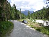
From the starting point, continue along the macadam road, where you will also be directed by the signposts at the beginning of the road. The road quickly turns left, crosses a stream and leads to a crossroads.
Route 273 leads to the left towards the Rifugio Ciareido hut, and we continue to the right along route 270. We walk through the woods for a short distance and then the road leads us to a wide torrent bed. Continue along the torrent bed for a few metres and then a signpost points to the right to cart track, which is on the other side of the torrent bed. Cart track begins to climb gently through the forest and passes above the stream for a short distance. Cart track then turns to the left and continues southwards, climbing gently. When approaching the torrent bed again, cart track becomes a track. The path then continues for some time along the right-hand edge of the torrent bed where the track is not visible. The orientation is aided by the markings and the numerous cairns. Soon the markings direct us to the left and there is a short climb through dwarf pines and a sparse forest on the left side of the torrent bed. The path then crosses the stream again to the right and leads into the forest.
The path then climbs slightly steeper for a long time through the forest. Higher up, the path turns slightly to the left and the forest slowly becomes dwarf pines. A relatively narrow path then leads to a crossroads.
To the left, the path leads towards the Fanton bivouac, and we continue to the right towards the Forcella Marmarole notch, where we are directed by the inscription on the rock. From the crossroads, we climb for some time through dwarf pines, and the path becomes less and less well beaten and soon disappears completely. As there is no trail for the most part further up the slope, we have to pay a little more attention to the markings and the little men who are directing us up the slope. Here, we follow the edge of dwarf pines up the slope. The path runs parallel to the bed of the torrent, which is on our right. The Dwarf pines then ends, and we continue for some time climbing up the grassy slope on the left side of the torrent bed. At a higher level, we cross a small section of the stream to the right and then climb up the increasingly steep slope again. When you reach the foot of the cliff, continue to the right and cross the steep slope. From the grassy slope to the rocky slope, the ascent becomes more difficult. The path here turns left steeply uphill and climbs a short gully. The slope here is very steep but there are many steps and steel cables in the narrow gully so the climbing is not too difficult. After a short steep climb the slope then becomes slightly less steep. The path then climbs up the slope slightly to the right and leads to a stream.
There is a short climb along the stream to the spring, then the path turns slightly to the right and continues up the valley below the precipitous walls of the surrounding mountains. A little higher up, the slope becomes steeper and the markings point sharply to the left.
The ascent becomes more difficult again. First we climb crosswise on a slightly exposed ledge and then the path leads us to the glaciers. Here the path climbs very steeply right up and then there is a short exposed crossing to the right. The challenging part of the route, which is protected by a steel cable, is relatively short and then again follows a climb up a slope which is slightly less steep. Although the climb is not technically too difficult, you have to pay close attention to the markings, as the track is mostly invisible. In fog, orientation can be very difficult.
The trail then climbs up the left side of the valley, and a little later turns to the right and then climbs along an undistinguished ridge that runs down the centre of the valley. Here the path becomes occasionally slightly more visible again. The path, which becomes more and more scenic, soon reaches the Forcella Marmarole.
The best way to descend is along the ascent route. If you are not tied to transport, you can also continue over the Forcella Froppa notch and then descend on routes 260 and 280 to the south side. The part of the route towards the Forcella Froppa notch where you cross a steep scree slope that is not trodden can be quite dangerous for slipping. The descent to the south side via the ravine directly from the Forcella Marmarole notch is also challenging.
The path described is lonely and poorly trodden. Even in peak season, it is very likely that you will not meet anyone on the trail. The whole Marmarole mountain group is well known for having no high mountain roads or cable cars. And there are no marked trails to most of the hard-to-reach peaks. The accesses from the north side also have no mountain huts, only bivouacs. A new modern bivouac is also planned on the Forcella Marmarole.

Pictures:
 1
1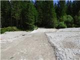 2
2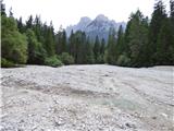 3
3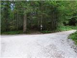 4
4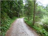 5
5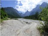 6
6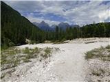 7
7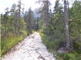 8
8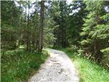 9
9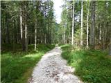 10
10 11
11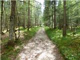 12
12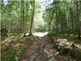 13
13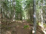 14
14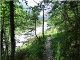 15
15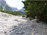 16
16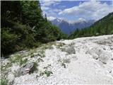 17
17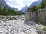 18
18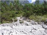 19
19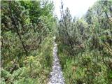 20
20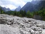 21
21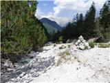 22
22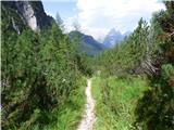 23
23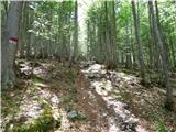 24
24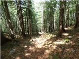 25
25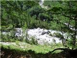 26
26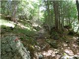 27
27 28
28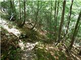 29
29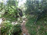 30
30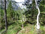 31
31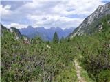 32
32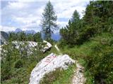 33
33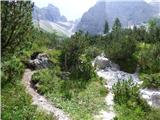 34
34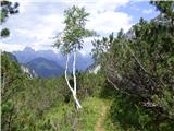 35
35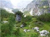 36
36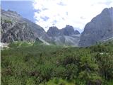 37
37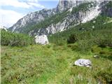 38
38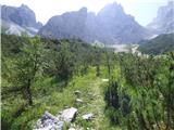 39
39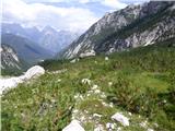 40
40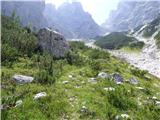 41
41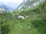 42
42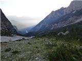 43
43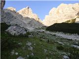 44
44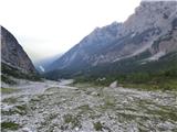 45
45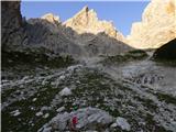 46
46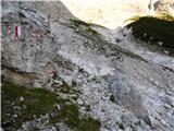 47
47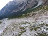 48
48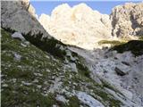 49
49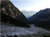 50
50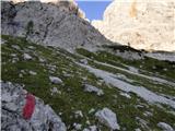 51
51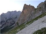 52
52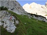 53
53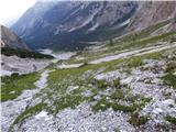 54
54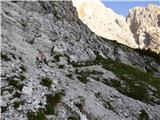 55
55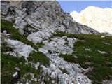 56
56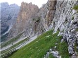 57
57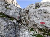 58
58 59
59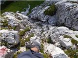 60
60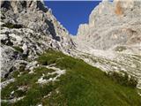 61
61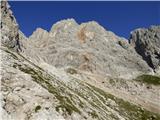 62
62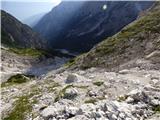 63
63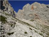 64
64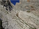 65
65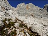 66
66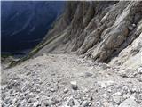 67
67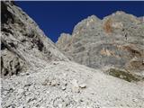 68
68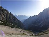 69
69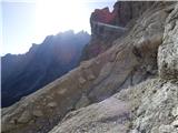 70
70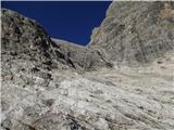 71
71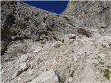 72
72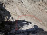 73
73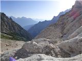 74
74 75
75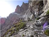 76
76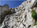 77
77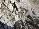 78
78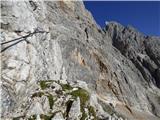 79
79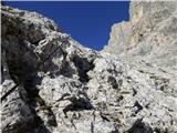 80
80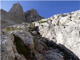 81
81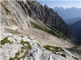 82
82 83
83 84
84 85
85 86
86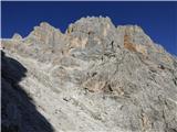 87
87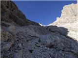 88
88 89
89 90
90 91
91 92
92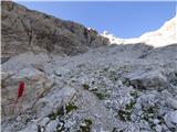 93
93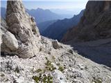 94
94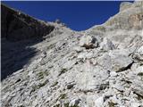 95
95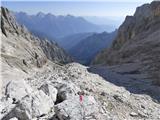 96
96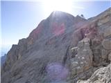 97
97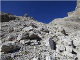 98
98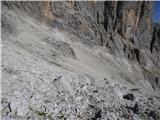 99
99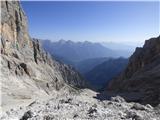 100
100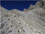 101
101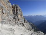 102
102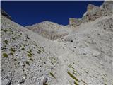 103
103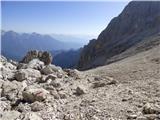 104
104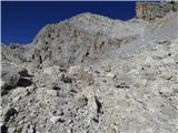 105
105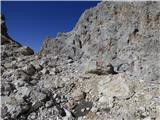 106
106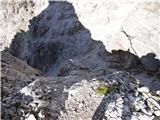 107
107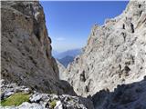 108
108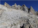 109
109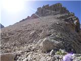 110
110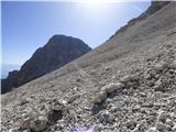 111
111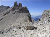 112
112
Discussion about the trail Rifugio Primula - Forcella Marmarole