Passo Campolongo - Ütia Franz Kostner
Starting point: Passo Campolongo (1860 m)
| Lat/Lon: | 46,5193°N 11,87393°E |
| |
Time of walking: 2 h 10 min
Difficulty: easy marked way
Altitude difference: 640 m
Altitude difference po putu: 660 m
Map:
Recommended equipment (summer):
Recommended equipment (winter):
Views: 992
 | 2 people like this post |
Access to the starting point:
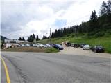
Drive through the Karavanke Tunnel into Austria, then continue to Spittal and on to Lienz (the motorway ends a little after Spittal). We continue along a relatively nice and wide road through the Drava Valley, which leads us into Itali. The road continues past Dobbiaco/Toblach and Brunico/Bruneck. Just after the last-mentioned town, which is passed by a bypass road, we turn left into the Val Badia valley. Continue along the valley past La Vila and Corvara. Then climb up to the Passo Campolongo. A few hundred metres before the pass, you will see a gravel parking area on your left. The parking lot is located behind the Hotel Laguscei, opposite the bus stop. The lower station of the chairlift is also along the road. There is also a smaller parking lot on the right hand side of the road in front of the bus station.
Path description:
From the parking lot, continue along the main road (south) to the Hotel Boe, which is on the right west side of the road. At the hotel, where there are also signs, turn right onto the dirt road after the signs "Rifugio Lago Boe". After the hotel, the road turns right and descends a little, then starts to climb and crosses the ski slope. The road then climbs briefly through the woods and then leads to mountain pasture Malga Plan Fisti
Continue on the road via mountain pasture and just after mountain pasture you will come to a marked crossroads where a footpath branches off to the left towards the Kaiser Hütte hut. We continue to the right and continue to climb up the road. After a short climb, the 638A trail then branches off to the right towards the summit of Crep de Munt. We continue left along the road, which offers beautiful views towards the Marmolada and the mountains above the Val Badia valley. The road climbs a little steeper here and leads us back to the ski slopes. A little higher up, the road turns to the right and continues to climb along the mostly grassy slopes. The road then becomes flatter and soon leads to the Rifugio Lago Boe hut. The hut is also reached by a circular cable car from Corvara in Val Badia. Near the hut, there is also the lower station of the chairlift leading to the Vallon peak (2530m). Both lifts are also in operation during the summer months.
Near the hut where there is a crossroads, continue left along the ski slope to the signs for Lech de Boe lake and Ütia Franz Kostner hut. The trail follows the right edge of the ski slope and after a short climb leads to the aforementioned lake, which is located to the right of the ski slope under a rocky ridge.
From the lake, continue along route 638, which turns left and crosses the ski resort. The trail then runs slightly to the left of the ski slope on partly grassy terrain. The path soon leads to a marked crossroads where path 636 branches off to the left towards the Kaiser Hütte (Rifugio Bec de Roces). We continue on the path as it climbs the slope parallel to the ski slope and soon path 646A branches off to the right towards the summit of Boeseekofel (Piz da Lech). We continue along the path to the left of the ski slope and slowly beautiful views begin to open up towards the Ütia Franz Kostner hut and the precipitous cliffs of the nearby peaks in the Sella mountain group. The slope becomes a little more gentle and the path leads to a marked crossroads.
A path branches off to the right towards the top station of the Vallon cable car and on to the top of Boeseekofel (Piz da Lech), and we continue left along the 638 towards the Ütia Franz Kostner hut. The wide and scenic trail runs westwards and quickly leads to another crossroads. This time, the path to the right branches off towards the Piz Boe peak and the Passo Pordoi pass, and we continue left along the wide path, which soon leads us to the Ütia Franz Kostner hut.

Pictures:
 1
1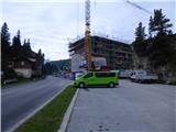 2
2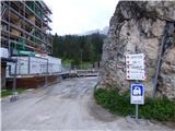 3
3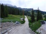 4
4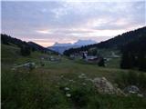 5
5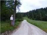 6
6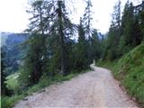 7
7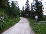 8
8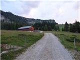 9
9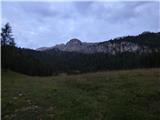 10
10 11
11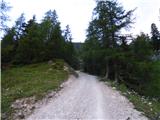 12
12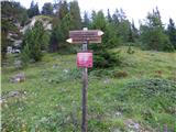 13
13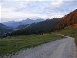 14
14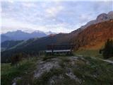 15
15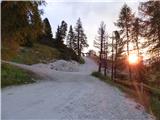 16
16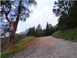 17
17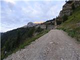 18
18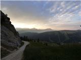 19
19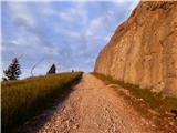 20
20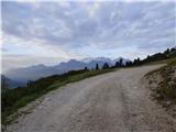 21
21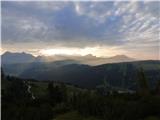 22
22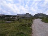 23
23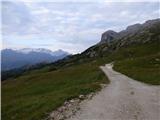 24
24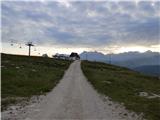 25
25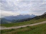 26
26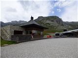 27
27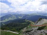 28
28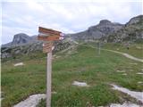 29
29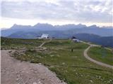 30
30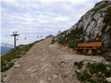 31
31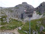 32
32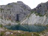 33
33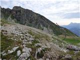 34
34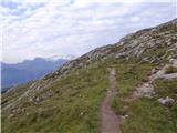 35
35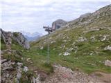 36
36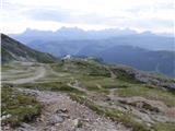 37
37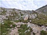 38
38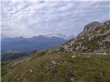 39
39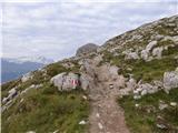 40
40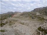 41
41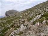 42
42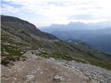 43
43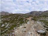 44
44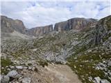 45
45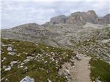 46
46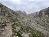 47
47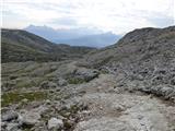 48
48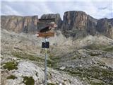 49
49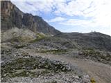 50
50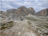 51
51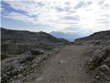 52
52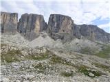 53
53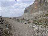 54
54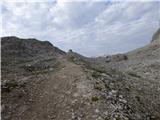 55
55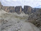 56
56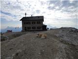 57
57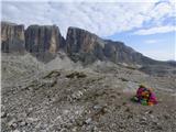 58
58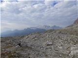 59
59 60
60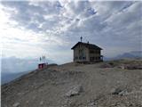 61
61
Discussion about the trail Passo Campolongo - Ütia Franz Kostner
|
| Savinja1127. 07. 2023 12:19:18 |
23. 7. 2023 sva bila ne tej poti. Nasproti hotela Monte Cherz na prelazu Campolongo (1875 m), ki povezuje Corvaro in Arabbo, vodi navkreber označena pot (makadamska cesta) proti koči Bec de Roces. Od tam sva nadaljevala po prav tako označeni in dobro uhojeni poti proti družinsko vodeni koči Franz Kostner (2500 m). Koča ponuja krasne razglede, domačo hrano in možnost dostopa s sedežnico tudi za zelo starejše in zelo mlade. Vračala sva se po tukaj opisani poti mimo jezera Boe. Pot je lahka, označena, orientacija jasna in enostavna, planinski izlet nas ne utrudi preveč in lahko mirno uživamo v lepem gorskem okolju. Primerna je za vse starostne skupine. Od koče do vrha Piz Boe je dve uri. Navpične stene tritisočakov okoli koče pa nudijo plezanje tudi zahtevnejšemu delu udeležencev v gorah. Za otroke je ob kočah dosti igral (razen pri Kostner jih seveda ni), razglednih ploščadi s slikami in označenimi gorami, ki jih vidimo naokoli, razlagami nastanka Dolomitov, zemljevidi ter drugimi informacijami, ki dopolnijo lepo in za zdravje koristno preživet dan.
|
|
|