Dom na Osankarici - Klopni vrh (eastern path)
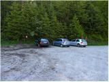
Starting point: Dom na Osankarici (1193 m)
| Lat/Lon: | 46,449°N 15,4196°E |
| |
Name of path: eastern path
Time of walking: 2 h 45 min
Difficulty: easy marked way
Altitude difference: 147 m
Altitude difference po putu: 350 m
Map: Pohorje 1:50.000
Recommended equipment (summer):
Recommended equipment (winter):
Views: 7.826
 | 1 person likes this post |
Access to the starting point:
a) From the Ljubljana - Maribor motorway, take the Slovenske Konjice exit and follow the road to the above-mentioned place. At Slovenske Konjice turn right towards Oplotnica, which is a few kilometres away on a winding road. At Oplotnica, where you join the road from Slovenska Bistrica, turn left towards Osankarica. Continue along the Oplotnica stream for some time, then reach a crossroads where the road splits into two. Here you can continue left towards Osankarica, or right towards the village of Kebelj. If you continue on the left road, it soon turns into a macadam road, and higher up it leads to a slightly larger crossroads, where you continue to the right in the direction of Osankarica (left Rogla). From the crossroads, there are a few more serpentines and the macadam road leads to a parking lot under Dom na Osankarici (from the fork in the road, it is about 9 km to the starting point). If you continue on the right road, you can reach Dom na Osankarici by a slightly longer, but still asphalted, road. All junctions are well marked.
b) From the motorway Maribor - Ljubljana, take the exit Slovenska Bistrica - South, then continue to Oplotnica. At Oplotnica, where you see signs for Osankarica, continue straight ahead, then climb for a while along the Oplotnica stream, where after a short climb you reach a point where the road splits into two parts. Here you can continue left towards Osankarica, or right towards the village of Kebelj. If you continue on the left road, it soon turns into a macadam road, and higher up it leads to a slightly larger crossroads, where you continue to the right in the direction of Osankarica (left Rogla). From the crossroads, there are a few more serpentines and the macadam road leads to a parking lot under Dom na Osankarici (from the fork in the road, it is about 9 km to the starting point). If you continue on the right road, you can reach Dom na Osankarici by a slightly longer, but still asphalted, road. All junctions are well marked.
c) Drive to Ruše (to get here from Maribor or Selnica ob Dravi) and then continue to Smolnik and higher up to Šumik. At the junction where the road to Koča na Šumiku turns right, continue straight ahead. There is a sharp left turn near which is the trailhead for the Šumik waterfall, and we arrive just a little further on at the next crossroads, where we continue to the right in the direction of Osankarica. A few kilometres of macadam road follow and you reach a parking area under the Dom na Osankarici.
Path description:
From the parking lot, walk first to Dom na Osankarici, and from there continue to the right in the direction of Pesek, Roga, Ribniška koča, the Partisan Home and the Pohorje Battalion Monument on Osankarica. The path goes immediately into the forest through which it begins to climb gently. During the ascent we cross a few small streams, through which we are led by a beautifully maintained path. Higher up, the path is laid, and then a short descent leads us to the Pohorje Battalion camp, where there are several memorials.
From the camp, where the marked path is somehow lost due to the numerous paths, continue slightly to the right, then at a nearby crossroads to the left in the direction of Treh nařebjev and Koča na Klopnem vrhu (slightly to the right Koča na Šumiku). From the crossroads onwards, the path descends for a short time along a pleasant forest path, and then we arrive at cart track, which is usually still quite muddy for a few more days after the rains have stopped. The cart track continues for a while, descending for a while and ascending for a while. After a while, the cart track changes transiently into a pleasant path again, which soon crosses a bubbling spring. The path then switches back to cart track, which is very muddy after rain and consequently impassable. A suitable crossing can be found a few metres away from cart track, where a partly beaten track has already been created. A little further on, the path is rejoined and leads through increasingly sparse forest.
At the part of the path where the forest thins out, we arrive at a marked crossroads, where we continue to the right in the direction of Klopnega vrha.
A few minutes of walking and a rather gently sloping path leads us to a macadam road where there is a small crossroads.
Continue straight across the road (left Falski rybnik for 3 minutes) and follow cart track, which starts to climb moderately. After a short climb, you reach an indistinct ridge, after which the path starts to descend. After a few minutes of descent, join the wider cart track and follow it to the left (to the right, Koča na Šumiku). Continue along and along the cart track for some time, and you will reach the NOB monument, after which you will soon reach a wider macadam road. Once on the road, continue straight ahead and then take the bottom right-hand road at the nearby crossroads. From the crossroads, it's just a few minutes of easy walking and the path leads you to the Klopni vrh hut.
From the hut, take a sharp left onto the marked footpath behind the Klopni vrh markers. After a short climb through the forest, you reach a macadam road (you can get here if you continue on the left road at the crossroads a few minutes before Koča na Klopnem vrhu), which you then walk along for a few 10 metres. When you see cart track on the right-hand side of the road and markings next to it pointing to the right, leave the road and continue your ascent along the above-mentioned cart track. Cart track then first crosses an overgrown clearing, then passes into a forest and turns into a winding footpath. Once in the woods, it is only a short walk to the top.

Pictures:
 1
1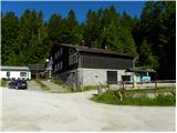 2
2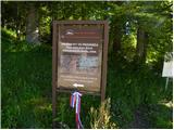 3
3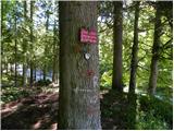 4
4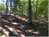 5
5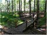 6
6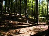 7
7 8
8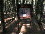 9
9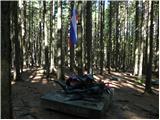 10
10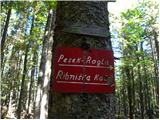 11
11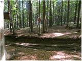 12
12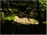 13
13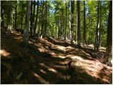 14
14 15
15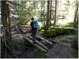 16
16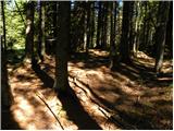 17
17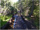 18
18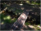 19
19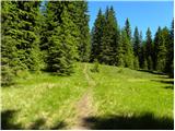 20
20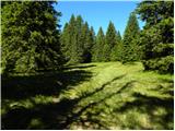 21
21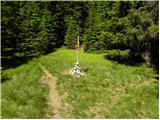 22
22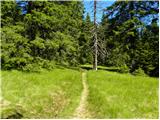 23
23 24
24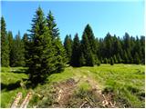 25
25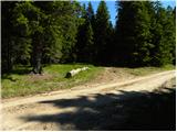 26
26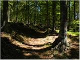 27
27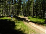 28
28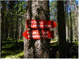 29
29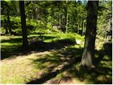 30
30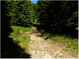 31
31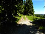 32
32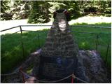 33
33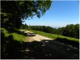 34
34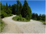 35
35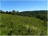 36
36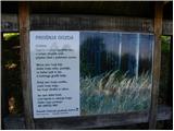 37
37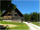 38
38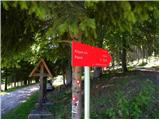 39
39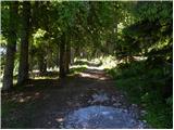 40
40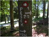 41
41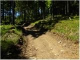 42
42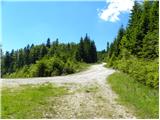 43
43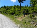 44
44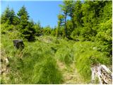 45
45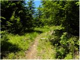 46
46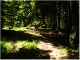 47
47 48
48
Discussion about the trail Dom na Osankarici - Klopni vrh (eastern path)
|
| Eva198810. 05. 2021 09:52:14 |
9.5.2021 prehojena ta pot...pot je slaba, veliko je bilo sečnje, vmes malo zmanjka markacij, ogromno vode(malo je še južnega snega), pred tihim jezerom podrt most...Koča na klopnem vrhu je zaprta, štempiljka je na vrhu na drevesu. Se mi zdi da je vse skupaj precej zapuščena pot...
|
|
|