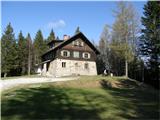
Koča na Šumiku - Koča na Klopnem vrhu
Starting point: Koča na Šumiku (1100 m)
| Lat/Lon: | 46,449°N 15,4196°E |
| |
Time of walking: 1 h 45 min
Difficulty: easy marked way
Altitude difference: 160 m
Altitude difference po putu: 235 m
Map: Pohorje 1:50.000
Recommended equipment (summer):
Recommended equipment (winter):
Views: 10.160
 | 1 person likes this post |
Access to the starting point:
a) From the Ljubljana - Maribor motorway, take the Slovenske Konjice exit and then follow the road to the above-mentioned place. At Slovenske Konjice turn right towards Oplotnica, which is a few kilometres away on a winding road. At Oplotnica, where you join the road from Slovenska Bistrica, turn left towards Osankarica. Continue along the Oplotnica stream for a while, then reach a crossroads where the road splits into two. Here you can continue left in the direction of Osankarica, or right in the direction of the village of Kebelj. If you continue on the left road, it soon turns into a macadam road, and higher up it leads to a slightly larger crossroads, where you continue to the right in the direction of Osankarica (left Rogla). From the crossroads, there are a few more serpentines, and the macadam road leads to a parking area under Dom na Osankarici, where there is a crossroads. Continue slightly left along the road, which initially continues northwards. The road then gradually starts to descend and we continue left at the junction after a few kilometres. Continue past the trailhead for the Šumik waterfall, where the road turns quite a bit to the right. At the junction after the bend, continue left, and then park just a little further on in a suitable space near the Šumik Cottage.
b) From the motorway Maribor - Ljubljana, take the exit Slovenska Bistrica - South, then continue towards Oplotnica. At Oplotnica, where you will see signs for Osankarica, continue straight ahead, then climb for some time along the Oplotnica stream, where after a short climb you will reach a point where the road splits into two parts. Here you can either continue left towards Osankarica, or right towards the village of Kebelj. If you continue on the left road, it soon turns into a macadam road, and higher up it leads to a slightly larger crossroads, where you continue to the right in the direction of Osankarica (left Rogla). From the crossroads, there are a few more serpentines, and the macadam road leads to a parking area under Dom na Osankarici, where there is a crossroads. Continue slightly left along the road, which initially continues northwards. The road then gradually starts to descend and we continue left at the junction after a few kilometres. Continue past the trailhead for the Šumik waterfall, where the road turns quite a bit to the right. At the junction after the bend, continue left, then park just a little further on in a suitable space near the Šumik Hut. c) Drive to Ruše (to get here from Maribor or Selnica ob Dravi) and then continue to Smolnik and higher up to Šumik. At the crossroads where the road to Koča na Šumiku turns right, turn right and then after a few 10 metres of further driving park in a suitable space near the Cottage on Šumik.
Path description:
From the starting point, follow the footpath in the direction of Osankarice and Koča na Klopnem vrh. After a few steps of ascent you reach a macadam road, which you follow to the left, and we walk along it only until the nearby crossroads, where we take the upper right road (straight on the lower road Osankarica). Walk along the road for a short time, and then the mountain signs direct you to the left on a marked footpath that continues slightly to the left of the road. At a higher altitude, we return to the road, and then leave it again for a short time. The next time you return to the road, follow it to its end.
From the end of the road, bear right after the Klopni vrh markers and continue along cart track, which gradually begins to descend gently. When the path is laid, a marked path from Dom na Osankarici joins us on the left.
Continue along and along cart track for some time, then reach the NOB monument, after which you soon enter a wider macadam road.
Once on the road, continue straight ahead, then at the nearby crossroads take the road on the bottom right. From the crossroads it is only a few minutes of easy walking and the path leads to the Koča na Klopnem vrh (Cottage on Klopne Top).

We can extend the trip to the following destinations: Klopni vrh
Pictures:
 1
1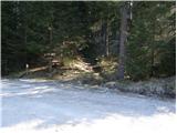 2
2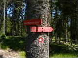 3
3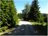 4
4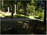 5
5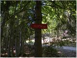 6
6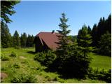 7
7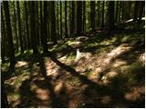 8
8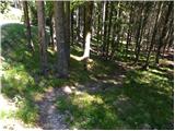 9
9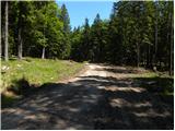 10
10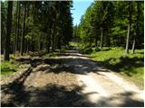 11
11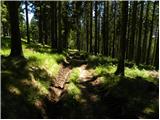 12
12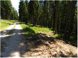 13
13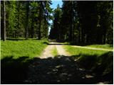 14
14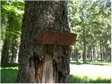 15
15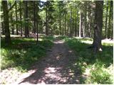 16
16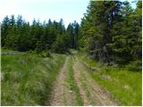 17
17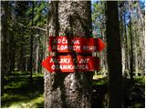 18
18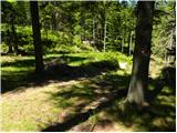 19
19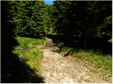 20
20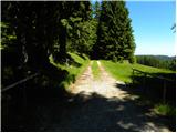 21
21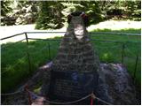 22
22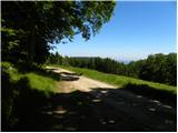 23
23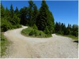 24
24 25
25 26
26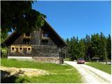 27
27
Discussion about the trail Koča na Šumiku - Koča na Klopnem vrhu
|
| balon19. 08. 2013 |
ali je mogoče priti z avtom do slike 10 in koliko je hoje do koče od tam? 
|
|
|
|
| artur19. 08. 2013 |
Če vam ni škoda avta, se lahko peljete do slike 15. Od tam je dobre pol ure do koče na Klopnem vrhu.
|
|
|
|
| balon19. 09. 2013 |
hvala za odgovor 
|
|
|
|
| balon17. 03. 2014 |
Smo se odločili, da gremo od začetka do konca peš. Ko se vrnemo objavim sličice . Balončki
|
|
|
|
| smatjaz18. 03. 2014 |
Se mi dozdeva da je še vedno preveč snega zgoraj za dostop z avtom. Pred 14 dni z Osankarice do koče na Šumniku na cesti vsaj pol metra snega ??? 
|
|
|
|
| balon4. 05. 2015 |
kako je kaj danes na poti do vrha?
|
|
|
|
| Ajda_Zitnik2. 02. 2020 |
Pot sem prehodila včeraj, 1.2.2020.
Obe koči sta trenutno zaprti. Za Kočo na Šumniku naj bi bilo to za čez zimo, za Kočo na Klopnem vrhu nisem zasledila, kdaj bo zopet odprta.
Pot je dokaj dobro označena, razen v zadnjem delu, kjer se markacije izgubljajo.
Trenutno so deli po cesti deloma zaledeneli in nevarni za zdrs.
Ostalo je bo.
|
|
|
|
| karibu2. 02. 2020 |
Koča na Klopnem vrhu je do nadaljnega zaprta (spor s PZS). Se mi je pa že zgodilo, da so me ob zelo slabem vremenu spustili pod streho Lep pozdrav in srečno!
|
|
|
|
| Enka2. 02. 2020 |
Mi smo poklicali v Kočo pod Klopnim vrhom, kjer so nam zagotovili, da se bo danes dalo tam pogreti in kaj pojesti. In tako je tudi bilo. Izjemno lepo urejena koča, kjer so nam prijazno postregli s kavico, pijačo in pasuljem ter nas častili s celim krožnikom ocvrtih mišk! Res, vse pohvale in zahvale! Je pa to zdaj zasebna koča. Pot lahka, OK označena, po cesti pa mestoma živ led, sem ter tja je na poti tudi sneg. Žig za SPP pa je sedaj - kolikor razumem - žig Klopnega vrha (ki je na vrhu v skrinjici).
|
|
|
|
| bbugari12. 02. 2020 |
Enka, vse drži. Koča je neuradna in odprta, tudi za zasilno spanje. In vse pohvale oskrbnikom!
|
|
|