Zgornje Poljčane - Sveta Lucija above Studenice
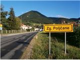
Starting point: Zgornje Poljčane (270 m)
Time of walking: 1 h 15 min
Difficulty: easy marked way
Altitude difference: 20 m
Altitude difference po putu: 140 m
Map: Posavsko hribovje Boč - Bohor 1:50.000
Recommended equipment (summer):
Recommended equipment (winter):
Views: 1.958
 | 2 people like this post |
Access to the starting point:
a) From Ljubljana, leave the motorway at Slovenske Konjice and drive to Poljčane via Žič, Loč and Zbelové. At the crossroads, turn right in the direction of Zgornje Poljčane for a few hundred metres and park in the centre of the village, a suitable place is the parking space next to the cemetery.
b) From the direction of Maribor, leave the motorway at Slovenski Bistrica, where signs direct you to Poljčane. Continue through the centre of Poljčane in the direction of Zgornje Poljčane, where you can park in the centre of the village, a suitable place is the parking space next to the cemetery.
Path description:
After a short visit to the centre of Zgornje Poljčane, continue across the Bela stream by the parish church, slightly up the road. On the left side of the path you reach the entrance to the church, with a relief of two Romans on the facade. After the visit, continue left towards Podboč along the asphalt road, also the Formila cycle path. Soon you reach the pleasant, small settlement of Podboč and to the left along the path the Černogova yew tree and a fountain restored by the locals.
Continue right up the road, now entering the Boč & Plešivec Landscape Park. The asphalt surface turns into a forest road. The view to the left is also a view lower down to the surroundings of Poljčany and the bed of the flooded river Dravinja between fields and meadows. The road turns into a forest and soon reaches a grassy plateau where the road is laid.
On the grassy plain there is a small warehouse with a field on the right and vineyards on the left. Continue through the forest again and the road winds pleasantly left, right. . . At the end of the flat part, take a sharp left downhill and follow the narrow forest stone road downhill, while up to the right is the continuation of the path higher up to Boč.
Continue downhill, the path descends pleasantly, is well beaten and soon reaches the intermediate trailhead of the Spring of the Toplega/Studeniškje Stream at 295 metres.
Cross a wooden footbridge and continue to the other side of the stream and soon continue downhill on a short level, where there is a nun's cemetery to the left of the path and a small spring/stream in a wooden trough to the right. To the right, slightly higher up, is Studenický Castle, a monument to the turbulent events of the centuries between the Dravinja and the Boč. We descend along the walls and soon reach the central part of Studenice, in front of the monastery complex, through a passageway/passageway by the parish church.
After a short tour of the central part of Studenice, continue northwards through the village of Studenice along the road by the brook. Continue over the bridge over the Dravinja and immediately turn slightly left and straight ahead between the cultural centre and the transformer. Continue left on a gentle ascent along a grassy path between a house on the left and a kindergarten on the right. At the kindergarten turn right and continue on the asphalt surface slightly more steeply uphill towards the destination, which is visible. Follow the road and you will soon reach the parking area in front of St Lucy's Church, which is surrounded by a cemetery within the walls. The length of the route described is about 4500 metres, 140 positive vertical metres and 120 negative vertical metres.

Pictures:
 1
1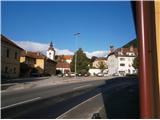 2
2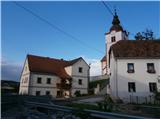 3
3 4
4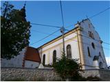 5
5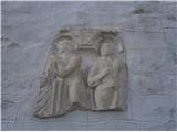 6
6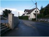 7
7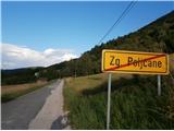 8
8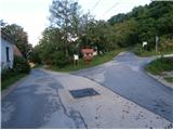 9
9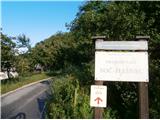 10
10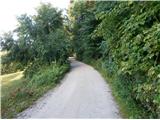 11
11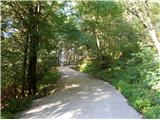 12
12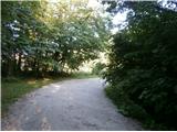 13
13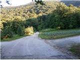 14
14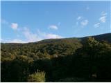 15
15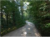 16
16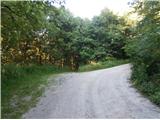 17
17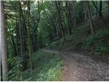 18
18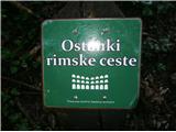 19
19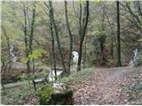 20
20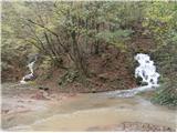 21
21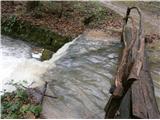 22
22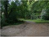 23
23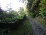 24
24 25
25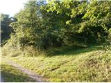 26
26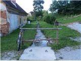 27
27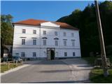 28
28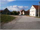 29
29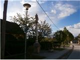 30
30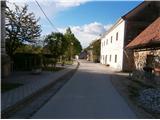 31
31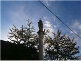 32
32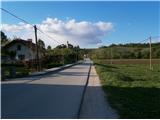 33
33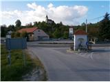 34
34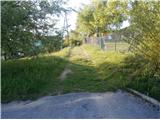 35
35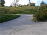 36
36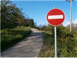 37
37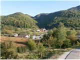 38
38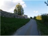 39
39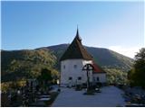 40
40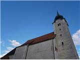 41
41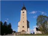 42
42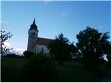 43
43
Discussion about the trail Zgornje Poljčane - Sveta Lucija above Studenice
|
| bruny30. 09. 2014 |
GPS sled... Zgornje Poljčane - Sv. Lucija nad Studenicami. S kolesom, bolj pripravno. Navzgor zaključno proti Sv. Luciji je kratko ampak strmo. Znotraj obzidja, območje pokopališča seveda hoja in zaključil pot na južnem delu ob glavnem vhodu/slika 42.
|
|
|
|
| bruny3. 02. 2015 |
Opisano pot danes v rahlem sneženju opravil...V nasprotni smeri in bilo je centimeter, morda dva novega snega. Ravno toliko, da je contragrip podplat pošteno zagrabil. Enostavna sicer trasa, zelo primerna za trening tu in tam... Višje nekaj megle ampak ni bilo potrebe po dodatni, umetni svetlobi. Z dodatkom ob Dravinji nekaj kilometrov več, morda ravno prav za torkov večer... Trasa poti...
|
|
|