Zgornje Poljčane - Source of Topli (Studeniški) potok
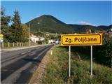
Starting point: Zgornje Poljčane (270 m)
Time of walking: 45 min
Difficulty: easy marked way
Altitude difference: 25 m
Altitude difference po putu: 100 m
Map: Posavsko hribovje Boč - Bohor 1:50.000
Recommended equipment (summer):
Recommended equipment (winter):
Views: 2.290
 | 2 people like this post |
Access to the starting point:
a) From Ljubljana, leave the motorway at Slovenske Konjice and drive to Poljčane via Žič, Loč and Zbelové. At the crossroads, turn right in the direction of Zgornje Poljčane for a few hundred metres and park in the centre of the village, a suitable place is the parking space next to the cemetery.
b) From the direction of Maribor, leave the motorway at Slovenski Bistrica, where signs direct you to Poljčane. Continue through the centre of Poljčane in the direction of Zgornje Poljčane, where you can park in the centre of the village, a suitable place is the parking space next to the cemetery.
Path description:
After a short visit to the centre of Zgornje Poljčane, continue across the Bela stream by the parish church, slightly up the road. On the left side of the path you reach the entrance to the church, with a relief of two Romans on the façade. After the visit, continue left towards Podboč on the asphalt road, also the Formila cycle path. Soon you reach the pleasant, small settlement of Podboč and on the left side of the path the Černogova yew tree and a fountain restored by the locals.
Continue right up the road, now entering the Boč & Plešivec Landscape Park. The asphalt surface turns into a forest road. The view to the left is also a view lower down to the surroundings of Poljčany and the bed of the flooded river Dravinja between fields and meadows. The road turns into a forest and soon reaches a grassy plateau where the road is laid.
On the grassy plain there is a small warehouse with a field on the right and vineyards on the left. Continue through the forest again and the road winds pleasantly left, right. . . At the end of the straight work sharp left and downhill on a narrow forest stone road, while up to the right is a continuation higher up into Boč.
Continue downhill, the path descends pleasantly, is well beaten and soon reaches the trail's terminus, the source of the Toplega/Studenišká brook at 295 metres. The trail is also very suitable for cycling.
The length of the route described is about 3200 metres, 100 positive vertical metres and 75 negative vertical metres.

Pictures:
 1
1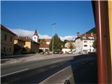 2
2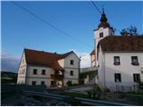 3
3 4
4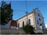 5
5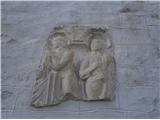 6
6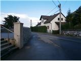 7
7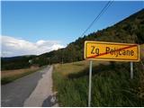 8
8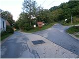 9
9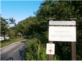 10
10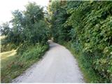 11
11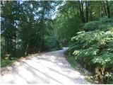 12
12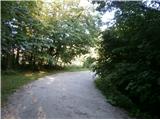 13
13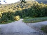 14
14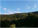 15
15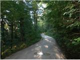 16
16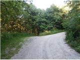 17
17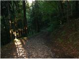 18
18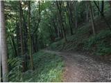 19
19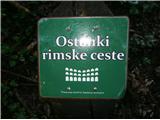 20
20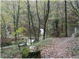 21
21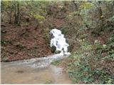 22
22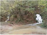 23
23
Discussion about the trail Zgornje Poljčane - Source of Topli (Studeniški) potok
|
| bruny28. 10. 2014 |
Do izvira/izvirov tja in nazaj in bila je že kar kratka večerna. Izhodišče Zgornje Poljčane. Srečal nikogar. Nezahtevna pot ampak zadnja deževja so pošteno načela spust proti Studenicam in previdnost vsekakor ni bila odveč. Trasa poti: Izvir Toplega/Studeniškega potoka iz Zgornjih Poljčan.
|
|
|
|
| bruny3. 12. 2014 |
V nasprotni smeri opisa danes v večernih urah. V kratki krožni pohodniški aktivnosti. Megla danes, nekje nad višino 450 metrov in rahlo je deževalo. Danes ,,delujoč,, samo srednji izvir iz slike 21. Vodnatost manjša kot na sliki 22. Ja, nekaj sto metrov meri struga potoka skozi naselje Studenic. Kmalu se združi z reko Dravinjo... Trasa poti: Izvir Toplega/Studeniškega potoka,03.12.2014.
|
|
|
|
| bruny17. 01. 2020 |
Po opisani poti zvečer v kratki aktivnosti...
|
|
|