Lovrenc na Dravskem polju - Ptujska Gora
Starting point: Lovrenc na Dravskem polju (236 m)
| Lat/Lon: | 46,37304°N 15,78571°E |
| |
Time of walking: 1 h 15 min
Difficulty: easy marked way
Altitude difference: 106 m
Altitude difference po putu: 130 m
Map:
Recommended equipment (summer):
Recommended equipment (winter):
Views: 574
 | 1 person likes this post |
Access to the starting point:
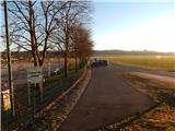
a) From the motorway Ljubljana - Maribor take the exit Slovenska Bistrica - north, then follow the signs for Ptuj. Leave the road to Ptuj at the signs for Cirkovce, and from Cirkovce follow the road to Lovrenec na Dravskem polju. At Župečja vas, which is before Lovrenc na Dravskem polju, go left, and then you will reach Lovrenec at Pohorje, where you will have several parking options. You can park at the cemetery, the sports ground or somewhere else in the centre of the village. The route described below starts at the Chapel of St. Vera, which is a few minutes' walk away.
b) Leave the Podravje motorway at exit Hajdina, then follow the signs for Slovenska Bistrica and Hajdina. Leave the road to Slovenska Bistrica quickly and turn left in the direction of Kidričevo. Continue through Kidričevo, and when you reach Apache, turn right at the roundabout towards Lovrenc na Dravskem polju, where you will have more parking options. You can park at the cemetery, the sports ground or somewhere else in the centre of the village. The route described below starts at the Chapel of St. Vera, which is a few minutes' walk away.
c) Take the road to Ptuj, then follow the signs for Lovrenc na Dravskem polju and Ptujska Gora. When you reach Lovrenc na Dravskem polju, park in one of the car parks in the village. You can park at the sports ground, the cemetery or somewhere else in the settlement. The trail described below starts at the Chapel of St. Vera, which is a few minutes' walk away.
Path description:
From the cemetery or the sports ground, go to the parish church of St. Lawrence, and a little beyond it, turn right and follow the edge of the road to a triangular crossroads, in the middle of which is the chapel of St. Faith.
At the chapel, the first yellow markings of the Jacob's Way appear, and we continue to the right, walking south. Just a little further on, turn right off the wider road, where the Jakob's Path markings also direct you, and then continue straight ahead or slightly left at the next two crossroads.
The path ahead leads between fields, and before the bridge over the Polskava River, a path joins us from the right, if we had started walking at the sports ground and had continued south from the starting point. A little further on, cross another small watercourse, and a few minutes later, as you approach the forest, go right after the cross and gradually start to climb gently. The way ahead takes us past the carpenter's shop, and we continue climbing gently for a few minutes, but after a small crossroads, where we continue along a slightly left-hand road, the path becomes steeper. Higher up, we get some views, and then we reach a small pass at a sign, where we go right. The way forward takes us past a few houses, then the road passes into the forest, where it splits at a left-hand bend.
The Jakob's Way signs point right into the woods, and there are also Jakob's Way signs if you continue along the road.
If you continue on the road, continue straight ahead at the two crossroads, and then you will reach the Chapel of St. Roko, where the path joins if you continue through the forest.
From the crossroads behind the chapel, turn right (the road to Selce leads off to the sharp right) and you will quickly reach the cemetery and the church of St Lenart. After the cemetery you reach a parking lot, and after the cemetery go left at a small crossroads. After a short walk of 10 steps, leave the road at the sign and climb the steps to the Basilica on Ptujska Gora, where you will have a nice view.
The description refers to the situation in January 2022, the pictures are from December 2021 and January 2022.

Pictures:
 1
1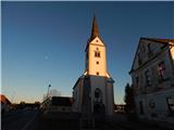 2
2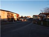 3
3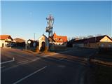 4
4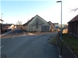 5
5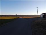 6
6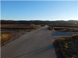 7
7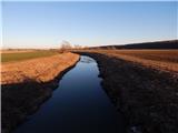 8
8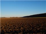 9
9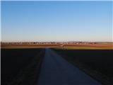 10
10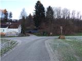 11
11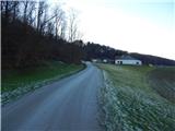 12
12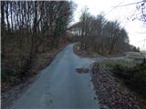 13
13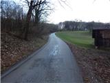 14
14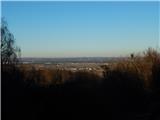 15
15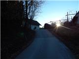 16
16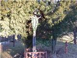 17
17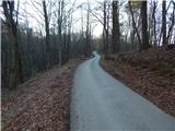 18
18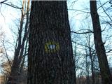 19
19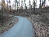 20
20 21
21 22
22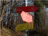 23
23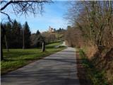 24
24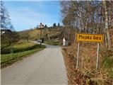 25
25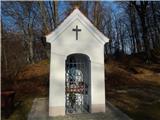 26
26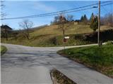 27
27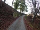 28
28 29
29 30
30 31
31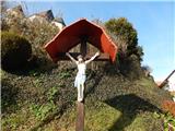 32
32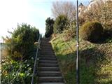 33
33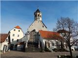 34
34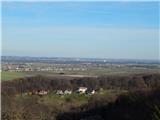 35
35
Discussion about the trail Lovrenc na Dravskem polju - Ptujska Gora