Starting point: Mislinja (640 m)
| Lat/Lon: | 46,4481°N 15,1944°E |
| |
Time of walking: 2 h 30 min
Difficulty: easy marked way
Altitude difference: 903 m
Altitude difference po putu: 903 m
Map: Pohorje 1:50.000
Recommended equipment (summer):
Recommended equipment (winter):
Views: 29.495
 | 4 people like this post |
Access to the starting point:
a) Access from Velenje: Drive towards Slovenj Gradec to Mislinja. At Mislinja, the road marked Mislinja graben turns off to the right. Continue straight ahead towards Slovenj Gradec for a few dozen metres until you see a petrol station on the left-hand side of the road. Just a few metres before the petrol station, turn right and follow the road to the next crossroads. Continue straight ahead and drive for another 100 metres to the parking lot at the signpost for Črni vrh.
b) Access from Slovenj Gradec: Drive towards Velenje to the village of Mislinja. Here, just after the petrol station, turn left. Follow the above description.
Path description:
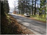
At the end of the parking lot, a signpost directs you to the right onto the narrow cart track, which soon turns left and becomes a barely visible lane. The path then climbs over a meadow and leads us past a small hamlet to a tarmac road. The path crosses the road and then ascends cart track, which soon leads us out of the wods and onto the edge of the wods. Here the track is lost again but the path is marked so that it is easier to find the right direction, which is along the right-hand side of the meadow. The path leads us to the next small hamlet, after which the path enters the forest and climbs steeply. This climb does not take long either, as we are soon at the next house. After the house, cross the forest road and continue climbing along the cart track, which leads us slightly higher to the forest road at the next hamlet. Continue along the gently sloping road which joins the 'main road' at the chapel. You can also walk along the road to get here, avoiding the orientation lops and the dogs barking as you walk past the houses.
Here, continue left up the road for a few metres to the point, when signs point you right up the road. The path first crosses a fine meadow, then goes into the wods, where it continues along cart track. Cart track soon turns into a footpath, which takes you a little higher up and leads you back to the forest road.
A slightly longer walk along the road follows to where the marked path to Črni vrh branches off up to the left. We take this path, which soon crosses a forest road, after which our path starts to climb steeply. A little higher we cross the forest road again, after which we come across a pleasant resting place (a bench and a table). Just a little further on the path leads us to a crossroads, where we continue straight on in the route Črni vrh for 20 minutes. The way forward climbs steeply and just below the top leads us to a small well behind which the forest becomes quite sparse. There is a short, folded climb up the top slope of Črni vrh which is easily reached.

Pictures:
 1
1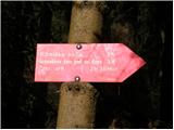 2
2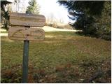 3
3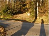 4
4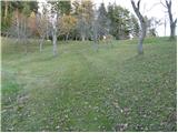 5
5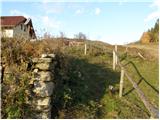 6
6 7
7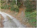 8
8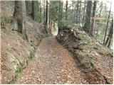 9
9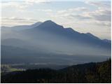 10
10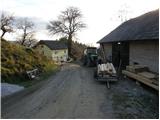 11
11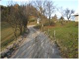 12
12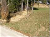 13
13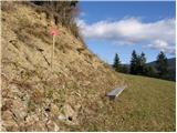 14
14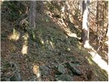 15
15 16
16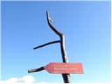 17
17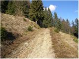 18
18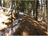 19
19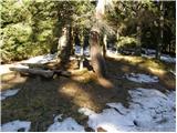 20
20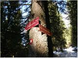 21
21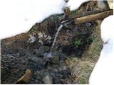 22
22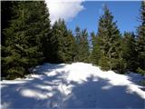 23
23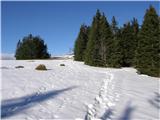 24
24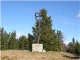 25
25
Discussion about the trail Mislinja - Črni vrh
|
| Marx20. 08. 2011 |
Bil na Črnem vrhu iz Mislinje.
Marke so zelo redko in marsikrat nelogično postavljene. Tudi mi se zdi da je začetek poti zdaj malce spremenjen , kajti se pot vzpinja dobrih 10 minut po asfaltu do odcepa v gozd (tu je na začetku eno zelo nelogično markirano razpotje) in do kmetije Medved (6. slika ) se gre le po gozdu , nikoli pa po travniku.
Tisto bi bil najoptimalniji pot za najvišjo točko Pohorja.
|
|
|
|
| rade745. 09. 2013 |
V soboto 31.08.2013 sem se pripeljal iz Postojne do Mislinje in se odpravil po tej poti.Zelo lepa pot,čeprav je pri kmetijah slabo označena.Drugače sem pa rabil 2 uri do vrha.Za rekreativce fantastična pot.No na koncu kjer se pri klopci usmerimo po strmi poti,je malce naporno.Drugače se pa splača,ker ko prideš na vrh ,se ti odpre prelep pogled na Pohorje,Avstrijo,Uršlo Goro,Peco,Kamniške Alpe,videi se tudi Krim nad Ljubljano in Slivnico nad Cerknico.Še bom prišel!
|
|
|
|
| lynx.attentus4. 01. 2014 |
Sledečo pot sem prehodil dvakrat. Moram priznati, da sem vsakič štartal z drugega izhodišča. Izhodišče v opisu je novo, tretje po vrsti zame. Poti je mnogo, prav tako tudi odcepov. Sicer ni orientacijska nočna mora, toda nič ne škodi imeti kakšen zemljevid v roki. Na kmetijah so pa tudi prijazni in te usmerijo na ta pravo pot, eno izmed mnogih  Načeloma pa se vse možne kombinacije sčasoma združijo nekje pri sliki 11 ali 15 v eno pot. In ta te pripelje prav na vrh. Zelo lep izlet. Upam, da ga bom še kdaj ponovil in odkril še kakšno novo izhodiče in pot
|
|
|
|
| Stamp25. 08. 2019 |
Kraća varijanta, start kod Sedovnikove kapele. Ukupno oko 15km sa uključenim Jezerskim vrhom i Ribniškom kočom. Staza ide skoro pa u krug (dolje su izbjegavani vrhovi Veliki i Mali Črni Vrh).. Jako puno berača borovnice.. Sve slike na OVOM LINKU a gps track hoda na MOJOJ WIKILOC ADRESI
|
|
|