Ribnica na Pohorju - Koča na Pesniku
Starting point: Ribnica na Pohorju (714 m)
| Lat/Lon: | 46,5332°N 15,2669°E |
| |
Time of walking: 1 h 5 min
Difficulty: easy marked way
Altitude difference: 387 m
Altitude difference po putu: 387 m
Map: Pohorje 1:50.000
Recommended equipment (summer):
Recommended equipment (winter):
Views: 7.740
 | 1 person likes this post |
Access to the starting point:
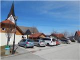
a) From the road Maribor - Dravograd, before the village of Brezno, turn left in the direction of Podvelka, Ribnica na Pohorju and Ribniška hut. After the bridge over the Drava River, we arrive at Podvelka, and we continue along the road in the direction of Ribnica na Pohorju. After about 10 km from the bridge over the Drava, we reach the centre of Ribnica na Pohorju, where we turn left and then park a little further on in the parking lot in the centre of the village. The parking lot is located a little further from the parish church of St. Jernej.
b) From Dravograd drive towards Maribor, after Radlje ob Dravi leave the main road at the roundabout towards Maribor and continue driving towards Vuhred, Ribnica na Pohorje and Ribniška koča. After the bridge over the Drava River, we arrive at Vuhred, and we continue along the road in the direction of Ribnica na Pohorje. After about 10 km from the bridge over the Drava, we reach the centre of Ribnica na Pohorju, where we turn right and then park a little further on in the parking lot in the centre of the village. The parking lot is located a little further from the parish church of St. Jernej.
Path description:
From the Ribnica na Pohorju centre, initially continue along the ascending asphalt road, from which you will soon turn right in the direction of Koča na Pesniku. You will quickly reach the foot of the ski slope, where you will leave the road and continue your ascent to the left along the edge of the ski slope. When you reach the top of the ski slope, you will cross another lane of forest, and then reach a dirt road where the trail ends. Continue along the road for a while, which leads through the forest, and higher up you will reach a crossroads from which you continue straight on the footpath towards the Hut na Pesniku. This is followed by about 15 minutes of moderate ascent and the path leads us out of the forest, where we can already see the mountain hut in front of us, which is only a few minutes' easy walk away.
We can extend the trip to the following destinations: Ribniška koča
Pictures:
 1
1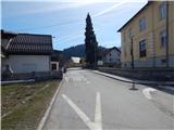 2
2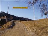 3
3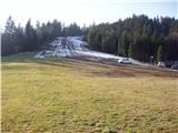 4
4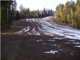 5
5 6
6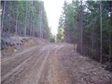 7
7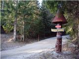 8
8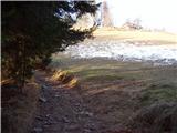 9
9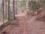 10
10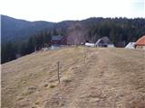 11
11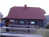 12
12
Discussion about the trail Ribnica na Pohorju - Koča na Pesniku
|
| klavdipo29. 07. 2008 |
Priporočam, da to kočo obiščete!Izredno prijazen oskrbniški par, odličen čaj ter prijetna okolica!  
|
|
|
|
| navdušena30. 12. 2018 |
Parkiramo v središču Ribnice na Pohorju, oznaka na drevesu nas usmeri na pot proti Pesniku.
|
|
|