Slovenj Gradec - Kremžarjev vrh
Starting point: Slovenj Gradec (413 m)
| Lat/Lon: | 46,5102°N 15,0817°E |
| |
Time of walking: 2 h 15 min
Difficulty: easy marked way
Altitude difference: 751 m
Altitude difference po putu: 760 m
Map: Pohorje - izletniška karta 1:50.000
Recommended equipment (summer):
Recommended equipment (winter): crampons
Views: 5.960
 | 1 person likes this post |
Access to the starting point:
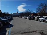
Drive to Slovenj Gradec and park near the roundabout by the Hofer store. Most of the car parks in the city centre charge for parking during the week, and most of them are only open for up to two hours, so it's best to park in these car parks at weekends and choose another car park during the week. The larger free car park is next to the point cemetery, which adds about 10 minutes to the journey. The cemetery is located on the outskirts of the city towards Velenje.
Path description:
From where you parked, walk to the roundabout by the Hofer shop, then turn onto the road towards the ski resort Kope and the village of Legen. Initially walk on the pavement, leaving the road to Kopy at the junction where the road to Kopy turns right, and continue straight ahead towards the marked trail to Kremžarjev vrh and the road to Gradišče. We continue walking on the pavement, but a little beyond the road sign marking the end of Slovenj Gradec, mountain signs direct us to the left onto a path that climbs over a meadow. At a few houses, cross an asphalt road, and a little higher up, join it and follow it to the right.
Walk along the asphalt road for a short distance, and then the signs direct you slightly to the left, onto a footpath that climbs through the forest. At a higher level, leave the woods, cross a dirt road and climb over a grassy slope with a view. At the upper edge of the meadow, cross a fainter road, then resume the climb through the forest. Quickly leave the forest and reach another hayfield, at the edge of which you continue to a small hamlet, where you join a road. Here, following the road for a few metres, you see a cross and then turn left onto a wide cart track, which you leave after a few metres. The signs point us right up the path, which leads through the forest to the next hamlet. Here, rejoin the road and follow it to the left. After a few minutes' walk along the road, you will come to a crossroads, where you continue straight ahead on the lower road, which leads you to the next hamlet. Just a few metres before the house, the marked path turns left and continues along cart track. Follow this path to the next hamlet, after which walk along the road for a few metres. Here the signs direct you to the footpath, which crosses the road again at a slightly higher level. The path then climbs a little more and leads to a crossroads where the path from Dravograd joins us. Here we continue to the right and after a short climb on a partly uncultivated slope we reach the hut below Kremžarjevim vrh.
From the hut, continue left in the direction of Kremžarjevý vrh. After a few minutes, the path leads to an interesting chapel, which is half open and half glass. Here we continue straight ahead and follow the path that leads us slightly upwards over the viewing slope, where we have a view towards Košenjak. The path then goes into the forest, which does not end even at the top, which is reached within a few minutes of further walking.
Slovenj Gradec - Koča pod Kremžarjevim vrhom 2:05, Koča pod Kremžarjevim vrhom - Kremžarjev vrh 0:10.

Pictures:
 1
1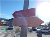 2
2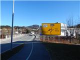 3
3 4
4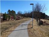 5
5 6
6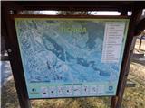 7
7 8
8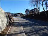 9
9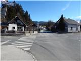 10
10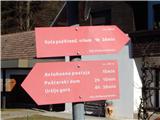 11
11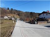 12
12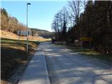 13
13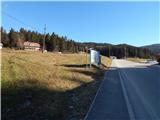 14
14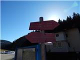 15
15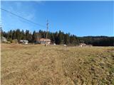 16
16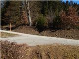 17
17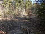 18
18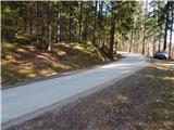 19
19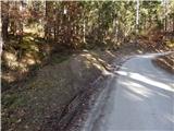 20
20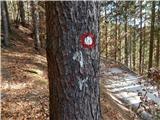 21
21 22
22 23
23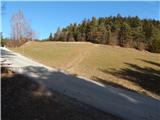 24
24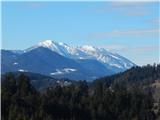 25
25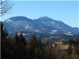 26
26 27
27 28
28 29
29 30
30 31
31 32
32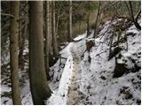 33
33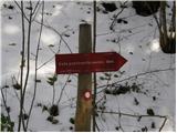 34
34 35
35 36
36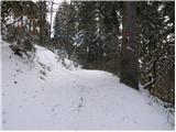 37
37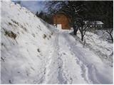 38
38 39
39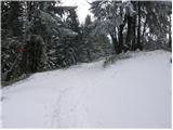 40
40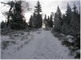 41
41 42
42 43
43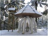 44
44 45
45 46
46 47
47
Discussion about the trail Slovenj Gradec - Kremžarjev vrh
|
| Berstuk22. 02. 2021 |
Vse OK, samo trajanje poti skrajšajte za 30 minut.
|
|
|
|
| mpp22. 02. 2021 |
Stanje 2021: Hofer ima zapornico, zraven njega proti Dravogradu je trgovski kompleks Spar, brezplačni parking
|
|
|
|
| djimuzl23. 02. 2021 |
Pokopališče se nahaja na obrobju mesta v smeri proti Kotljam.
|
|
|