Slovenske Konjice - Stolpnik (via castle)
Starting point: Slovenske Konjice (333 m)
| Lat/Lon: | 46,3372°N 15,4204°E |
| |
Name of path: via castle
Time of walking: 2 h 15 min
Difficulty: easy marked way
Altitude difference: 679 m
Altitude difference po putu: 800 m
Map:
Recommended equipment (summer):
Recommended equipment (winter):
Views: 28.160
 | 2 people like this post |
Access to the starting point:
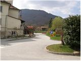
From the Ljubljana - Maribor motorway, take the Slovenske Konjice exit and follow the road to the point. In the centre of Slovenske Konjice, leave the main road (continue left) and head towards the church, near which you will park in a large marked parking lot.
Path description:
From the parking lot of the church, continue along the pavement (westwards), which leads us after a few dozen metres to the school, where we see the mountain signs for Stolpnik. Continue left on the pavement, which climbs slightly and after a short ascent leads to the mountain signs in the immediate vicinity of the cemetery. Here, continue straight ahead towards the Old Castle along the path that leads along the left side of the cemetery. At the top of the cemetery, leave the road and continue your ascent along the marked footpath, which climbs steeply. After a few minutes of ascent, the steepness eases and the path leads us out of the forest onto a macadam road, which we only cross (right Konjice Castle 5 minutes).
The wide cart track along which we walk, leads us in a few steps to a crossroads on the path, where a marking directs us upwards to the left. After a few dozen steps, the situation repeats itself, the only difference being that the ascent is not continued along the cart track but along a footpath that climbs through the forest. Higher up, the path leads to the next road, where we continue on the road ahead (left Skala). When the road makes a left turn, we leave it and continue the climb on a moderately steep footpath (kolovozu), which climbs through the forest again. After a 15-minute climb, you will rejoin the road, which you follow to the right. The road continues past three crosses, and just beyond them you come to the next crossroads, where you continue to the right. Walking for some time, we then continue along the road, which climbs gently at first, then leads us in a moderate descent to the crossroads where the path crosses. Continue straight up the footpath in the direction of Stolpnik (to the left Kamna gora, to the right Slovenske Konjice, where you can get off), which climbs moderately. The wide moderately steep path leads us on through the forest, where we cross a small partly overgrown clearing. Behind the clearing, the path lays down completely for a short time, and then leads us in a moderate ascent to the top, where the lookout tower stands.

We can extend the trip to the following destinations: Stolpnik
Pictures:
 1
1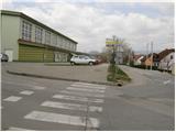 2
2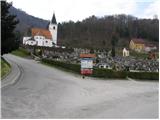 3
3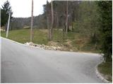 4
4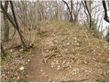 5
5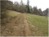 6
6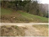 7
7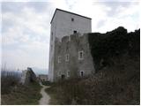 8
8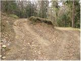 9
9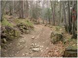 10
10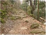 11
11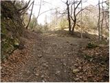 12
12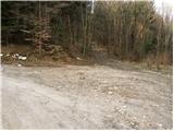 13
13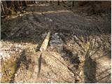 14
14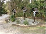 15
15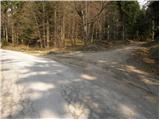 16
16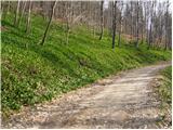 17
17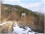 18
18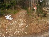 19
19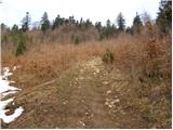 20
20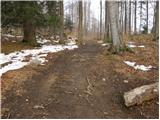 21
21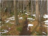 22
22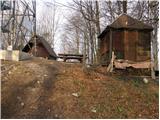 23
23 24
24
Discussion about the trail Slovenske Konjice - Stolpnik (via castle)
|
| godlike21. 05. 2011 |
Danes sma bila na Stolpniku. Lep izlet, edino na koncu pričakuješ za vsakim kucljem vrh, pa se še kr pot nadaljuje. Malo naju je tudi preganjalo grmenje a padavin ni blo.
Dol sva se vrnila po opisani poti, gor pa sva za spremembo upoštevala oznake za Stolpnik, ki se pojavijo na pokopališču. Ta pot še ni opisana na strani. Gre pa se pod pokopališčem naprej in kaj kmalu v gozd. Z navedevo potjo se združi na razpotju pred zadnjim vrhom. Pride pa z desne strani.
|
|
|
|
| pohodnik3823. 09. 2012 |
Včeraj sem ga mahnil na Konjiško goro v bližini Slovenskih Konjic in si turo omislil malo po svoje.Začetek v centru v bližini cerkve v smer Skala in po plezalni poti.Od tukaj pa sem nadaljeval še na osrednji vrh Stolpnik.Zelo lepo je bilo razgled čudovit le veter na na vrhu stolpa bil kar precej močan.Na poti srečal samo tri pohodnike cel ljubi dan  Video-Konjiška gora-Skala-Stolpnik-1012m Video-Konjiška gora-Skala-Stolpnik-1012m Lp! Tone
|
|
|
|
| Hribolazec816. 02. 2016 |
Danes naredil to pot in na vrhu so nekoga prsti srbeli ni nikjer žiga :/
|
|
|
|
| aonuk17. 02. 2016 |
ŽIG JE NA PRVEM PLATOJU RAZGLEDNEGA STOLPA(še ena pločevinasta škatla na kateri je pritrjen ŽIG) 
|
|
|
|
| ivanka.zrna18. 03. 2017 |
Res ni nič nenavadno, če imaš blazinico s sabo,
nenavadno pa je, če je blazinica suha.
|
|
|
|
| dkavcic23. 07. 2020 |
Žiga ni bilo več, v nedeljo 19.7.2020
|
|
|