Suhi Dol - Marinčeva planina (Hrib)
Starting point: Suhi Dol (681 m)
| Lat/Lon: | 46,0502°N 14,2013°E |
| |
Time of walking: 35 min
Difficulty: easy pathless terrain
Altitude difference: 124 m
Altitude difference po putu: 135 m
Map: Škofjeloško in Cerkljansko hribovje 1:50.000
Recommended equipment (summer):
Recommended equipment (winter):
Views: 3.968
 | 2 people like this post |
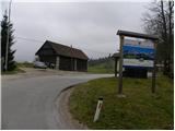
Access to the starting point:
First we drive to Horjul (to get here from Dobrova near Ljubljana or Vrhnika), then we continue driving towards Vrzdenc, Šentjošt and Gorenjska vas. At Vrzdenec, the road starts to climb steeply, and then a little further on leads to a serpentine, in the middle of which the road to Šentjošt and Smrečje branches off to the left. Continue right along the main road, which soon leads to a small pass, at the end of which the road branches off to the right towards the village of Samotorica. Continue straight ahead and the road starts to descend steeply and after a short descent leads to the hamlet of Ljubljanica (lower part of Butajnova), where you reach the next crossroads. Continue left in the direction of Gorenje vas and follow the road to Suhe Dolo, where you can park in a suitable place.
The starting point can also be reached from the direction of Polhov Gradec and Gorenjska vas.
Path description:
At the bus stop in Suhe Dol, you will notice signs for Mountain pasture, which direct you to the right on the road, which soon splits into two parts. Continue on the right marked road (the two roads merge higher up), which leads you along a slightly steeper road, which is between the houses in the village. Above the village, the two roads merge and we follow it to the right, where we quickly enter the forest. We continue climbing through the forest for a while, then we reach a grassy hay meadow. There is a short climb and the road leads to a small crossroads, where we continue along the right-hand road in the route Butajnova (Zalog and Črni Vrh on the left). The road then crosses the slopes below the peak on which the Church of St Andrew stands and leads us past a small hamlet. When the hamlet ends, so does the asphalt, and we follow the macadam road to a nearby sign (cross), before which we turn right into a pasture.
Cross the grazing fence (crossing is forbidden during the grazing season, but also in winter, when the pasture is usually empty, take care not to damage the undergrowth) and in 5 minutes climb to the top of Marinčeva planina (from the point where you leave the road, walk along the trackless path or pasture).

Pictures:
 1
1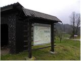 2
2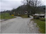 3
3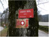 4
4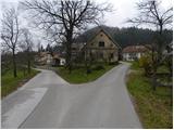 5
5 6
6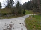 7
7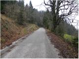 8
8 9
9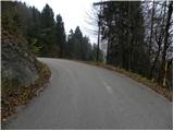 10
10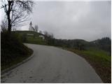 11
11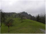 12
12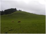 13
13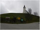 14
14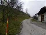 15
15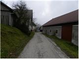 16
16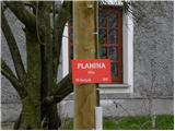 17
17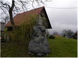 18
18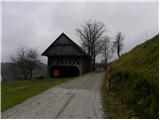 19
19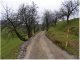 20
20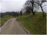 21
21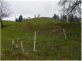 22
22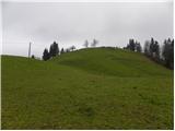 23
23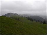 24
24 25
25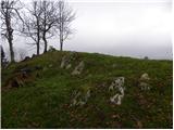 26
26 27
27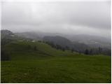 28
28
Discussion about the trail Suhi Dol - Marinčeva planina (Hrib)
|
| grega_p11. 02. 2015 |
Prelep dan s prelepimi razgledi. Tale manj znan hribček res ponuja 360 stopinjski razgled od Kamniških, Polhograjcev, spodnje Bohinjskih gora pa vse od manjših do večjih kucljev v okolici Ljubljane.
Lahek dostop, še posebej zdaj ko ni pašne živine. Priporočam za kakšen meglen dan spodaj v kotlini...
|
|
|
|
| grega_p11. 02. 2015 |
Še to, če koga zanima rezbarjenje, je na desni (ob skednju) preden zapustimo Planino in asfaltirano cesto, veliko zelo lepo izrezljanih podob.
|
|
|
|
| ljubitelj gora11. 02. 2015 |
Krn, Triglav, Snežnik, Grintovec in še kaj se vidi ob lepem jasnem vremenu.
|
|
|
|
| svetilka14. 02. 2021 |
Lepa pa je tudi planina direktno nad Sv. andrejom, ki se jo vidi na sliki št. 13.
|
|
|