Parking Erichhütte - Hoher Kopf (path 432)
Starting point: Parking Erichhütte (1339 m)
| Lat/Lon: | 47,39164°N 13,04879°E |
| |
Name of path: path 432
Time of walking: 4 h 45 min
Difficulty: very difficult marked way
Altitude difference: 1536 m
Altitude difference po putu: 1600 m
Map:
Recommended equipment (summer): helmet, self belay set
Recommended equipment (winter): helmet, self belay set, ice axe, crampons
Views: 3.075
 | 2 people like this post |
Access to the starting point:
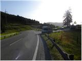
Drive through the Karavanke Tunnel into Austria, then continue along the Tauern motorway. We continue through the Katschberg Tunnel and later the Thuringian Tunnel / Tauerntunnel, and follow the motorway to Salzburg (aka Solnograd) only as far as the exit for Bischofshofen, from where we continue on the four-lane road to the aforementioned town. From Bischofshofen follow the signs for Höchkonig and Dienten am Höchkonig. The road starts to climb and leads to the Dientner sattel. From the saddle, continue for another 100 metres along the road, which begins to descend, and then you will see a parking area on the right-hand side of the road where you park.
Path description:
From the parking lot, follow the signs "Erichhütte 30min" to the mountain road, which is closed to traffic. The macadam road we are climbing leads us along pastures with a beautiful view of the High Tauern and the nearby peaks above the Erichhütte hut. The path then leads us through a short lane of forest where we also cross a small stream. The path continues along the pasture again until it reaches hut Erichhütte on the mountain pasture Schönbergalm.
From the hut, continue to the right, following the signs "Königsjodler Klettersteig, Hochkönig", and start to climb gently up the grassy slopes to the north-east. The path soon leads to a crossroads where you continue left in the direction of Hochkönig, and to the right the path leads to the summit of Taghaube (2159 m).
The trail then climbs for a while along the rare dwarf pines, and then, on a slightly steeper grassy slope, leads to another crossroads. To the right is the protected climbing route to Granlspitz (2307 m), and we continue left towards the Hochscharte.
Here the path turns slightly to the left and leads from the grassy slopes to steeper rocky slopes, which are initially traversed to the north. After crossing, the path turns to the right and ascends towards the Hochscharte. The path is quite steep at this part and a short ladder is helpful. Continue left at the notch and after a short climb you are back at the crossroads.
There is only a short climb to the left to enter the extremely difficult Königsjodler route, and we continue right and descend the gully to the east side of the ridge. There is also a warning sign at the crossroads about the danger of falling rocks on the path. The path in the ravine is quite rugged and is protected by a steel cable. Lower down, the path turns left out of the ravine and is followed by an unprotected crossing which leads to a crossroads.
Continue left on route 432 after the Hochkönig markers, and the path to the right leads to mountain pasture Stegmoosalm. The Fixed safety gear are very rare on the trail, so extra care is needed. The path then climbs up a relatively steep slope for some time, which is also a slip hazard. From the trail we start to get a nice view towards Hochkönig, and all the time we also have a nice view towards the "horns of the devil" through which the Königsjodler trail leads. Later on, the path becomes a bit more crumbly, and a wedge or a rope will help us. Higher up, the slope becomes a little less steep but full of rubble, so caution is still needed. There is a cross-climb on a sliding scree to the Birgkarscharte notch. At the notch where beautiful views open up to the north, continue to the left, and to the right the path leads to Hochkönig, the highest peak of the Berchtesgaden Alps. A less demanding trail continues along the north side of the ridge and soon leads to the summit.

Pictures:
 1
1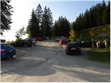 2
2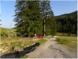 3
3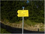 4
4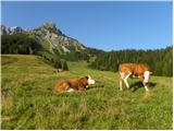 5
5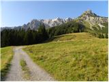 6
6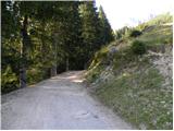 7
7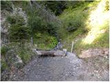 8
8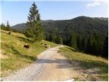 9
9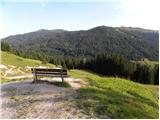 10
10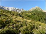 11
11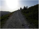 12
12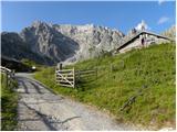 13
13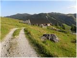 14
14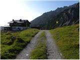 15
15 16
16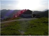 17
17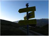 18
18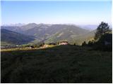 19
19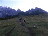 20
20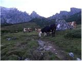 21
21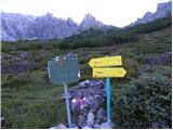 22
22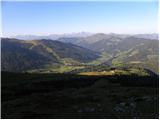 23
23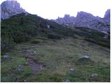 24
24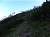 25
25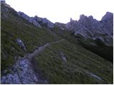 26
26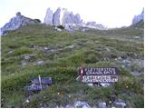 27
27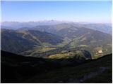 28
28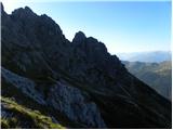 29
29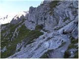 30
30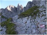 31
31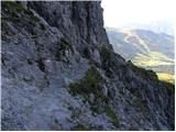 32
32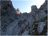 33
33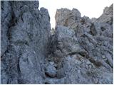 34
34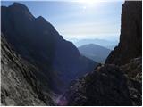 35
35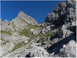 36
36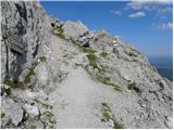 37
37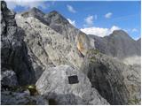 38
38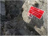 39
39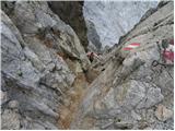 40
40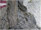 41
41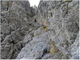 42
42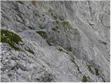 43
43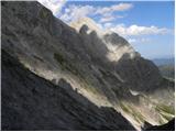 44
44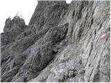 45
45 46
46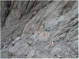 47
47 48
48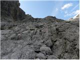 49
49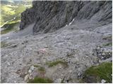 50
50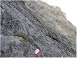 51
51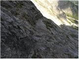 52
52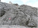 53
53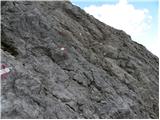 54
54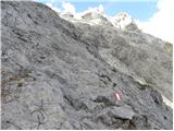 55
55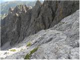 56
56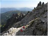 57
57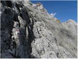 58
58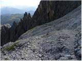 59
59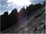 60
60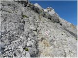 61
61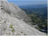 62
62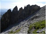 63
63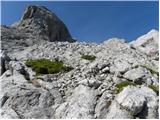 64
64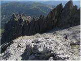 65
65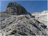 66
66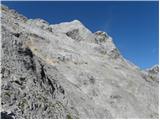 67
67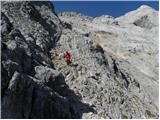 68
68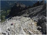 69
69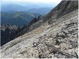 70
70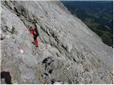 71
71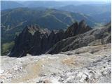 72
72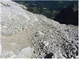 73
73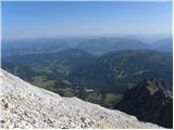 74
74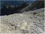 75
75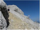 76
76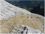 77
77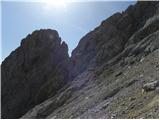 78
78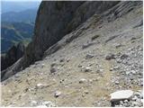 79
79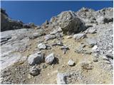 80
80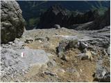 81
81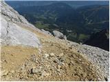 82
82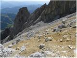 83
83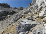 84
84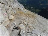 85
85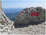 86
86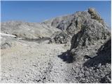 87
87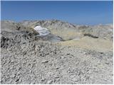 88
88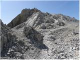 89
89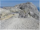 90
90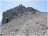 91
91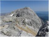 92
92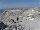 93
93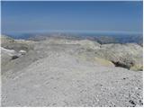 94
94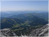 95
95 96
96
Discussion about the trail Parking Erichhütte - Hoher Kopf (path 432)