Žarovnica - Ravna Gora (Babice (Glažarjeva pečina and climbing path))
Starting point: Žarovnica (240 m)
Name of path: Babice (Glažarjeva pečina and climbing path)
Time of walking: 1 h 45 min
Difficulty: very difficult marked way
Altitude difference: 454 m
Altitude difference po putu: 480 m
Map:
Recommended equipment (summer): helmet, self belay set
Recommended equipment (winter): helmet, self belay set, ice axe, crampons
Views: 3.600
 | 1 person likes this post |
Access to the starting point:
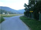
a) Arrive in Croatia via Border crossing Gruškovje / Macelj, then continue driving towards Trakoščan and Lepoglava. In Lepoglava, at the petrol station, continue straight in the direction of Višnjica and Klenovski (right centre of Lepoglava and Varaždin). Further on, you will arrive in the village of Vulišinec and Kamenički Vrhovec. When you reach the signpost marking the beginning of Žarovnica, turn left at the crossroads in the direction of Kamenice. Continue through Kamenica and then arrive back in Žarovnica. There are two crossroads here, and we park near the second one (there is a carpenter's shop on the right and there are always a lot of old vehicles nearby).
b) From Prekmurje, we first go to Varaždin, and from there we continue in the direction of Ivanec. At the end of Ivanec you reach Lepoglava, where you turn right towards Trakoščan, immediately after the bridge on Bednja, turn right in the direction of Višnjice and Klenovnik. Continue as in the above description.
Path description:
Due to the missing barrier, the described route is officially CLOSED until further notice (information from 6. 5. 2015).
The trail officially starts at the railway station in Lepoglava, but from there to "our" starting point it is a 3-hour walk on an asphalt road.
We will start our journey in the village of Žarovnica, where we will see white mountain signs at the second crossroads from the route of Kamenice. From here we go left in the direction of Glažari and Golubi and arrive at a small bridge where there are also some suitable parking places. After crossing the little bridge, you are in the village of Kameničko Podgorje, and the asphalt path begins to climb through the village. When the asphalt road starts to descend, continue right into the forest. Through the forest, walk first along the wider macadam road, then from the first crossroads continue along the narrower logging trail, where the path becomes steeper. Higher up, logging trail turns into a track, which leads to the rocky part of Babica. The rocky part is not technically difficult, but in wet conditions it is dangerous to slip. At the top of this part there is a crossroads, where the path to the left branches off towards the Glažarjeva cliff lookout point, (the Babice path continues straight ahead, and the path to the Babice rock leads downhill - not marked).
The path to Glažarjeva Cliff climbs gently at first and then steeply. Towards the end of the climb the ground becomes rockier and rockier. Glažarjeva Cliff is an exceptional viewpoint, from where you can enjoy a beautiful view to the south and east. There is also a small bivouac (the inside is locked) next to the viewpoint, where you can rest or cheer up in the rain.
From Glažarjeva Cliff, continue along the ridge to the north-west. The path ahead is gentle, except in one part where a fence helps us. Higher up, the ridge widens and we reach a crossroads where the path from Lapornjak joins us on the right.
We continue on, steeply upwards and after a few minutes we are back at the crossroads, where we return to the Babice trail.
We are now on a well-maintained forest road, which first goes west, but soon we come to a long bend where the road turns north and we return to the ridge of Ravne Gora. Follow the road to one of the coniferous forest belts, where signs lead you to the left. From here we will walk for some time along a narrower track which continues along the eastern slope, just a few metres below the ridge. Continue through the forest and then reach a clearing where the track is more overgrown. From here you have a nice view to the north, where you can see the Ptuj field, and to the east, where the view reaches all the way to Hungary. At the end of the clearing there is another crossroads where we will leave the Grandmother's path and go left onto the nature trail. This crossroads is less visible because a spruce tree is blocking the direction sign and this is the only one we can see when we are just in front of it. The path is now gradually becoming more and more challenging. First, we descend gently to an overhanging cliff where climbers have their own directions (this overhanging cliff is also a good shelter from the rain). After a few minutes of walking on an increasingly rocky surface, we reach another crossroads where we go left downhill (to the right we would go back to the Babice trail again).
Here the trail turns into a partly difficult trail and the first rocks are helpful. The path continues to descend, and the ground is increasingly slippery and rocky. Here the forest thins out and we reach the start of the Balkon climbing route.
The climbing part of the route will show its "teeth" right from the start, because the first part is almost vertical. The wedges are more sparsely "scattered", so you have to grab the rocks to make progress. After this harder C part, the route will turn more to the left and go into B difficulty. The extremely difficult D variant also branches off here somewhere. When we reach a small gallery, our route switches to a very difficult part, which is vertical and again sparsely measured with pegs. As we get higher, there is a bend to the right, where we cross smooth rock slabs. At the end of the traverse, we join the D variant.
There is some more easy rock scrambling and we are on the way out of the climbing direction. The way forward returns to the Babice route and after a minute of further walking we reach the Balkon lookout point, from where it is only a minute to the Krešimir Filić home, where we can have a snack or spend the night.
From the house, continue north-west along the road until you reach the paratroopers' airstrip, where you climb into the forest and after a minute you reach the "rock", which is the highest peak of Ravna Gora. A little further on is the lookout tower, from which, despite its relatively low altitude, you will be rewarded with an exceptional view in all directions except to the south, where Ivanščica is higher.

Pictures:
 1
1 2
2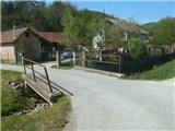 3
3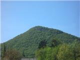 4
4 5
5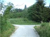 6
6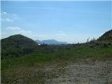 7
7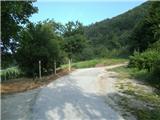 8
8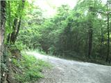 9
9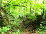 10
10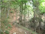 11
11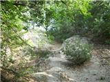 12
12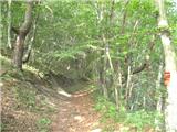 13
13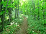 14
14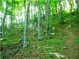 15
15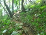 16
16 17
17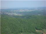 18
18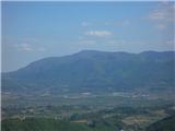 19
19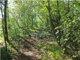 20
20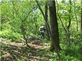 21
21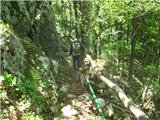 22
22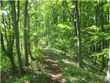 23
23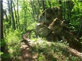 24
24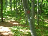 25
25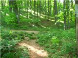 26
26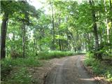 27
27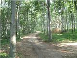 28
28 29
29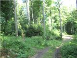 30
30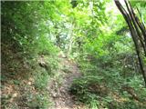 31
31 32
32 33
33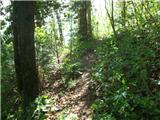 34
34 35
35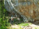 36
36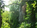 37
37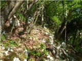 38
38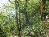 39
39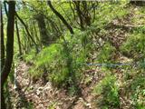 40
40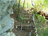 41
41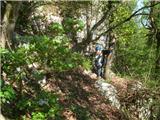 42
42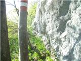 43
43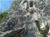 44
44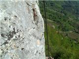 45
45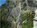 46
46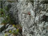 47
47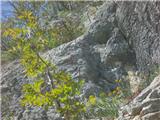 48
48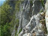 49
49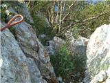 50
50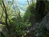 51
51 52
52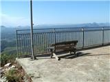 53
53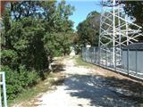 54
54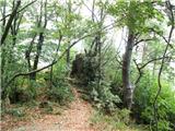 55
55 56
56
Discussion about the trail Žarovnica - Ravna Gora (Babice (Glažarjeva pečina and climbing path))
|
| zico105. 05. 2015 |
Tisti ki pozna malo bolj te poti, me zanima ali je plezalni del po omenjeni poti isti kot tisti iz cvetlina ali gre za popolnoma drugo plezalno pot? Hvala
|
|
|
|
| Marx6. 05. 2015 |
Žal moj prvi komentar te poti ne bo lep. Izginila je jeklenica na delu plezalke (od slike 46 naprej) in je zdaj ta težka mini-ferata še bolj težja. Uradno je plezalka zaprta , gre se na lastno odgovornost.
Na plezalnu pot Balkon je mogoče priti tudi ko bi od doma Krešimir Filić nadaljevali na učno pot - plezalke se začne na najnižem delu učne poti.
To je posvem druga in posvem noca pot. Iz Cvetlina se gre na plezalno pot Velike pečine. Škoda da je jeklenica izginila... Upam da se ne bo zgodilo kot na Kalniku kjer je jeklenica izginila prej pet let in še ni obnovljena...
Zato še enkrat - ta plezalna pot je uradno zaprta , ampak se da preplezati. Potrebno pa je biti res previden...
|
|
|
|
| zico106. 05. 2015 |
Tudi sam sem danes šel po tej poti. Moram recti, da me je del brez jeklenice presenetil, saj sem mislil da je cez celo pot jeklenica. Sam sem vseeno preplezal pot, vendar jo ne priporocam dokler se jeklenica ne napelje ponovno. Sploh zadnji del je zelo tezek In moras biti res previden!
@Marx hvala za razlago o cvetlinu. Bo treba se to poskusit....
|
|
|
|
| Marx27. 01. 2016 |
Spet loše novice...
Ne le da jeklenica ki je izginila še ni popravljena , sicer so zdaj izginile tudi vse ostale jeklenice. Kline na srečo pe nikgo ni vzel...
|
|
|
|
| zdomec28. 01. 2016 |
Kako? A so jeklenice bile vkradene ali so nalasc odstranjene?
Gdo upravlja in skrbi za poti na Ravno goro?
/mogoce PD Ravna gora Varazdin?/ PD katero skrbi za te poti bi moralo takoj urgirati in pot zapreti do nadaljnega.
|
|
|
|
| Marx16. 05. 2018 |
Žal še vedno ni jeklenic...
Ta ferata je bila najtežja te vrste na Hrvaškem, ampak le do 2017. ker je zdaj nova ekstremna ferata na Kalniku / Sedmem zobu (kliče se "Koprivnički smjer") še bolj težja (težavnost E).
V stiku z obskrbikom Filićeveg doma sem izvedel da bo sanacija ferate tisto poletje. V planu je namesto jeklenic (da ih spet negdo ne vzeme) nadelati kable , kot tiste na Jelenku/Kendovi robi...
|
|
|