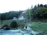
Planinski dom Kalnik - Vranilac (Kalnik)
Starting point: Planinski dom Kalnik (480 m)
Time of walking: 25 min
Difficulty: easy marked way
Altitude difference: 163 m
Altitude difference po putu: 163 m
Map:
Recommended equipment (summer):
Recommended equipment (winter): crampons
Views: 2.523
 | 2 people like this post |
Access to the starting point:
From the Zagreb - Varaždin motorway, take the Sveta Helena exit and follow the road towards Vrbovec. The motorway (only half-way in 2012, as it is still under construction) leads to Gradac, where you turn right towards Sveti Ivan Žabno, from where you continue towards Križevci. From Križevci onwards, orientation is easy, as the mountain lodge and the Old Castle of Veliki Kalnik can be seen from a distance. The mountain home can be reached without any major problems by car, which is left in a large parking lot near the home.
Path description:
From home, head west, first through a sparse and then through a partly spruce forest. The way forward takes us past two crossroads, and we continue towards the summit of Vranilac at both. About 10 minutes higher, we reach an asphalt road leading to the TV tower (the road is intended for the TV tower and is closed to public traffic). We walk along the road for about 5 minutes and then we see steps made of staples. Continue on the steps and follow the steep mountain path. Higher up, the path leads over a short, crumbly slope, beyond which you reach the TV tower mentioned earlier.
Here we join the route from Ljubelj (route 2), and we continue westwards, where a very difficult climbing route joins us from the left. From here, we are only a short climb over steep rock (one rock to help us) away from the summit.
There is a geodetic point at the top, and the registration book is a little below the top, reached by a rope.
Pictures:
 1
1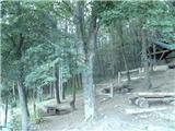 2
2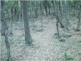 3
3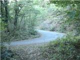 4
4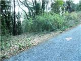 5
5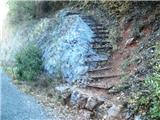 6
6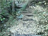 7
7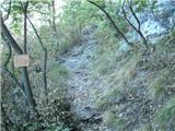 8
8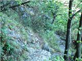 9
9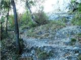 10
10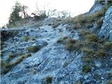 11
11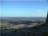 12
12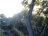 13
13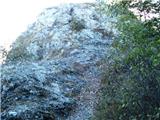 14
14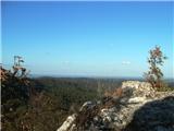 15
15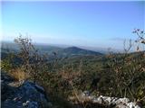 16
16
Discussion about the trail Planinski dom Kalnik - Vranilac (Kalnik)
|
| Marx16. 05. 2018 |
Od kdaj je nastal ta opis so na sliki 6 zdaj nove skobe in nam je na pomoč tudi rokohvat.
Na sliki 8 je malenkost naprej začetek izjemno zahtevne ekstremne ferate "Koprivnički smjer" , najtežje te vrste na ozemlju Hrvaške.
Skobe na sliki 14 ni več kar malce oteža dostop na vrh Vranilac.
|
|
|