Planinski dom Kalnik - Vranilac (Kalnik) (climbing way)
Starting point: Planinski dom Kalnik (480 m)
Name of path: climbing way
Time of walking: 30 min
Difficulty: difficult marked way
Altitude difference: 163 m
Altitude difference po putu: 163 m
Map:
Recommended equipment (summer):
Recommended equipment (winter):
Views: 4.243
 | 1 person likes this post |
Access to the starting point:
From the Zagreb - Varaždin motorway, take the Sveta Helena exit and follow the road towards Vrbovec. The motorway (only half-way in 2012, as it is still under construction) leads to Gradac, where you turn right towards Sveti Ivan Žabno, from where you continue towards Križevci. From Križevci onwards, orientation is easy, as the mountain lodge and the Old Castle of Veliki Kalnik can be seen from a distance. The mountain home can be reached without any major problems by car, which is left in a large parking lot near the home.
Path description:
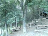
From home, head west, first through a sparse and then through a partly spruce forest. The way forward takes us past two crossroads, and we continue towards the summit of Vranilac at both. About 10 minutes higher up, you reach an asphalt road leading to the TV tower (the road is dedicated to the needs of the TV tower and is closed to public traffic).
As you walk along the road, the path from the village of Borje joins from the left, and two minutes higher up, the normal path to the top branches off to the right. Continue along the road, but only as far as the fence of the nearby TV tower, where you continue left along the fence (at first it looks like there is no path here). Continue along the fence for a short distance, then you arrive in the forest on a steep slope.
Just beyond the end of the fence you will see a sign for Vranilac, which directs you to a steep and slightly overgrown path. When you reach the overhanging cliff, go right and at the next bend the difficult part of the trail begins. The climb is quite difficult at first, but then you reach a rocky ridge where you can rest for a while.
Further on, a marker on an overhanging rock points right to the east and we reach the most difficult part of the trail. We continue along a very narrow path that passes under a small overhang above exposed vegetated slopes (there used to be a steel cable here, but it is no longer there). Once we have crossed the exposed passage, we have an even easier climb up a partly rocky slope. The path then quickly leads to a ridge, where you go left to the nearby summit.

Pictures:
 1
1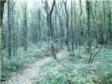 2
2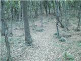 3
3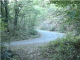 4
4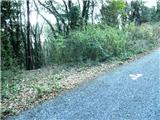 5
5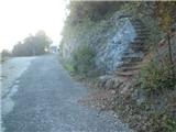 6
6 7
7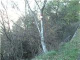 8
8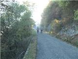 9
9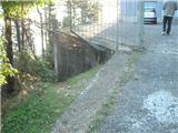 10
10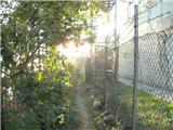 11
11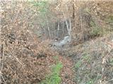 12
12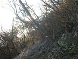 13
13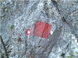 14
14 15
15 16
16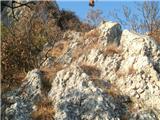 17
17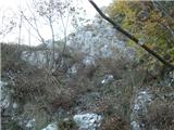 18
18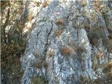 19
19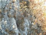 20
20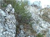 21
21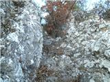 22
22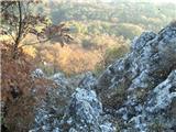 23
23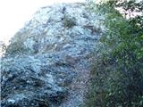 24
24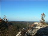 25
25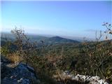 26
26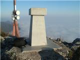 27
27
Discussion about the trail Planinski dom Kalnik - Vranilac (Kalnik) (climbing way)
|
| jprim22. 11. 2012 |
Zanima me, kdo oceni zahtevnost poti pri novo opisanih poteh. Ali je težavnost vzeta iz kakšnega vodnika ali pa je povsem subjektivna.  LP!
|
|
|
|
| Tadej22. 11. 2012 |
Zahtevnost poti je vedno označena subjektivno, čeprav se trudimo, da jo označimo čim bolj objektivno (po klasifikaciji težavnosti planinskih poti).
|
|
|
|
| Marx22. 11. 2012 |
Okej , poskusil bom z primerjavo z zahtevnim poti ki sam ih še obiskal...
Sedam zubi / Kalnik - na posameznimi deli lažja
Pogačnikova pot na Grmadi - za drobtico lažja
Presedljaj-Konj (KSA) - za drobtico težja
Skala na Konjiški gori - težja
Lavamünd - lažja
Velike pečine/Ravna gora - lažja
Donačka gora - težja
Hudičev graben - težja
Krvavica (okno) težja
Okić(Samobor) - težja od obe poti (Žohar in Dragojla)
Ampak , kot je tudi Tadej povedal , je zahtevnost res subjektivna in je pri vsakem posamezniku drogačja. Ko sam prvič bil na Skali (Konjice) mi se zdila lahka , tek drugič sam se zavedal koliko zahtevna je zares... Na Donački gori sam prvič na jeklenici odustal , zdaj jo prehodim z eno roko. Edini problem na tisti plezalni poti je ker nam nič ni na pomoč , žal jeklenica ki je izginila pred par let še ni obnovljena. Ko pridemo na previsno prečenje je potrebno zelo previdno poiskati na skali rokohvate in potem gre...
Zakaj nisam tisti poti dal oceno zelo zahtevna? Zato ker moč v rokami ni odločojoča. Zakaj pa ne delno zahtevna? Ker bomo roke v vsakem primeru morali uporabiti.
|
|
|
|
| Marx4. 08. 2013 |
Danes (03.08.2013.) poplezal po poti. Žal je vhod v plezalni del kjer se odcepimo od male obhodnice še bol zarasel in je skalo na sliki 14 težje najti... ampak gre.
|
|
|
|
| smatjaz7. 10. 2018 |
Bil danes gor, od doma na Kalniku po grebenu 7 zob in potem še kratka feratka ki je uradno ocenjena na C/D in tudi tako je.
|
|
|